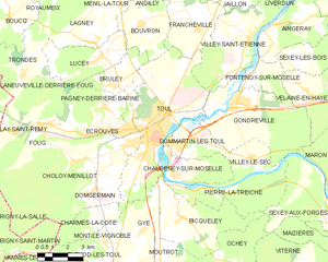
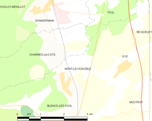
Gye (Gye)

- commune in Meurthe-et-Moselle, France
- Country:

- Postal Code: 54113
- Coordinates: 48° 37' 12" N, 5° 52' 32" E


- GPS tracks (wikiloc): [Link]
- Area: 6.51 sq km
- Population: 224
- Web site: http://lannuaire.service-public.fr/mairies/lorraine/meurthe-et-moselle/mairie-54242-01.html
- Wikipedia en: wiki(en)
- Wikipedia: wiki(fr)
- Wikidata storage: Wikidata: Q640129
- Wikipedia Commons Category: [Link]
- Freebase ID: [/m/03qdhxn]
- Freebase ID: [/m/03qdhxn]
- GeoNames ID: Alt: [6424434]
- GeoNames ID: Alt: [6424434]
- SIREN number: [215402421]
- SIREN number: [215402421]
- BnF ID: [15264311w]
- BnF ID: [15264311w]
- INSEE municipality code: 54242
- INSEE municipality code: 54242
Shares border with regions:

Toul
- commune in Meurthe-et-Moselle, France
- Country:
- Postal Code: 54200
- Coordinates: 48° 40' 30" N, 5° 53' 30" E
- GPS tracks (wikiloc): [Link]
- AboveSeaLevel: 215 м m
- Area: 30.59 sq km
- Population: 16021
- Web site: [Link]


Moutrot
- commune in Meurthe-et-Moselle, France
- Country:
- Postal Code: 54113
- Coordinates: 48° 36' 11" N, 5° 53' 35" E
- GPS tracks (wikiloc): [Link]
- Area: 7.26 sq km
- Population: 292

Mont-le-Vignoble
- commune in Meurthe-et-Moselle, France
- Country:
- Postal Code: 54113
- Coordinates: 48° 36' 47" N, 5° 50' 26" E
- GPS tracks (wikiloc): [Link]
- Area: 4.12 sq km
- Population: 419

Blénod-lès-Toul
- commune in Meurthe-et-Moselle, France
- Country:
- Postal Code: 54113
- Coordinates: 48° 35' 58" N, 5° 50' 0" E
- GPS tracks (wikiloc): [Link]
- Area: 17.6 sq km
- Population: 1089

Bicqueley
- commune in Meurthe-et-Moselle, France
- Country:
- Postal Code: 54200
- Coordinates: 48° 37' 35" N, 5° 54' 43" E
- GPS tracks (wikiloc): [Link]
- Area: 16.82 sq km
- Population: 902
- Web site: [Link]