Halloville (Halloville)

- commune in Meurthe-et-Moselle, France
- Country:

- Postal Code: 54450
- Coordinates: 48° 33' 15" N, 6° 51' 40" E


- GPS tracks (wikiloc): [Link]
- Area: 3.93 sq km
- Population: 76
- Wikipedia en: wiki(en)
- Wikipedia: wiki(fr)
- Wikidata storage: Wikidata: Q1000253
- Wikipedia Commons Category: [Link]
- Freebase ID: [/m/03qdhzc]
- Freebase ID: [/m/03qdhzc]
- GeoNames ID: Alt: [6436648]
- GeoNames ID: Alt: [6436648]
- SIREN number: [215402462]
- SIREN number: [215402462]
- BnF ID: [152643158]
- BnF ID: [152643158]
- INSEE municipality code: 54246
- INSEE municipality code: 54246
Shares border with regions:


Nonhigny
- commune in Meurthe-et-Moselle, France
- Country:
- Postal Code: 54450
- Coordinates: 48° 33' 2" N, 6° 52' 50" E
- GPS tracks (wikiloc): [Link]
- Area: 5.75 sq km
- Population: 131


Montreux
- commune in Meurthe-et-Moselle, France
- Country:
- Postal Code: 54450
- Coordinates: 48° 32' 9" N, 6° 52' 56" E
- GPS tracks (wikiloc): [Link]
- Area: 3.69 sq km
- Population: 63


Harbouey
- commune in Meurthe-et-Moselle, France
- Country:
- Postal Code: 54450
- Coordinates: 48° 34' 12" N, 6° 53' 12" E
- GPS tracks (wikiloc): [Link]
- Area: 10.14 sq km
- Population: 115

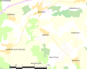
Barbas
- commune in Meurthe-et-Moselle, France
- Country:
- Postal Code: 54450
- Coordinates: 48° 34' 23" N, 6° 50' 49" E
- GPS tracks (wikiloc): [Link]
- Area: 7.33 sq km
- Population: 185


Ancerviller
- commune in Meurthe-et-Moselle, France
- Country:
- Postal Code: 54450
- Coordinates: 48° 31' 56" N, 6° 50' 6" E
- GPS tracks (wikiloc): [Link]
- Area: 12.34 sq km
- Population: 273