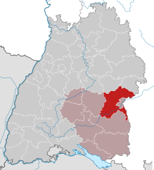
Heidenheim (Landkreis Heidenheim)

- district in Baden-Württemberg, Germany
 Hiking in Heidenheim
Heidenheim, located in Baden-Württemberg, Germany, is a region that offers a variety of hiking opportunities amidst beautiful landscapes, historical sites, and natural attractions. Here are some aspects to consider when hiking in Heidenheim and its surroundings:
Trails and Locations
-
Swabian Jura (Schwäbische Alb):
- The Heidenheim district is near the Swabian Jura, known for its stunning sandstone formations, limestone cliffs, and deep valleys. There are numerous marked trails that cater to all levels of hikers.
-
Trekking Paths:
- The region has numerous designated hiking trails such as the "Schwäbische Alb Panoramaweg," which provides breathtaking views and glimpses into the unique geology of the area.
-
Local Parks and Recreation Areas:
- Popular spots for shorter and leisurely hikes include parks and forested areas around Heidenheim, such as the Stadtwald Heidenheim and surrounding nature reserves that have well-maintained paths.
Highlights
-
Historical Landmarks:
- Hikers can incorporate visits to historical sites such as the Hellenstein Castle, offering a rich cultural experience in addition to the natural beauty.
-
Flora and Fauna:
- The area is home to diverse ecosystems, making it great for nature enthusiasts interested in birdwatching, wildflowers, and local wildlife.
Tips for Hiking in Heidenheim
-
Trail Maps:
- It’s advisable to carry a local hiking map or use a GPS app designed for hiking that highlights trails and points of interest.
-
Weather Considerations:
- Be aware of the local weather conditions, especially in the spring and fall, as they can change rapidly. Dressing in layers is a good practice.
-
Safety Precautions:
- Always inform someone of your hiking plans, especially if you’re venturing into more remote areas. Carry a first-aid kit, sufficient water, and snacks.
-
Accommodations:
- If you plan to hike for multiple days, check for local lodging options like guesthouses or camping sites that are scattered throughout the region.
-
Respect Nature:
- Stay on marked trails, respect wildlife, and follow local guidelines to lessen your impact on the environment.
Hiking in Heidenheim offers a blend of physical activity, nature appreciation, and cultural exploration, making it a fulfilling experience for all types of hikers. Whether you’re a beginner or an experienced walker, you’ll find something to enjoy in this picturesque part of Germany.
- Country:

- Licence Plate Code: HDH
- Coordinates: 48° 38' 24" N, 10° 7' 12" E


- GPS tracks (wikiloc): [Link]
- AboveSeaLevel: 599 м m
- Area: 627.13 sq km
- Population: 130527
- Web site: http://www.landkreis-heidenheim.de
- Wikipedia en: wiki(en)
- Wikipedia: wiki(de)
- Wikidata storage: Wikidata: Q8523
- Wikipedia Commons Category: [Link]
- Freebase ID: [/m/01k2qf]
- GeoNames ID: Alt: [3220738]
- VIAF ID: Alt: [139554354]
- OSM relation ID: [2812850]
- GND ID: Alt: [4024008-3]
- archINFORM location ID: [2450]
- Library of Congress authority ID: Alt: [n80097983]
- TGN ID: [7077339]
- ISNI: Alt: [0000 0004 0629 3895]
- NUTS code: [DE11C]
- Ringgold ID: [60844]
- German district key: 08135
Includes regions:


Dischingen
- municipality in Germany
Hiking in Dischingen
Dischingen, located in Baden-Württemberg, Germany, is a charming area known for its beautiful landscapes and outdoor activities, particularly hiking. The region offers a variety of trails that cater to different skill levels, making it suitable for both beginners and experienced hikers....
- Country:
- Postal Code: 89561
- Local Dialing Code: 07326; 07327
- Licence Plate Code: HDH
- Coordinates: 48° 41' 52" N, 10° 21' 38" E
- GPS tracks (wikiloc): [Link]
- AboveSeaLevel: 463 м m
- Area: 78.06 sq km
- Population: 4352
- Web site: [Link]


Herbrechtingen
- municipality in Germany
Hiking in Herbrechtingen
Herbrechtingen, located in the state of Baden-Württemberg in Germany, is surrounded by beautiful natural landscapes, offering a variety of hiking opportunities. The area features both scenic views and a range of trails suited for different skill levels. Here are some key points to consider for hiking in and around Herbrechtingen:...
- Country:
- Postal Code: 89538–89542
- Local Dialing Code: 07324
- Licence Plate Code: HDH
- Coordinates: 48° 37' 31" N, 10° 10' 26" E
- GPS tracks (wikiloc): [Link]
- AboveSeaLevel: 471 м m
- Area: 58.63 sq km
- Population: 13096
- Web site: [Link]


Königsbronn
- municipality in Germany
Hiking in Königsbronn
Königsbronn is a picturesque town located in the Swabian region of Germany, known for its beautiful natural landscapes and hiking opportunities. Here are some key points about hiking in Königsbronn:...
- Country:
- Postal Code: 89551
- Local Dialing Code: 07328
- Coordinates: 48° 44' 35" N, 10° 6' 43" E
- GPS tracks (wikiloc): [Link]
- AboveSeaLevel: 498 м m
- Area: 45.46 sq km
- Population: 7086
- Web site: [Link]


Nattheim
- municipality in Germany
Hiking in Nattheim
Nattheim, a small town in the state of Baden-Württemberg, Germany, offers a variety of hiking opportunities for outdoor enthusiasts. The region is characterized by picturesque landscapes, rolling hills, and lush forests, making it an appealing destination for hiking....
- Country:
- Postal Code: 89564
- Local Dialing Code: 07321
- Licence Plate Code: HDH
- Coordinates: 48° 41' 59" N, 10° 14' 32" E
- GPS tracks (wikiloc): [Link]
- AboveSeaLevel: 561 м m
- Area: 44.99 sq km
- Population: 6095
- Web site: [Link]

Sontheim
- municipality in Germany
Hiking in Sontheim
Sontheim, a small town in Bavaria, Germany, offers a variety of hiking opportunities that cater to different skill levels and preferences. The region is known for its picturesque landscapes, including rolling hills, forests, and scenic viewpoints. Here are some key aspects to consider when hiking in and around Sontheim:...
- Country:
- Postal Code: 89567
- Local Dialing Code: 07325
- Licence Plate Code: HDH
- Coordinates: 48° 33' 8" N, 10° 17' 27" E
- GPS tracks (wikiloc): [Link]
- AboveSeaLevel: 445 м m
- Area: 28.92 sq km
- Population: 5425
- Web site: [Link]


Steinheim am Albuch
- municipality in Germany
Hiking in Steinheim am Albuch
Steinheim am Albuch is a picturesque village located in the Swabian Jura region of Germany, and it offers a variety of hiking opportunities for outdoor enthusiasts. Here are some highlights for hiking in this area:...
- Country:
- Postal Code: 89555
- Local Dialing Code: 07329
- Licence Plate Code: HDH
- Coordinates: 48° 41' 27" N, 10° 3' 50" E
- GPS tracks (wikiloc): [Link]
- AboveSeaLevel: 540 м m
- Area: 82.41 sq km
- Population: 8465
- Web site: [Link]

Giengen an der Brenz
- municipality in Germany
Hiking in Giengen an der Brenz
Giengen, a charming town in southern Germany, is situated near the edge of the Swabian Jura and offers beautiful landscapes for hiking enthusiasts. The surrounding area features a variety of trails, ranging from easy walks to more challenging hikes, making it suitable for hikers of all levels....
- Country:
- Postal Code: 89537
- Local Dialing Code: 07322
- Coordinates: 48° 37' 18" N, 10° 14' 42" E
- GPS tracks (wikiloc): [Link]
- AboveSeaLevel: 464 м m
- Area: 44.07 sq km
- Population: 19135
- Web site: [Link]


Niederstotzingen
- municipality in Germany
Hiking in Niederstotzingen
Niederstotzingen, located in the state of Baden-Württemberg, Germany, is a quaint village that offers charming landscapes for hiking enthusiasts. The surrounding area is characterized by rolling hills, lush forests, and scenic views of the Swabian Jura, which provides a variety of hiking trails suitable for different skill levels....
- Country:
- Postal Code: 89168
- Local Dialing Code: 07325
- Licence Plate Code: HDH
- Coordinates: 48° 32' 28" N, 10° 13' 59" E
- GPS tracks (wikiloc): [Link]
- AboveSeaLevel: 473 м m
- Area: 29.81 sq km
- Population: 4528
- Web site: [Link]


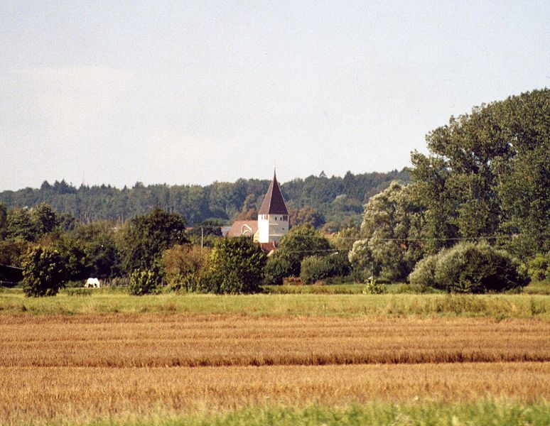
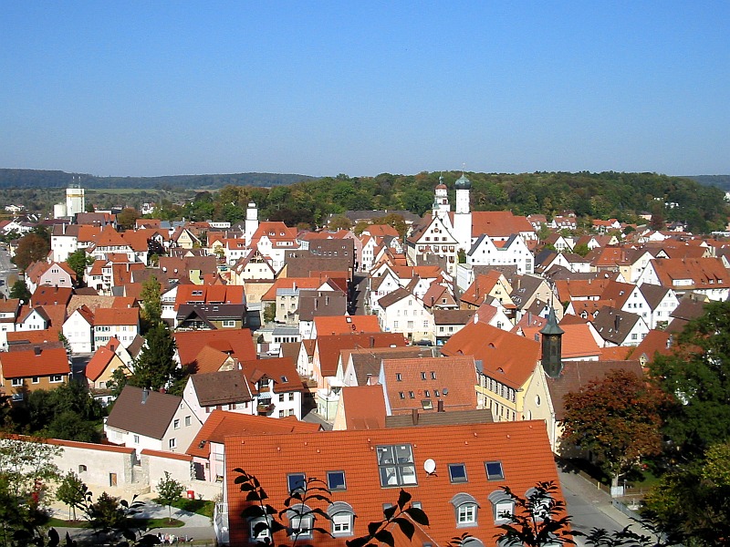
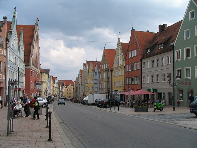
Heidenheim an der Brenz
- town in Baden-Württemberg in southern Germany
Hiking in Heidenheim an der Brenz
Heidenheim an der Brenz is a charming town in southern Germany, located in the state of Baden-Württemberg, surrounded by beautiful landscapes that make it an excellent destination for hiking enthusiasts. Here are some highlights and tips for hiking in the area:...
- Country:
- Postal Code: 89518–89522
- Local Dialing Code: 07321
- Licence Plate Code: HDH
- Coordinates: 48° 40' 34" N, 10° 9' 16" E
- GPS tracks (wikiloc): [Link]
- AboveSeaLevel: 504 м m
- Area: 107.1 sq km
- Population: 48048
- Web site: [Link]


Hermaringen
- municipality in southern Germany
Hiking in Hermaringen
Hermaringen is a small town in Germany located in the state of Baden-Württemberg. It's not as well known as some other hiking destinations, but it offers a lovely backdrop for nature enthusiasts and hikers. Here are some highlights and tips for hiking in the Hermaringen area:...
- Country:
- Postal Code: 89568
- Local Dialing Code: 07322
- Licence Plate Code: HDH
- Coordinates: 48° 35' 44" N, 10° 15' 38" E
- GPS tracks (wikiloc): [Link]
- AboveSeaLevel: 498 м m
- Area: 15.26 sq km
- Population: 2182
- Web site: [Link]


Gerstetten
- municipality in Germany
Hiking in Gerstetten
Gerstetten, located in the state of Baden-Württemberg in Germany, offers a range of hiking opportunities that showcase its beautiful landscapes and natural beauty. Here are some highlights of hiking in the area:...
- Country:
- Postal Code: 89547
- Local Dialing Code: 07323
- Licence Plate Code: HDH
- Coordinates: 48° 37' 21" N, 10° 1' 14" E
- GPS tracks (wikiloc): [Link]
- AboveSeaLevel: 624 м m
- Area: 92.43 sq km
- Population: 11601
- Web site: [Link]
Shares border with regions:

Günzburg
- district in Bavaria, Germany
Hiking in Günzburg
Günzburg district, located in Bavaria, Germany, offers various hiking opportunities that showcase the beautiful landscapes of southern Germany. Here are some highlights about hiking in the area:...
- Country:
- Capital: Günzburg
- Licence Plate Code: KRU; GZ
- Coordinates: 48° 19' 48" N, 10° 19' 48" E
- GPS tracks (wikiloc): [Link]
- AboveSeaLevel: 537 м m
- Area: 763.00 sq km
- Population: 107120
- Web site: [Link]

Dillingen
- district in Bavaria, Germany
Hiking in Dillingen
Dillingen, located in Bavaria, Germany, offers a variety of hiking opportunities amidst beautiful landscapes. The district is characterized by rolling hills, lush forests, and scenic views, making it an excellent destination for both casual walkers and serious hikers....
- Country:
- Capital: Dillingen an der Donau
- Licence Plate Code: WER; DLG
- Coordinates: 48° 34' 48" N, 10° 25' 12" E
- GPS tracks (wikiloc): [Link]
- AboveSeaLevel: 425 м m
- Area: 792.00 sq km
- Population: 80209
- Web site: [Link]
Donau-Ries
- district in Bavaria, Germany
Hiking in Donau-Ries
Donau-Ries is a beautiful region in Bavaria, Germany, known for its stunning landscapes, rich history, and cultural significance. Spanning both the Danube River and the Ries crater, this area offers diverse hiking opportunities for both beginners and more experienced trekkers....
- Country:
- Capital: Donauwörth
- Licence Plate Code: NÖ; DON
- Coordinates: 48° 49' 48" N, 10° 40' 12" E
- GPS tracks (wikiloc): [Link]
- AboveSeaLevel: 508 м m
- Area: 1275.00 sq km
- Population: 117483
- Web site: [Link]
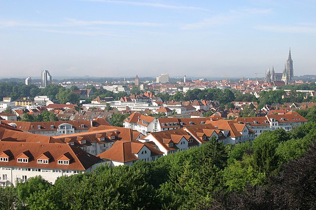
Alb-Donau-Kreis
- district in Baden-Württemberg, Germany
Hiking in Alb-Donau-Kreis
The Alb-Donau-Kreis is a beautiful district located in Baden-Württemberg, Germany, known for its diverse landscapes, rich nature, and historical sites. Hiking in this area offers a range of trails suitable for all levels of hikers, from beginners to more experienced trekkers. Here are some highlights and tips for hiking in Alb-Donau-Kreis:...
- Country:
- Capital: Ulm
- Licence Plate Code: UL
- Coordinates: 48° 24' 0" N, 9° 51' 0" E
- GPS tracks (wikiloc): [Link]
- AboveSeaLevel: 670 м m
- Area: 1358.67 sq km
- Population: 192104
- Web site: [Link]