Dillingen (Landkreis Dillingen a. d. Donau)
- district in Bavaria, Germany
Dillingen, located in Bavaria, Germany, offers a variety of hiking opportunities amidst beautiful landscapes. The district is characterized by rolling hills, lush forests, and scenic views, making it an excellent destination for both casual walkers and serious hikers.
Hiking Trails
-
Nature Trails: Dillingen features several well-marked nature trails that allow hikers to explore the local flora and fauna. These trails often include educational signage about the region's ecosystems.
-
The Danube Trail: This famous trail follows the course of the Danube River and can be accessed from Dillingen. It's perfect for those looking to enjoy a leisurely hike with beautiful river views.
-
Regional Hiking Routes: The area around Dillingen has been integrated into larger regional hiking networks, linking it to other picturesque towns and natural attractions in Bavaria.
Points of Interest
- Cultural Landmarks: Many hiking routes pass by historical sites, including churches and castles, which can provide a nice break from the hike and a chance to learn about the region’s history.
- Scenic Overlooks: Certain trails lead to vantage points that offer stunning views of the surrounding countryside, particularly during the fall when foliage is vibrant.
Best Times to Hike
The ideal times for hiking in Dillingen are during spring and fall when the weather is mild, and nature is at its most beautiful. Summer can also be enjoyable, but be prepared for warmer temperatures.
Tips for Hiking in Dillingen
- Prepare for Varying Terrain: Some trails can be rugged, so wearing proper hiking boots is essential.
- Hydrate and Snack: Carry enough water and snacks to keep your energy levels up, especially on longer hikes.
- Respect Nature: Always follow the Leave No Trace principles to preserve the area for future hikers.
Other Activities
In addition to hiking, Dillingen offers opportunities for cycling and exploring local parks. Many accommodations cater to outdoor enthusiasts, providing the perfect base for your adventures.
Overall, Dillingen offers a rich hiking experience for everyone, with diverse trails and beautiful scenery just waiting to be explored!
- Country:

- Capital: Dillingen an der Donau
- Licence Plate Code: WER; DLG
- Coordinates: 48° 34' 48" N, 10° 25' 12" E


- GPS tracks (wikiloc): [Link]
- AboveSeaLevel: 425 м m
- Area: 792.00 sq km
- Population: 80209
- Web site: http://www.landkreis-dillingen.de
- Wikipedia en: wiki(en)
- Wikipedia: wiki(de)
- Wikidata storage: Wikidata: Q10417
- Wikipedia Commons Category: [Link]
- Freebase ID: [/m/01l309]
- GeoNames ID: Alt: [2936975]
- VIAF ID: Alt: [123164092]
- OSM relation ID: [62521]
- GND ID: Alt: [4091003-9]
- archINFORM location ID: [2382]
- Library of Congress authority ID: Alt: [n81054177]
- TGN ID: [7196283]
- Historical Gazetteer (GOV) ID: [adm_139773]
- Bavarikon ID: [ODB_A00000622]
- NUTS code: [DE277]
- BabelNet ID: [01845527n]
- German district key: 09773
Includes regions:


Haunsheim
- municipality of Germany
Haunsheim is a small municipality located in Bavaria, Germany, known for its picturesque landscapes and access to nature. While it may not be a famous hiking destination compared to larger national parks or mountainous regions, there are still opportunities for enjoyable walks and hikes in and around the area....
- Country:

- Postal Code: 89437
- Local Dialing Code: 09072
- Licence Plate Code: DLG
- Coordinates: 48° 36' 0" N, 10° 22' 0" E


- GPS tracks (wikiloc): [Link]
- AboveSeaLevel: 445 м m
- Area: 17.79 sq km
- Population: 1482
- Web site: [Link]

Ziertheim
- municipality of Germany
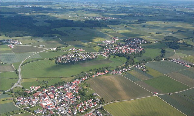
Ziertheim is a quaint village located in Bavaria, Germany, near the picturesque Danube River. While the area may not be as widely known as some larger hiking destinations in Germany, it offers a unique experience for hiking enthusiasts looking to explore scenic routes and local nature....
- Country:

- Postal Code: 89446
- Local Dialing Code: 09076
- Licence Plate Code: DLG
- Coordinates: 48° 39' 0" N, 10° 23' 0" E


- GPS tracks (wikiloc): [Link]
- AboveSeaLevel: 460 м m
- Area: 20.83 sq km
- Population: 1083
- Web site: [Link]


Zusamaltheim
- municipality of Germany
Zusamaltheim, a charming village in Bavaria, Germany, is located near the Lech River and surrounded by picturesque landscapes, making it an excellent destination for hiking enthusiasts. Here are some highlights and tips for hiking in and around Zusamaltheim:...
- Country:

- Postal Code: 86637
- Local Dialing Code: 08272
- Licence Plate Code: DLG
- Coordinates: 48° 32' 0" N, 10° 38' 0" E


- GPS tracks (wikiloc): [Link]
- AboveSeaLevel: 444 м m
- Area: 17.90 sq km
- Population: 912
- Web site: [Link]
Zöschingen
- municipality of Germany
Zöschingen is a small municipality in Germany, located in the state of Bavaria. While it may not be as widely known as some larger hiking destinations, it offers several attractive trails and beautiful natural scenery that can be appealing for hikers....
- Country:

- Postal Code: 89447
- Local Dialing Code: 09077
- Licence Plate Code: DLG
- Coordinates: 48° 40' 0" N, 10° 19' 0" E


- GPS tracks (wikiloc): [Link]
- AboveSeaLevel: 510 м m
- Area: 14.60 sq km
- Population: 640
- Web site: [Link]


Aislingen
- municipality of Germany
Aislingen, a small town located in Bavaria, Germany, is surrounded by beautiful landscapes that can make for a pleasing hiking experience. While Aislingen itself might not have extensive hiking trails, there are opportunities to explore nearby regions and natural areas....
- Country:

- Postal Code: 89344
- Local Dialing Code: 09075
- Licence Plate Code: DLG
- Coordinates: 48° 30' 0" N, 10° 27' 0" E


- GPS tracks (wikiloc): [Link]
- AboveSeaLevel: 437 м m
- Area: 19.35 sq km
- Population: 1395
- Web site: [Link]


Dillingen an der Donau
- town in Bavaria, Germany
 Hiking in Dillingen an der Donau
Dillingen an der Donau is a charming town in Bavaria, Germany, situated along the banks of the Danube River. The surrounding area offers a variety of hiking opportunities, making it a great destination for outdoor enthusiasts. Here are some highlights and tips for hiking in and around Dillingen an der Donau:...
- Country:

- Postal Code: 89407
- Local Dialing Code: 09071
- Licence Plate Code: DLG
- Coordinates: 48° 34' 0" N, 10° 28' 0" E


- GPS tracks (wikiloc): [Link]
- AboveSeaLevel: 433 м m
- Area: 75.59 sq km
- Population: 15803
- Web site: [Link]


Wertingen
- municipality of Germany
Wertingen, a small town located in Bavaria, Germany, offers various opportunities for hiking enthusiasts. The surrounding countryside is characterized by beautiful landscapes, including fields, forests, and rolling hills, making it a suitable destination for nature lovers....
- Country:

- Postal Code: 86637
- Local Dialing Code: 08272
- Coordinates: 48° 32' 0" N, 10° 40' 0" E


- GPS tracks (wikiloc): [Link]
- AboveSeaLevel: 421 м m
- Area: 51.88 sq km
- Population: 6829
- Web site: [Link]

Bachhagel
- Municipality in Bavaria, Germany
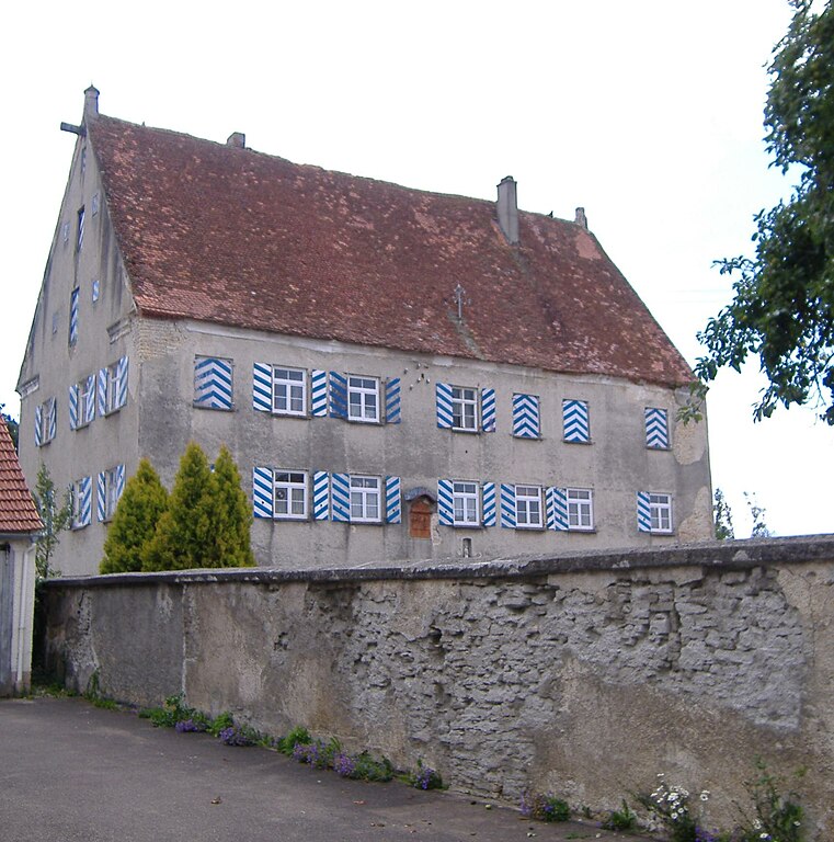
Bachhagel is a charming small municipality in Bavaria, Germany, nestled in the picturesque landscape of the Swabian region. While it may not be as widely known as some other hiking destinations in Germany, it offers several opportunities for outdoor enthusiasts looking to explore the natural beauty of the area....
- Country:

- Postal Code: 89429
- Local Dialing Code: 09077
- Licence Plate Code: DLG
- Coordinates: 48° 37' 56" N, 10° 19' 14" E


- GPS tracks (wikiloc): [Link]
- AboveSeaLevel: 470 м m
- Area: 19.72 sq km
- Population: 1788
- Web site: [Link]


Höchstädt an der Donau
- municipality of Germany
 Hiking in Höchstädt an der Donau
Höchstädt an der Donau is a charming town located in Bavaria, Germany, and is well known for its scenic landscapes and rich history. Hiking in this region can be a rewarding experience, offering trails that wind through beautiful countryside, alongside the Danube River, and into the surrounding forests and hills....
- Country:

- Postal Code: 89420
- Local Dialing Code: 09074
- Licence Plate Code: DLG
- Coordinates: 48° 36' 40" N, 10° 34' 5" E


- GPS tracks (wikiloc): [Link]
- AboveSeaLevel: 416 м m
- Area: 37.45 sq km
- Population: 4762
- Web site: [Link]


Syrgenstein
- municipality of Germany
Hiking in Syrgenstein, located in Germany, particularly in the region’s natural landscapes and along the Swabian Jura, offers a variety of trails suitable for different skill levels. The area is known for its stunning views, limestone cliffs, and diverse flora and fauna....
- Country:

- Postal Code: 89428
- Local Dialing Code: 09077
- Licence Plate Code: DLG
- Coordinates: 48° 39' 0" N, 10° 18' 0" E


- GPS tracks (wikiloc): [Link]
- AboveSeaLevel: 485 м m
- Area: 16.66 sq km
- Population: 3038
- Web site: [Link]

Gundelfingen an der Donau
- municipality of Germany
 Hiking in Gundelfingen an der Donau
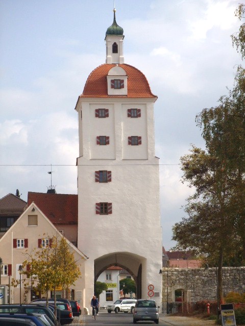
Gundelfingen an der Donau, located in Bavaria, Germany, is surrounded by beautiful landscapes that make it a great destination for hiking enthusiasts. The area around Gundelfingen offers a variety of trails suited for different skill levels, allowing hikers to enjoy nature whether they are beginners or experienced trekkers....
- Country:

- Postal Code: 89423
- Local Dialing Code: 09073
- Licence Plate Code: DLG
- Coordinates: 48° 33' 0" N, 10° 22' 0" E


- GPS tracks (wikiloc): [Link]
- AboveSeaLevel: 438 м m
- Area: 53.97 sq km
- Population: 6492
- Web site: [Link]

Buttenwiesen
- municipality of Germany
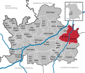
Buttenwiesen is a charming village located in Bavaria, Germany, surrounded by beautiful countryside and picturesque landscapes that are perfect for hiking enthusiasts. While it may not be as well-known as some larger hiking destinations, it offers a variety of trails that cater to different skill levels....
- Country:

- Postal Code: 86647
- Local Dialing Code: 08274
- Licence Plate Code: DLG
- Coordinates: 48° 36' 0" N, 10° 43' 0" E


- GPS tracks (wikiloc): [Link]
- AboveSeaLevel: 415 м m
- Area: 59.49 sq km
- Population: 4864
- Web site: [Link]


Finningen
- municipality of Germany
While I don't have specific information on a place called Finningen, it is possible that you might be referring to a locality in Germany, particularly in the Schwaben region. If that is correct, here are some general tips and recommendations for hiking in such areas:...
- Country:

- Postal Code: 89435
- Local Dialing Code: 09074
- Licence Plate Code: DLG
- Coordinates: 48° 39' 0" N, 10° 30' 0" E


- GPS tracks (wikiloc): [Link]
- AboveSeaLevel: 495 м m
- Area: 27.84 sq km
- Population: 1402
- Web site: [Link]


Binswangen
- municipality of Germany
Binswangen, a quaint village in Germany, offers some beautiful hiking opportunities, particularly in the surrounding areas of the Swabian Jura (Schwäbische Alb). While specific marked trails may not be as abundant as in more tourist-heavy regions, the natural landscape provides a delightful setting for outdoor enthusiasts. Here are some details and tips for hiking in and around Binswangen:...
- Country:

- Postal Code: 86637
- Local Dialing Code: 08272
- Licence Plate Code: DLG, WER
- Coordinates: 48° 34' 0" N, 10° 39' 0" E


- GPS tracks (wikiloc): [Link]
- AboveSeaLevel: 425 м m
- Area: 11.91 sq km
- Population: 1094
- Web site: [Link]

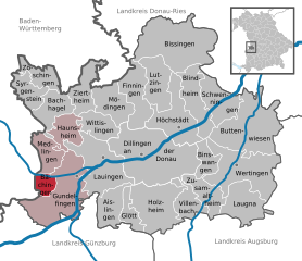
Bächingen an der Brenz
- municipality of Germany
 Hiking in Bächingen an der Brenz
Bächingen, located in the Swabian region of Germany, offers beautiful scenery and various hiking opportunities for outdoor enthusiasts. The area is characterized by lush green landscapes, rolling hills, and picturesque views, making it an ideal spot for hiking....
- Country:

- Postal Code: 89431
- Local Dialing Code: 07325
- Licence Plate Code: DLG
- Coordinates: 48° 32' 47" N, 10° 18' 46" E


- GPS tracks (wikiloc): [Link]
- AboveSeaLevel: 440 м m
- Area: 7.34 sq km
- Population: 1069
- Web site: [Link]

Blindheim
- municipality of Germany
Blindheim is a picturesque area located in Germany, known for its natural beauty and outdoor recreational opportunities. When hiking in Blindheim, you can expect a combination of lush landscapes, rolling hills, and tranquil forests. Here are some highlights and tips for hiking in this region:...
- Country:

- Postal Code: 89434
- Local Dialing Code: 09074
- Licence Plate Code: DLG
- Coordinates: 48° 38' 0" N, 10° 38' 0" E


- GPS tracks (wikiloc): [Link]
- AboveSeaLevel: 415 м m
- Area: 26.39 sq km
- Population: 1620
- Web site: [Link]


Bissingen
- municipality in Bavaria, Germany
Bissingen is a charming village located in the Swabian region of Bavaria, Germany. While it may not be as well-known as larger hiking destinations, it offers beautiful landscapes and serene nature that can make for a delightful hiking experience....
- Country:

- Postal Code: 86657
- Local Dialing Code: 09084
- Licence Plate Code: DLG, WER
- Coordinates: 48° 43' 0" N, 10° 37' 0" E


- GPS tracks (wikiloc): [Link]
- AboveSeaLevel: 454 м m
- Area: 34.22 sq km
- Population: 3244
- Web site: [Link]


Wittislingen
- human settlement in Germany
Wittislingen is a small village in Bavaria, Germany, known for its picturesque landscape and proximity to natural attractions. While it may not be as widely recognized as some of the larger hiking destinations, it offers some charming hiking opportunities, especially for those who appreciate the beauty of the Bavarian countryside....
- Country:

- Postal Code: 89426
- Local Dialing Code: 09076
- Licence Plate Code: DLG
- Coordinates: 48° 37' 0" N, 10° 25' 0" E


- GPS tracks (wikiloc): [Link]
- AboveSeaLevel: 450 м m
- Area: 17.41 sq km
- Population: 2322
- Web site: [Link]


Laugna
- municipality of Germany
It seems there might be a slight typo in your query regarding "Laugna." If you meant "Laguna" or "Launa," as in locations like Laguna Beach, Laguna Mountains, or specific areas within those regions, please let me know. Alternatively, if you meant a different place, kindly provide more context, and I’ll be glad to assist you!...
- Country:

- Postal Code: 86502
- Local Dialing Code: 08272
- Licence Plate Code: DLG
- Coordinates: 48° 32' 0" N, 10° 42' 0" E


- GPS tracks (wikiloc): [Link]
- AboveSeaLevel: 442 м m
- Area: 27.60 sq km
- Population: 1313
- Web site: [Link]


Glött
- municipality of Germany
Glött is a small village located in Bavaria, Germany, and while it's not a widely recognized hiking destination, it does offer access to the scenic Bavarian countryside. If you're interested in hiking in and around Glött, here are some things to consider:...
- Country:

- Postal Code: 89353
- Local Dialing Code: 09075
- Licence Plate Code: DLG
- Coordinates: 48° 30' 0" N, 10° 29' 0" E


- GPS tracks (wikiloc): [Link]
- AboveSeaLevel: 449 м m
- Area: 10.99 sq km
- Population: 1099
- Web site: [Link]


Mödingen
- municipality of Germany
Mödingen is a charming village located in Bavaria, Germany, offering various opportunities for hiking enthusiasts. The surrounding landscape is characterized by picturesque views, rolling hills, and lush forests, making it an ideal area for outdoor activities....
- Country:

- Postal Code: 89426
- Local Dialing Code: 09076
- Licence Plate Code: DLG
- Coordinates: 48° 39' 0" N, 10° 26' 0" E


- GPS tracks (wikiloc): [Link]
- AboveSeaLevel: 447 м m
- Area: 23.37 sq km
- Population: 1205
- Web site: [Link]


Medlingen
- municipality of Germany
Medlingen is a charming village located in the Bavaria region of Germany, known for its scenic landscapes and accessibility to hiking trails. Whether you are an experienced hiker or a casual walker, Medlingen offers a variety of trails that showcase the natural beauty of the area....
- Country:

- Postal Code: 89441
- Local Dialing Code: 09073
- Licence Plate Code: DLG
- Coordinates: 48° 34' 0" N, 10° 19' 0" E


- GPS tracks (wikiloc): [Link]
- AboveSeaLevel: 433 м m
- Area: 17.09 sq km
- Population: 817
- Web site: [Link]


Villenbach
- municipality of Germany
Villenbach is a picturesque village located in Bavaria, Germany, which offers a charming backdrop for hiking enthusiasts. The surrounding region boasts a variety of hiking trails that cater to different skill levels and preferences. Here are some highlights of hiking in Villenbach and its nearby areas:...
- Country:

- Postal Code: 86637
- Local Dialing Code: 08296
- Licence Plate Code: DLG
- Coordinates: 48° 31' 0" N, 10° 37' 0" E


- GPS tracks (wikiloc): [Link]
- AboveSeaLevel: 437 м m
- Area: 17.81 sq km
- Population: 1062
- Web site: [Link]
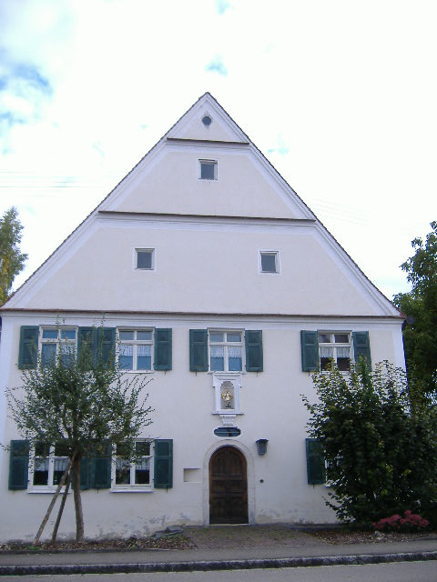

Lutzingen
- municipality of Germany
Lutzingen is a quaint village located in Bavaria, Germany, offering a range of outdoor activities, including hiking. While it's not widely known as a major hiking destination, the surrounding region is rich in natural beauty and scenic landscapes, making it a great spot for hiking enthusiasts....
- Country:

- Postal Code: 89440
- Local Dialing Code: 09074
- Licence Plate Code: DLG
- Coordinates: 48° 39' 0" N, 10° 33' 0" E


- GPS tracks (wikiloc): [Link]
- AboveSeaLevel: 439 м m
- Area: 24.93 sq km
- Population: 983
- Web site: [Link]


Holzheim
- town in Dillingen District, Bavaria, Germany
Holzheim, located in the Dillingen district of Bavaria, Germany, is a charming area suitable for hiking enthusiasts. The region is characterized by its scenic landscapes, which include lush forests, rolling hills, and beautiful meadows....
- Country:

- Postal Code: 89438
- Local Dialing Code: 09075
- Licence Plate Code: DLG
- Coordinates: 48° 31' 0" N, 10° 32' 0" E


- GPS tracks (wikiloc): [Link]
- AboveSeaLevel: 431 м m
- Area: 40.86 sq km
- Population: 3240
- Web site: [Link]


Lauingen
- municipality of Germany
Lauingen is a charming town located in Bavaria, Germany, and while it may not be the first destination that comes to mind for hiking, it offers several opportunities for outdoor enthusiasts. Here are some insights into hiking around Lauingen:...
- Country:

- Postal Code: 89415
- Local Dialing Code: 09072
- Licence Plate Code: DLG
- Coordinates: 48° 34' 0" N, 10° 26' 0" E


- GPS tracks (wikiloc): [Link]
- AboveSeaLevel: 439 м m
- Area: 44.39 sq km
- Population: 9308
- Web site: [Link]
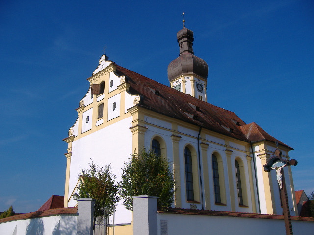

Schwenningen
- municipality in the district of Dillingen an der Donau, Bavaria, Germany
Schwenningen, located in Bavaria, Germany, offers a variety of hiking opportunities for enthusiasts of all levels. Nestled in a picturesque landscape, the area is characterized by rolling hills, lush forests, and beautiful meadows. Here are some highlights of hiking in Schwenningen and its surrounding areas:...
- Country:

- Postal Code: 89443
- Local Dialing Code: 09070
- Licence Plate Code: DLG
- Coordinates: 48° 39' 0" N, 10° 39' 0" E


- GPS tracks (wikiloc): [Link]
- AboveSeaLevel: 416 м m
- Area: 25.02 sq km
- Population: 1343
- Web site: [Link]
Shares border with regions:


Günzburg
- district in Bavaria, Germany
Günzburg district, located in Bavaria, Germany, offers various hiking opportunities that showcase the beautiful landscapes of southern Germany. Here are some highlights about hiking in the area:...
- Country:

- Capital: Günzburg
- Licence Plate Code: KRU; GZ
- Coordinates: 48° 19' 48" N, 10° 19' 48" E


- GPS tracks (wikiloc): [Link]
- AboveSeaLevel: 537 м m
- Area: 763.00 sq km
- Population: 107120
- Web site: [Link]


Augsburg
- district in Bavaria, Germany
Augsburg is a city in Bavaria, Germany, known for its rich history and beautiful surroundings, making it a great base for hiking enthusiasts. While the city itself offers various parks and local trails, the surrounding district provides a variety of hiking options for different skill levels. Here are some highlights:...
- Country:

- Capital: Augsburg
- Licence Plate Code: A
- Coordinates: 48° 25' 12" N, 10° 49' 48" E


- GPS tracks (wikiloc): [Link]
- AboveSeaLevel: 521 м m
- Area: 1071.00 sq km
- Population: 191469
- Web site: [Link]
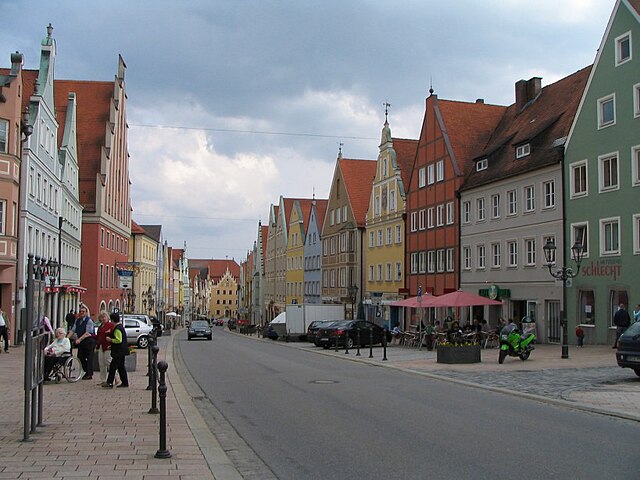
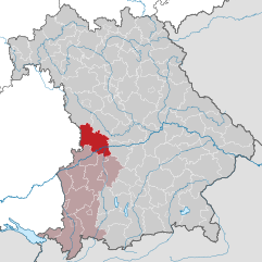
Donau-Ries
- district in Bavaria, Germany
Donau-Ries is a beautiful region in Bavaria, Germany, known for its stunning landscapes, rich history, and cultural significance. Spanning both the Danube River and the Ries crater, this area offers diverse hiking opportunities for both beginners and more experienced trekkers....
- Country:

- Capital: Donauwörth
- Licence Plate Code: NÖ; DON
- Coordinates: 48° 49' 48" N, 10° 40' 12" E


- GPS tracks (wikiloc): [Link]
- AboveSeaLevel: 508 м m
- Area: 1275.00 sq km
- Population: 117483
- Web site: [Link]

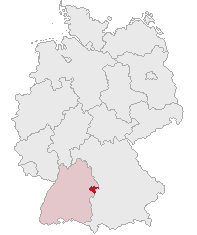
Heidenheim
- district in Baden-Württemberg, Germany
Heidenheim, located in Baden-Württemberg, Germany, is a region that offers a variety of hiking opportunities amidst beautiful landscapes, historical sites, and natural attractions. Here are some aspects to consider when hiking in Heidenheim and its surroundings:...
- Country:

- Licence Plate Code: HDH
- Coordinates: 48° 38' 24" N, 10° 7' 12" E


- GPS tracks (wikiloc): [Link]
- AboveSeaLevel: 599 м m
- Area: 627.13 sq km
- Population: 130527
- Web site: [Link]
