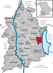
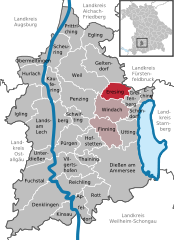
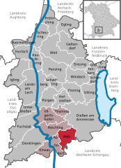
Landsberg (Landkreis Landsberg am Lech)

- district of Bavaria, Germany
 Hiking in Landsberg
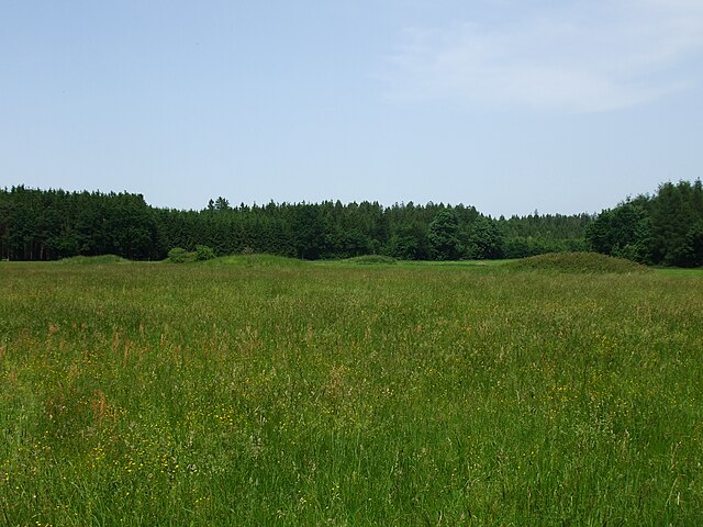
Landsberg district, located in Bavaria, Germany, is a beautiful area that offers a variety of hiking opportunities amidst stunning natural landscapes. The region is characterized by its rolling hills, lush forests, and picturesque lakes, making it an ideal destination for outdoor enthusiasts. Here are some key points about hiking in Landsberg district:
1. :
- The district features numerous marked hiking trails that cater to all levels of hikers, from easy walks to more challenging treks. Popular routes include trails around the Ammersee and the surrounding countryside.
- The trails often offer breathtaking views of the Alps, especially on clear days.
2. :
- The presence of lakes like Ammersee and Pilsen lakes provides opportunities for waterside hikes, swimming, and picnicking.
- The area's rich biodiversity means you may encounter a variety of flora and fauna along the trails.
3. :
- The region is steeped in history, with several trails passing through charming Bavarian towns, offering a chance to explore local culture, architecture, and cuisine.
- Landsberg itself has historical significance, with buildings dating back to the medieval times, which can be incorporated into a hike.
4. :
- Many trails are well-marked and easily accessible, with parking areas and public transportation links. The area is also popular for cycling, which can be a good alternative for those looking to explore more extensively.
5. :
- Late spring through early autumn (May to September) is typically the best time for hiking, with pleasant weather and vibrant landscapes.
- In autumn, the changing leaf colors provide a stunning backdrop for hikes.
6. :
- As with any hike, it’s important to prepare adequately. Carry sufficient water, snacks, and wear appropriate footwear.
- Weather can change, so checking the forecast and being prepared for sudden changes is crucial.
7. :
- Consider joining local hiking clubs or guided tours to meet fellow hiking enthusiasts and discover hidden gems in the area.
Overall, Landsberg district offers a wonderful mix of nature, history, and culture, making it a fantastic destination for anyone interested in hiking and outdoor activities. Always make sure to do some research on specific trails before you go, and enjoy your hiking adventures!
- Country:

- Capital: Landsberg am Lech
- Licence Plate Code: LL
- Coordinates: 48° 1' 12" N, 10° 57' 0" E


- GPS tracks (wikiloc): [Link]
- AboveSeaLevel: 636 м m
- Area: 804.00 sq km
- Population: 83612
- Web site: http://www.lra-landsberg.de/
- Wikipedia en: wiki(en)
- Wikipedia: wiki(de)
- Wikidata storage: Wikidata: Q10507
- Wikipedia Commons Gallery: [Link]
- Wikipedia Commons Category: [Link]
- Freebase ID: [/m/01z05g]
- GeoNames ID: Alt: [3220834]
- VIAF ID: Alt: [244531145]
- OSM relation ID: [62498]
- GND ID: Alt: [4034338-8]
- archINFORM location ID: [2487]
- TGN ID: [7077296]
- Historical Gazetteer (GOV) ID: [adm_139181]
- Bavarikon ID: [ODB_A00002352]
- NUTS code: [DE21E]
- BabelNet ID: [02841655n]
- German district key: 09181
Includes regions:


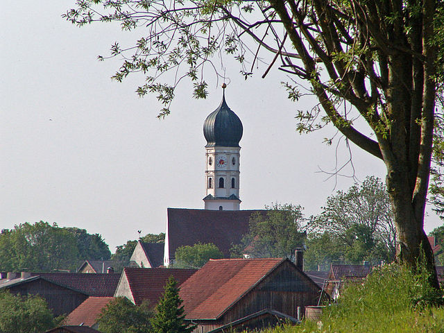
Dießen am Ammersee
- municipality of Germany
Hiking in Dießen am Ammersee
Dießen am Ammersee is a picturesque town located in Bavaria, Germany, near the beautiful Ammersee Lake. It offers a variety of hiking opportunities that cater to different skill levels, providing stunning views of the lake, rolling hills, and surrounding countryside. Here are some highlights for hiking in the area:...
- Country:
- Postal Code: 86911
- Local Dialing Code: 08807
- Licence Plate Code: LL
- Coordinates: 47° 57' 3" N, 11° 6' 11" E
- GPS tracks (wikiloc): [Link]
- AboveSeaLevel: 535 м m
- Area: 82.64 sq km
- Population: 10326
- Web site: [Link]


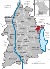
Eching am Ammersee
- municipality of Germany
Hiking in Eching am Ammersee
Eching am Ammersee is a picturesque village located near the Ammersee lake in Bavaria, Germany. It's a fantastic spot for hiking, offering scenic trails that meander through beautiful landscapes, forests, and along the shores of the lake. Here are some highlights and tips for hiking in this area:...
- Country:
- Postal Code: 82279
- Local Dialing Code: 08143
- Licence Plate Code: LL
- Coordinates: 48° 8' 0" N, 11° 12' 0" E
- GPS tracks (wikiloc): [Link]
- AboveSeaLevel: 602 м m
- Area: 6.24 sq km
- Population: 1293
- Web site: [Link]

Utting
- municipality of Germany
Hiking in Utting
Utting, a charming village located by the Ammersee in Bavaria, Germany, offers several opportunities for hiking enthusiasts to explore beautiful landscapes and enjoy the peaceful surroundings. Here are some highlights about hiking in and around Utting:...
- Country:
- Postal Code: 86919
- Local Dialing Code: 08806
- Licence Plate Code: LL
- Coordinates: 48° 1' 34" N, 11° 5' 10" E
- GPS tracks (wikiloc): [Link]
- AboveSeaLevel: 544 м m
- Area: 19.01 sq km
- Population: 2933
- Web site: [Link]

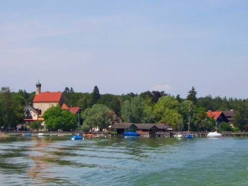
Ammersee
- unincorporated area in Germany
Hiking in Ammersee
Ammersee, located in Bavaria, Germany, offers a beautiful setting for hiking enthusiasts. This picturesque lake area is surrounded by scenic landscapes, charming villages, and plenty of trails suitable for various skill levels. Here are some highlights for hiking in and around the Ammersee region, specifically in the gemeindefreies Gebiet (non-municipal areas):...
- Country:
- Coordinates: 48° 0' 0" N, 11° 7' 0" E
- GPS tracks (wikiloc): [Link]

Kaufering
- municipality of Germany
Hiking in Kaufering
Kaufering is a small town located in Bavaria, Germany, near the Ammergebirge mountains and the picturesque landscapes of the surrounding region. Hiking in and around Kaufering offers beautiful natural scenery, well-maintained trails, and a chance to explore the stunning Bavarian countryside....
- Country:
- Postal Code: 86916
- Local Dialing Code: 08191
- Licence Plate Code: LL
- Coordinates: 48° 5' 0" N, 10° 53' 0" E
- GPS tracks (wikiloc): [Link]
- AboveSeaLevel: 585 м m
- Area: 17.70 sq km
- Population: 8140
- Web site: [Link]


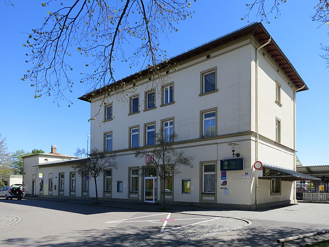
Landsberg am Lech
- town in Bavaria, Germany
Hiking in Landsberg am Lech
Landsberg am Lech is a charming town in Bavaria, Germany, located along the banks of the Lech River. It's surrounded by beautiful landscapes, making it a great starting point for various hiking opportunities. Here are some highlights and tips for hiking in and around Landsberg am Lech:...
- Country:
- Postal Code: 86899
- Local Dialing Code: 08191
- Licence Plate Code: LL
- Coordinates: 48° 2' 0" N, 10° 53' 0" E
- GPS tracks (wikiloc): [Link]
- AboveSeaLevel: 585 м m
- Area: 57.9 sq km
- Population: 28708
- Web site: [Link]


Unterdießen
- municipality of Germany
Hiking in Unterdießen
Unterdießen is a charming village located in Bavaria, Germany, surrounded by picturesque landscapes that are ideal for hiking enthusiasts. The area features rolling hills, lush forests, and scenic meadows, making it a beautiful destination for outdoor activities....
- Country:
- Postal Code: 86944
- Local Dialing Code: 08243
- Licence Plate Code: LL
- Coordinates: 47° 59' 0" N, 10° 50' 0" E
- GPS tracks (wikiloc): [Link]
- AboveSeaLevel: 635 м m
- Area: 12.79 sq km
- Population: 1026
- Web site: [Link]


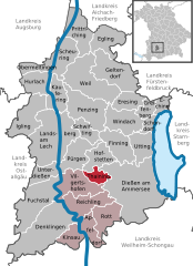
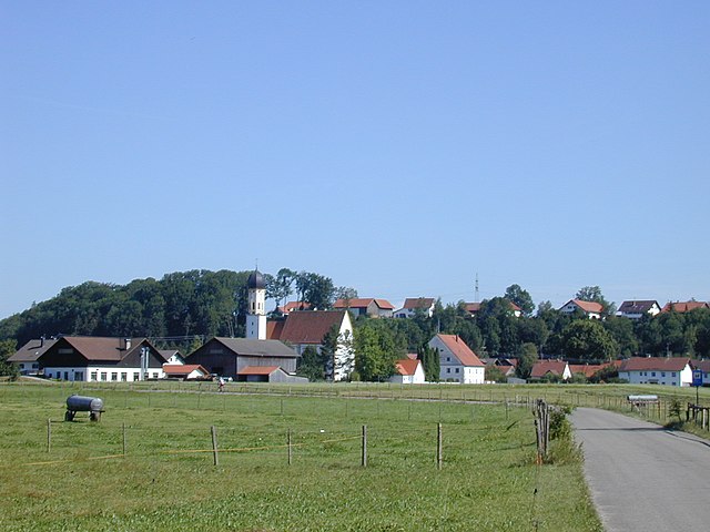
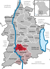
Reichling
- municipality of Germany
Hiking in Reichling
Reichling, a quaint town located in Bavaria, Germany, offers a variety of hiking opportunities suited for different skill levels and preferences. The surrounding landscapes are beautifully diverse, encompassing scenic meadows, dense forests, and picturesque hills that provide stunning views of the Bavarian countryside....
- Country:
- Postal Code: 86934
- Local Dialing Code: 08194
- Licence Plate Code: LL
- Coordinates: 47° 55' 0" N, 10° 56' 0" E
- GPS tracks (wikiloc): [Link]
- AboveSeaLevel: 731 м m
- Area: 23.26 sq km
- Population: 1272
- Web site: [Link]

Schwifting
- municipality of Germany
Hiking in Schwifting
Schwifting is a small village in Bavaria, Germany, known for its picturesque landscapes and access to the surrounding natural beauty of the region. While it may not be as widely recognized as larger tourist destinations, it offers some lovely hiking opportunities, particularly for those who enjoy a more tranquil and less crowded environment....
- Country:
- Postal Code: 86940
- Local Dialing Code: 08191
- Licence Plate Code: LL
- Coordinates: 48° 2' 0" N, 10° 55' 0" E
- GPS tracks (wikiloc): [Link]
- AboveSeaLevel: 631 м m
- Area: 11.45 sq km
- Population: 616
- Web site: [Link]

Thaining
- municipality of Germany
Hiking in Thaining
Thaining is a small municipality in Bavaria, Germany, which is often less well-known compared to larger destinations in the region. However, it offers a charming environment for hiking enthusiasts, blending the beauty of the Bavarian landscape with the serenity of rural Germany....
- Country:
- Postal Code: 86943
- Local Dialing Code: 08194
- Licence Plate Code: LL
- Coordinates: 47° 57' 0" N, 10° 58' 0" E
- GPS tracks (wikiloc): [Link]
- AboveSeaLevel: 692 м m
- Area: 8.70 sq km
- Population: 846
- Web site: [Link]


Prittriching
- municipality in Germany
Hiking in Prittriching
Prittriching is a small town located in Bavaria, Germany, and while it might not be as well-known as some of the larger hiking destinations in the area, it can still offer appealing outdoor experiences for those looking to explore nature. The surrounding regions of Bavaria are renowned for their scenic landscapes, which include rolling hills, forests, and picturesque views....
- Country:
- Postal Code: 86931
- Local Dialing Code: 08206
- Licence Plate Code: LL
- Coordinates: 48° 12' 0" N, 10° 55' 0" E
- GPS tracks (wikiloc): [Link]
- AboveSeaLevel: 551 м m
- Area: 25.37 sq km
- Population: 1863
- Web site: [Link]

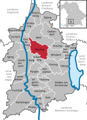
Schondorf am Ammersee
- town in Bavaria, Germany
Hiking in Schondorf am Ammersee
Schondorf am Ammersee is a charming village located in Bavaria, Germany, near the scenic shores of Lake Ammersee. The surrounding area offers a variety of hiking opportunities that cater to different skill levels and preferences. Here's what you need to know about hiking in and around Schondorf:...
- Country:
- Postal Code: 86938
- Local Dialing Code: 08192
- Licence Plate Code: LL
- Coordinates: 48° 3' 0" N, 11° 5' 0" E
- GPS tracks (wikiloc): [Link]
- AboveSeaLevel: 565 м m
- Area: 6.60 sq km
- Population: 2930
- Web site: [Link]


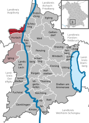
Hurlach
- municipality of Germany
Hiking in Hurlach
Hurlach is a quaint village located in Bavaria, Germany, and while it may not be as well-known as some major hiking destinations, it offers access to beautiful landscapes and opportunities for outdoor activities. The surrounding region features rolling hills, lush meadows, and scenic paths that are perfect for hiking....
- Country:
- Postal Code: 86857
- Local Dialing Code: 08248
- Licence Plate Code: LL
- Coordinates: 48° 7' 0" N, 10° 49' 0" E
- GPS tracks (wikiloc): [Link]
- AboveSeaLevel: 584 м m
- Area: 17.15 sq km
- Population: 1075
- Web site: [Link]

Obermeitingen
- municipality of Germany
Hiking in Obermeitingen
Obermeitingen, located in Bavaria, Germany, is a charming village that offers various opportunities for hiking enthusiasts. The region is characterized by its picturesque landscapes, lush greenery, and tranquil surroundings. Here are some insights to help you enjoy hiking in Obermeitingen:...
- Country:
- Postal Code: 86836
- Local Dialing Code: 08232
- Licence Plate Code: LL
- Coordinates: 48° 8' 0" N, 10° 48' 0" E
- GPS tracks (wikiloc): [Link]
- AboveSeaLevel: 575 м m
- Area: 9.93 sq km
- Population: 1265
- Web site: [Link]


Windach
- municipality in the district of Landsberg in Bavaria in Germany
Hiking in Windach
Windach is a charming village located in Bavaria, Germany, nestled in the foothills of the Alps. It serves as a great starting point for various hiking adventures in the surrounding area. Here are some highlights about hiking in and around Windach:...
- Country:
- Postal Code: 86949
- Local Dialing Code: 08193
- Licence Plate Code: LL
- Coordinates: 48° 3' 51" N, 11° 2' 27" E
- GPS tracks (wikiloc): [Link]
- AboveSeaLevel: 599 м m
- Area: 24.85 sq km
- Population: 2264
- Web site: [Link]
Kinsau
- municipality of Germany
Hiking in Kinsau
Kinsau is a picturesque area in Bavaria, Germany, known for its stunning landscapes, charming villages, and scenic hiking trails. Located near the foothills of the Alps, Kinsau offers various trails suited for all skill levels, from gentle walks to more challenging hikes....
- Country:
- Postal Code: 86981
- Local Dialing Code: 08869
- Licence Plate Code: LL
- Coordinates: 47° 53' 0" N, 10° 55' 0" E
- GPS tracks (wikiloc): [Link]
- AboveSeaLevel: 664 м m
- Area: 11.44 sq km
- Population: 790
- Web site: [Link]

Eresing
- municipality in Bavaria, in Germany
Hiking in Eresing
Eresing is a small town located in the Upper Bavaria region of Germany, near the beautiful Ammersee lake. It's a great starting point for hiking enthusiasts looking to explore the scenic Bavarian countryside and the foothills of the Alps....
- Country:
- Postal Code: 86922
- Local Dialing Code: 08193
- Licence Plate Code: LL
- Coordinates: 48° 4' 0" N, 11° 1' 0" E
- GPS tracks (wikiloc): [Link]
- AboveSeaLevel: 600 м m
- Area: 14.23 sq km
- Population: 1345
- Web site: [Link]
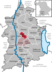
Pürgen
- municipality of Germany
Hiking in Pürgen
Pürgen, located in Bavaria, Germany, offers a picturesque setting for hiking enthusiasts. Here are some key points to consider when planning your hiking adventure in this lovely region:...
- Country:
- Postal Code: 86932
- Local Dialing Code: 08196
- Licence Plate Code: LL
- Coordinates: 48° 2' 0" N, 10° 55' 0" E
- GPS tracks (wikiloc): [Link]
- AboveSeaLevel: 648 м m
- Area: 21.99 sq km
- Population: 2241
- Web site: [Link]


Denklingen
- municipality of Germany
Hiking in Denklingen
Denklingen is a picturesque village located in Bavaria, Germany, surrounded by beautiful landscapes that make it an appealing destination for hiking enthusiasts. The region features a mix of rolling hills, lush forests, and tranquil lakes, offering a variety of hiking trails suitable for different skill levels....
- Country:
- Postal Code: 86920
- Local Dialing Code: 08243
- Licence Plate Code: LL
- Coordinates: 47° 55' 0" N, 10° 51' 0" E
- GPS tracks (wikiloc): [Link]
- AboveSeaLevel: 708 м m
- Area: 56.76 sq km
- Population: 1979
- Web site: [Link]


Geltendorf
- municipality of Germany
Hiking in Geltendorf
Geltendorf, located in Bavaria, Germany, offers a variety of beautiful hiking opportunities for outdoor enthusiasts. Here are some highlights and tips for hiking in the area:...
- Country:
- Postal Code: 82269
- Local Dialing Code: 08193
- Coordinates: 48° 7' 20" N, 11° 1' 40" E
- GPS tracks (wikiloc): [Link]
- AboveSeaLevel: 603 м m
- Area: 34.82 sq km
- Population: 5645
- Web site: [Link]

Vilgertshofen
- municipality of Germany
Hiking in Vilgertshofen
Vilgertshofen is a small village located in Bavaria, Germany, offering a serene environment for hiking enthusiasts. The surrounding countryside is characterized by picturesque landscapes, lush fields, and charming forests, making it an excellent choice for those looking to escape into nature....
- Country:
- Postal Code: 86946
- Local Dialing Code: 08194
- Licence Plate Code: LL
- Coordinates: 47° 57' 0" N, 10° 55' 0" E
- GPS tracks (wikiloc): [Link]
- AboveSeaLevel: 714 м m
- Area: 27.14 sq km
- Population: 1741
- Web site: [Link]


Finning
- municipality of Germany
Hiking in Finning
Hiking in Finning, Bavaria, offers a delightful experience for outdoor enthusiasts. Located near the foothills of the Bavarian Alps, this small town is surrounded by beautiful landscapes, rolling hills, and lush forests, making it an excellent starting point for various hiking trails....
- Country:
- Postal Code: 86923
- Local Dialing Code: 08806
- Licence Plate Code: LL
- Coordinates: 48° 1' 0" N, 11° 0' 0" E
- GPS tracks (wikiloc): [Link]
- AboveSeaLevel: 609 м m
- Area: 23.33 sq km
- Population: 1191
- Web site: [Link]


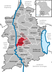
Hofstetten
- municipality in Bavaria, Germany
Hiking in Hofstetten
Hofstetten, located in Bavaria, Germany, is a charming village offering access to beautiful hiking trails that showcase the stunning landscapes of the Bavarian countryside. Here are some highlights and tips for hiking in Hofstetten:...
- Country:
- Postal Code: 86928
- Local Dialing Code: 08196
- Licence Plate Code: LL
- Coordinates: 48° 1' 0" N, 10° 58' 0" E
- GPS tracks (wikiloc): [Link]
- AboveSeaLevel: 676 м m
- Area: 17.02 sq km
- Population: 1245
- Web site: [Link]

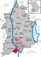
Rott
- municipality of Germany
Hiking in Rott
Rott, located near Landsberg am Lech in Bavaria, Germany, is a charming area that offers opportunities for hiking amidst beautiful natural scenery. The region is characterized by rolling hills, woodlands, and agricultural landscapes, making it a picturesque setting for outdoor enthusiasts....
- Country:
- Postal Code: 86935
- Local Dialing Code: 08869
- Licence Plate Code: LL
- Coordinates: 47° 54' 0" N, 10° 58' 0" E
- GPS tracks (wikiloc): [Link]
- AboveSeaLevel: 702 м m
- Area: 19.73 sq km
- Population: 1018
- Web site: [Link]


Fuchstal
- municipality of Germany
Hiking in Fuchstal
Fuchstal is a picturesque region in Bavaria, Germany, known for its beautiful landscapes, charming villages, and accessible hiking trails. Here’s what you need to know about hiking in Fuchstal:...
- Country:
- Postal Code: 86925
- Local Dialing Code: 08243
- Licence Plate Code: LL
- Coordinates: 47° 56' 0" N, 10° 49' 0" E
- GPS tracks (wikiloc): [Link]
- AboveSeaLevel: 659 м m
- Area: 39.75 sq km
- Population: 2771
- Web site: [Link]


Apfeldorf
- municipality of Germany
Hiking in Apfeldorf
Apfeldorf, a small village located in Bavaria, Germany, offers a picturesque setting for hiking enthusiasts. Nestled near the foothills of the Alps, the region is characterized by beautiful landscapes, rolling hills, lush forests, and charming villages....
- Country:
- Postal Code: 86974
- Local Dialing Code: 08869
- Licence Plate Code: LL
- Coordinates: 47° 54' 0" N, 10° 56' 0" E
- GPS tracks (wikiloc): [Link]
- AboveSeaLevel: 665 м m
- Area: 12.31 sq km
- Population: 828
- Web site: [Link]


Egling an der Paar
- municipality of Germany
Hiking in Egling an der Paar
Egling an der Paar is a beautiful village located in Bavaria, Germany, known for its scenic landscapes and outdoor activities, including hiking. If you're planning to hike in this area, here are some highlights to consider:...
- Country:
- Postal Code: 86492
- Local Dialing Code: 08206
- Licence Plate Code: LL
- Coordinates: 48° 10' 0" N, 10° 58' 0" E
- GPS tracks (wikiloc): [Link]
- AboveSeaLevel: 552 м m
- Area: 20.77 sq km
- Population: 1543
- Web site: [Link]

Weil
- Upper Bavarian municipality in the rural district of Landsberg am Lech
Hiking in Weil
Weil, located in Bavaria, Germany, is surrounded by stunning landscapes that offer great opportunities for hiking enthusiasts. Here are some highlights and tips for hiking in this area:...
- Country:
- Postal Code: 86947
- Local Dialing Code: 08195
- Licence Plate Code: LL
- Coordinates: 48° 7' 0" N, 10° 55' 0" E
- GPS tracks (wikiloc): [Link]
- AboveSeaLevel: 587 м m
- Area: 44.48 sq km
- Population: 2608
- Web site: [Link]

Penzing
- municipality in Bavaria, Germany
Hiking in Penzing
Penzing, Bavaria, is a charming village located in the beautiful Allgäu region of Germany. It's a great destination for hiking, offering a mix of scenic landscapes, rolling hills, and access to the nearby Alps....
- Country:
- Postal Code: 86929
- Local Dialing Code: 08191
- Licence Plate Code: LL
- Coordinates: 48° 4' 20" N, 10° 55' 40" E
- GPS tracks (wikiloc): [Link]
- AboveSeaLevel: 620 м m
- Area: 33.79 sq km
- Population: 3104
- Web site: [Link]


Igling
- municipality of Germany
Hiking in Igling
Igling is a small municipality in Bavaria, Germany, located near the picturesque city of Landsberg am Lech. The surrounding area offers a variety of beautiful hiking trails suitable for different skill levels, making it a great destination for outdoor enthusiasts. Here are some highlights for hiking in and around Igling:...
- Country:
- Postal Code: 86859
- Local Dialing Code: 08248
- Licence Plate Code: LL
- Coordinates: 48° 4' 0" N, 10° 48' 0" E
- GPS tracks (wikiloc): [Link]
- AboveSeaLevel: 620 м m
- Area: 26.37 sq km
- Population: 1767
- Web site: [Link]


Scheuring
- municipality of Germany
Hiking in Scheuring
Scheuring is a small village in Bavaria, Germany, located near the larger town of Landsberg am Lech. The area surrounding Scheuring offers beautiful landscapes and various opportunities for hiking, particularly in the nearby nature reserves and the rolling hills of the Bavarian countryside....
- Country:
- Postal Code: 86937
- Local Dialing Code: 08195
- Licence Plate Code: LL
- Coordinates: 48° 10' 0" N, 10° 54' 0" E
- GPS tracks (wikiloc): [Link]
- AboveSeaLevel: 564 м m
- Area: 21.25 sq km
- Population: 1277
- Web site: [Link]

Greifenberg
- municipality of Germany
Hiking in Greifenberg
Greifenberg, located in Bavaria, Germany, is a charming area that offers a mix of beautiful landscapes, serene lakes, and scenic hiking trails. Here are some key points to consider if you're planning a hiking trip in Greifenberg:...
- Country:
- Postal Code: 86926
- Local Dialing Code: 08192
- Licence Plate Code: ll
- Coordinates: 48° 4' 0" N, 11° 5' 0" E
- GPS tracks (wikiloc): [Link]
- AboveSeaLevel: 580 м m
- Area: 8.21 sq km
- Population: 2167
- Web site: [Link]
Shares border with regions:

Ostallgäu
- district in Bavaria, Germany
Hiking in Ostallgäu
Ostallgäu is a picturesque region in Bavaria, Germany, known for its stunning landscapes dominated by the Alps, rolling hills, and charming villages. It's an excellent destination for hiking, offering a variety of trails suitable for different skill levels, from beginner to advanced. Here are some key highlights of hiking in Ostallgäu:...
- Country:
- Capital: Marktoberdorf
- Licence Plate Code: OAL; MOD; FÜS
- Coordinates: 47° 45' 0" N, 10° 34' 48" E
- GPS tracks (wikiloc): [Link]
- AboveSeaLevel: 724 м m
- Area: 1395.00 sq km
- Population: 114547
- Web site: [Link]
Augsburg
- district in Bavaria, Germany
Hiking in Augsburg
Augsburg is a city in Bavaria, Germany, known for its rich history and beautiful surroundings, making it a great base for hiking enthusiasts. While the city itself offers various parks and local trails, the surrounding district provides a variety of hiking options for different skill levels. Here are some highlights:...
- Country:
- Capital: Augsburg
- Licence Plate Code: A
- Coordinates: 48° 25' 12" N, 10° 49' 48" E
- GPS tracks (wikiloc): [Link]
- AboveSeaLevel: 521 м m
- Area: 1071.00 sq km
- Population: 191469
- Web site: [Link]
Aichach-Friedberg
- district in Bavaria, Germany
Hiking in Aichach-Friedberg
Aichach-Friedberg is a beautiful region located in Bavaria, Germany, known for its diverse landscapes, charming villages, and historical sites. Hiking in this area offers a variety of trails that cater to different skill levels, making it an excellent destination for both novice hikers and experienced outdoor enthusiasts....
- Country:
- Capital: Aichach
- Licence Plate Code: FDB; AIC
- Coordinates: 48° 25' 12" N, 11° 4' 48" E
- GPS tracks (wikiloc): [Link]
- AboveSeaLevel: 483 м m
- Area: 781.00 sq km
- Population: 101792
- Web site: [Link]


Fürstenfeldbruck
- district of Bavaria, Germany
Hiking in Fürstenfeldbruck
Fürstenfeldbruck is a beautiful district located just outside of Munich, Germany, and offers a variety of scenic hiking opportunities. The region is characterized by its rolling hills, lush forests, and picturesque landscapes, making it a great destination for hikers of all skill levels....
- Country:
- Capital: Fürstenfeldbruck
- Licence Plate Code: FFB
- Coordinates: 48° 10' 12" N, 11° 10' 12" E
- GPS tracks (wikiloc): [Link]
- AboveSeaLevel: 550 м m
- Area: 435.00 sq km
- Population: 172760
- Web site: [Link]
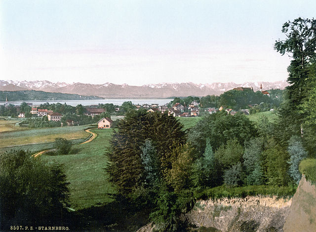
Starnberg
- district of Bavaria, Germany
Hiking in Starnberg
Hiking in the Starnberg district, located in Bavaria, Germany, offers a beautiful blend of scenic landscapes, including lakes, forests, and picturesque villages. Here are some highlights and tips for hiking in the area:...
- Country:
- Capital: Starnberg
- Licence Plate Code: WOR; STA
- Coordinates: 48° 0' 36" N, 11° 16' 48" E
- GPS tracks (wikiloc): [Link]
- AboveSeaLevel: 683 м m
- Area: 488.01 sq km
- Population: 108887
- Web site: [Link]

Weilheim-Schongau
- district of Bavaria, Germany
Hiking in Weilheim-Schongau
Weilheim-Schongau, located in Bavaria, Germany, is a fantastic area for hiking enthusiasts. The region is characterized by its stunning landscapes, which include rolling hills, lush forests, and the picturesque foothills of the Alps. Here are some highlights and recommendations for hiking in this beautiful region:...
- Country:
- Capital: Weilheim in Oberbayern
- Licence Plate Code: SOG; WM
- Coordinates: 47° 49' 48" N, 11° 0' 0" E
- GPS tracks (wikiloc): [Link]
- AboveSeaLevel: 647 м m
- Area: 966.22 sq km
- Population: 106376
- Web site: [Link]
Landsberg am Lech
- town in Bavaria, Germany
Hiking in Landsberg am Lech
Landsberg am Lech is a charming town in Bavaria, Germany, located along the banks of the Lech River. It's surrounded by beautiful landscapes, making it a great starting point for various hiking opportunities. Here are some highlights and tips for hiking in and around Landsberg am Lech:...
- Country:
- Postal Code: 86899
- Local Dialing Code: 08191
- Licence Plate Code: LL
- Coordinates: 48° 2' 0" N, 10° 53' 0" E
- GPS tracks (wikiloc): [Link]
- AboveSeaLevel: 585 м m
- Area: 57.9 sq km
- Population: 28708
- Web site: [Link]