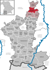
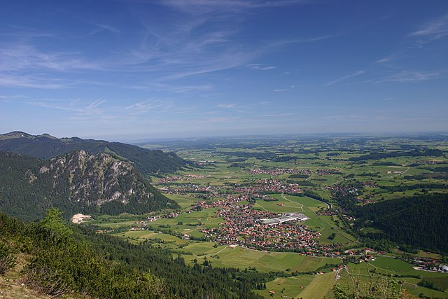
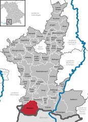
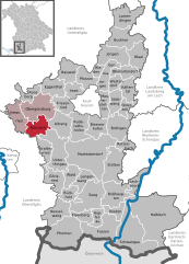
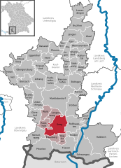
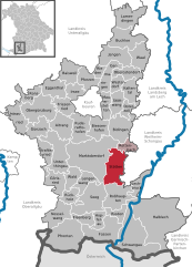
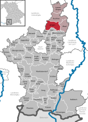
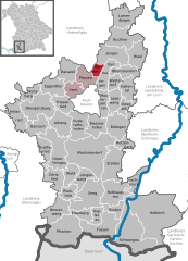
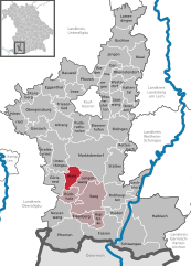
Ostallgäu (Landkreis Ostallgäu)

- district in Bavaria, Germany
 Hiking in Ostallgäu
Ostallgäu is a picturesque region in Bavaria, Germany, known for its stunning landscapes dominated by the Alps, rolling hills, and charming villages. It's an excellent destination for hiking, offering a variety of trails suitable for different skill levels, from beginner to advanced. Here are some key highlights of hiking in Ostallgäu:
Scenic Trails
-
Forggensee Trail: A beautiful loop around Forggensee, offering breathtaking views of the Alps, especially during sunset. The trail has sections with meadows, forests, and viewpoints.
-
The Königsschlösser (King's Castles) Trail: This trail takes you past the famous Neuschwanstein and Hohenschwangau castles. The hike offers various routes, some of which lead through charming forests and provide stunning views of the castles.
-
Tegelberg Summit: A well-marked trail leads you up to the Tegelberg mountain, where you can enjoy panoramic views of the surrounding area. If you're looking for a challenge, consider the longer routes that include scenic viewpoints along the way.
Flora and Fauna
Ostallgäu is rich in biodiversity, with various wildlife and plant species along the hiking trails. Keep an eye out for local fauna, including deer, foxes, and numerous bird species. The blooming wildflowers in spring and summer create a colorful landscape.
Facilities
Many trails in Ostallgäu are well-marked and maintained, with signposts providing directions and distances. Along the routes, you'll find traditional Bavarian huts where you can stop for refreshments, rewarding yourself with hearty local cuisine and snacks.
Best Time to Hike
The ideal time for hiking in Ostallgäu is between late spring and early autumn (May to September), when the weather is generally mild and the trails are accessible. However, be mindful of possible snowfall in early spring or late autumn in higher elevations.
Tips for Hikers
- Equipment: Wear sturdy hiking boots and dress in layers to accommodate changing weather conditions. A good backpack, water, and snacks are essential.
- Maps and Apps: Use reliable hiking maps or mobile apps to help navigate the trails. It’s also wise to inform someone about your hiking plans for safety.
- Respect Nature: Stick to the designated trails to protect the local flora and fauna. Always follow the Leave No Trace principles.
Local Attractions
After your hike, take time to explore the charming towns of Füssen and Schwangau, where you can enjoy local cuisine and visit additional attractions, including lakes and historical sites.
Ostallgäu is an ideal hiking destination that combines outdoor adventure with stunning natural beauty and cultural experiences. Enjoy your hiking journey!
- Country:

- Capital: Marktoberdorf
- Licence Plate Code: OAL; MOD; FÜS
- Coordinates: 47° 45' 0" N, 10° 34' 48" E


- GPS tracks (wikiloc): [Link]
- AboveSeaLevel: 724 м m
- Area: 1395.00 sq km
- Population: 114547
- Web site: http://www.ostallgaeu.de/
- Wikipedia en: wiki(en)
- Wikipedia: wiki(de)
- Wikidata storage: Wikidata: Q10405
- Wikipedia Commons Category: [Link]
- Freebase ID: [/m/027wx6]
- GeoNames ID: Alt: [3220888]
- VIAF ID: Alt: [3163147270414735700002]
- OSM relation ID: [62533]
- GND ID: Alt: [4075723-7]
- archINFORM location ID: [2552]
- TGN ID: [7077083]
- Bavarikon ID: [ODB_A00000723]
- ISNI: Alt: [0000 0004 0581 7642]
- NUTS code: [DE27B]
- German district key: 09777
Includes regions:


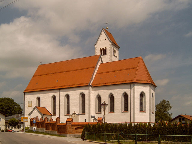
Hopferau
- municipality of Germany
Hiking in Hopferau
Hopferau is a charming village located in the Allgäu region of Bavaria, Germany. It's a great starting point for exploring the natural beauty of the area, including the nearby Alps. Here are some highlights and tips for hiking in and around Hopferau:...
- Country:
- Postal Code: 87659
- Local Dialing Code: 08364
- Licence Plate Code: OAL
- Coordinates: 47° 37' 0" N, 10° 38' 0" E
- GPS tracks (wikiloc): [Link]
- AboveSeaLevel: 811 м m
- Area: 13.19 sq km
- Population: 972
- Web site: [Link]


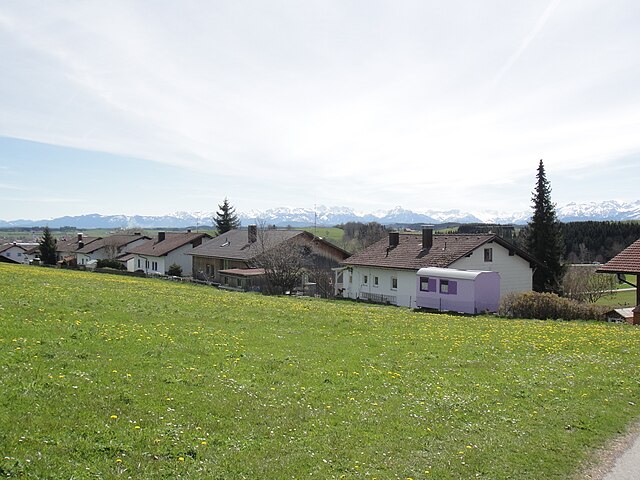
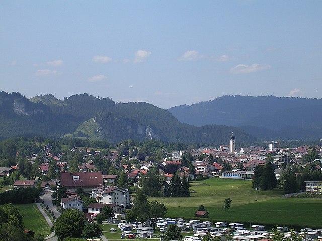
Schwangau
- municipality of Germany
Hiking in Schwangau
Schwangau is a picturesque village in Bavaria, Germany, known for its stunning landscapes, rich history, and proximity to famous landmarks like Neuschwanstein Castle and Hohenschwangau Castle. The area offers a variety of hiking opportunities that cater to different skill levels and preferences. Here are some highlights:...
- Country:
- Postal Code: 87643–87645
- Local Dialing Code: 08362
- Licence Plate Code: OAL
- Coordinates: 47° 34' 36" N, 10° 44' 7" E
- GPS tracks (wikiloc): [Link]
- AboveSeaLevel: 796 м m
- Area: 76.06 sq km
- Population: 3188
- Web site: [Link]


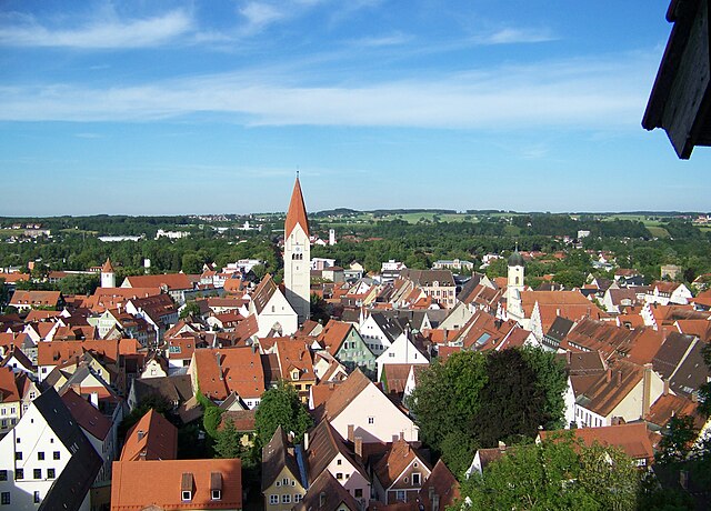
Füssen
- municipality of Germany
Hiking in Füssen
Füssen, located in the Bavarian Alps near the German-Austrian border, is a beautiful destination for hiking enthusiasts. The area is renowned for its stunning landscapes, including picturesque lakes, rolling hills, and, of course, the majestic Alps. Here’s what you need to know about hiking in Füssen:...
- Country:
- Postal Code: 87629
- Local Dialing Code: 08362
- Coordinates: 47° 34' 0" N, 10° 42' 0" E
- GPS tracks (wikiloc): [Link]
- AboveSeaLevel: 808 м m
- Area: 43.52 sq km
- Population: 15265
- Web site: [Link]

Buchloe
- municipality of Germany
Hiking in Buchloe
Buchloe, located in the Bavarian region of Germany, may not be as widely known as some other hiking destinations, but it offers beautiful landscapes and a peaceful environment for those looking to explore nature....
- Country:
- Postal Code: 86807
- Local Dialing Code: 08241
- Licence Plate Code: OAL
- Coordinates: 48° 2' 15" N, 10° 43' 30" E
- GPS tracks (wikiloc): [Link]
- AboveSeaLevel: 627 м m
- Area: 36.16 sq km
- Population: 8640
- Web site: [Link]

Lechbruck
- municipality of Germany
Hiking in Lechbruck
Lechbruck am See is a picturesque village located in Bavaria, Germany, situated near the picturesque Lech River and surrounded by beautiful landscapes, making it a great destination for hiking enthusiasts. Here are some things to consider if you're planning to hike in Lechbruck:...
- Country:
- Postal Code: 86983
- Local Dialing Code: 08862
- Licence Plate Code: OAL
- Coordinates: 47° 42' 6" N, 10° 47' 42" E
- GPS tracks (wikiloc): [Link]
- AboveSeaLevel: 728 м m
- Area: 17.23 sq km
- Population: 2248
- Web site: [Link]


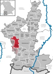
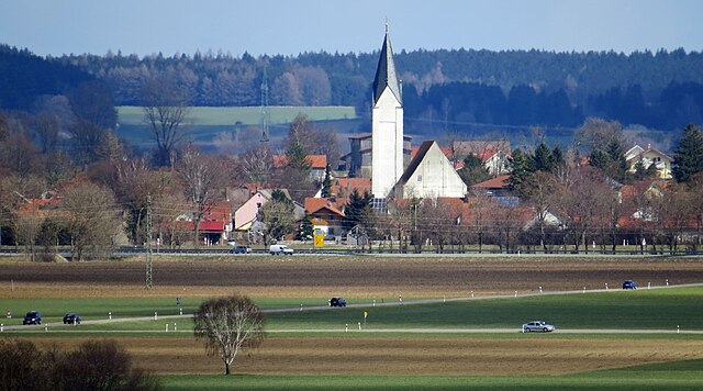
Aitrang
- municipality of Germany
Hiking in Aitrang
Aitrang, located in Bavaria, Germany, offers a picturesque setting for hiking enthusiasts. The region is characterized by rolling hills, lush forests, and scenic landscapes, making it an ideal place for outdoor activities. Here are some key points to consider when hiking in Aitrang:...
- Country:
- Postal Code: 87648
- Local Dialing Code: 08343
- Licence Plate Code: OAL
- Coordinates: 47° 49' 0" N, 10° 32' 0" E
- GPS tracks (wikiloc): [Link]
- AboveSeaLevel: 745 м m
- Area: 30.71 sq km
- Population: 1757
- Web site: [Link]

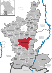
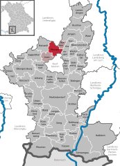
Marktoberdorf
- municipality of Germany
Hiking in Marktoberdorf
Marktoberdorf, located in the Allgäu region of Bavaria, Germany, offers a variety of hiking opportunities ideal for both beginners and experienced hikers. The surrounding landscape features stunning views of the Alps, lush forests, and picturesque meadows, making it a great destination for outdoor enthusiasts....
- Country:
- Postal Code: 87616
- Local Dialing Code: 08342
- Coordinates: 47° 46' 0" N, 10° 37' 0" E
- GPS tracks (wikiloc): [Link]
- AboveSeaLevel: 756 м m
- Area: 95.25 sq km
- Population: 18349
- Web site: [Link]

Kaltental
- municipality of Germany
Hiking in Kaltental
Kaltental, located in Germany, is known for its scenic landscapes, characterized by lush forests, winding trails, and beautiful views. It’s a great spot for hiking enthusiasts of all skill levels. Here are some key points to consider when hiking in Kaltental:...
- Country:
- Postal Code: 87662
- Local Dialing Code: 08345
- Licence Plate Code: OAL
- Coordinates: 47° 54' 0" N, 10° 45' 0" E
- GPS tracks (wikiloc): [Link]
- AboveSeaLevel: 710 м m
- Area: 22.14 sq km
- Population: 1232
- Web site: [Link]
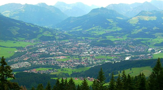
Pfronten
- municipality in Bavaria, Germany
Hiking in Pfronten
Pfronten is a picturesque village located in the Allgäu region of Bavaria, Germany, nestled at the foot of the majestic Alps. It is an ideal destination for hikers, offering a variety of trails that cater to all skill levels, from leisurely strolls to challenging treks. Here are some key points about hiking in Pfronten:...
- Country:
- Postal Code: 87459
- Local Dialing Code: 08363
- Licence Plate Code: OAL
- Coordinates: 47° 35' 0" N, 10° 33' 0" E
- GPS tracks (wikiloc): [Link]
- AboveSeaLevel: 853 м m
- Area: 62.22 sq km
- Population: 8221
- Web site: [Link]


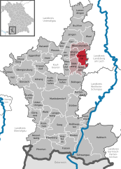
Rieden am Forggensee
- municipality of Germany
Hiking in Rieden am Forggensee
Rieden am Forggensee, located in Bavaria, Germany, is a beautiful destination for hiking enthusiasts. Nestled near the picturesque Forggensee lake and surrounded by the stunning backdrop of the Bavarian Alps, it offers a variety of hiking trails suitable for different skill levels....
- Country:
- Postal Code: 87669
- Local Dialing Code: 08362
- Licence Plate Code: OAL
- Coordinates: 47° 37' 0" N, 10° 43' 0" E
- GPS tracks (wikiloc): [Link]
- AboveSeaLevel: 814 м m
- Area: 13.17 sq km
- Population: 991
- Web site: [Link]


Roßhaupten
- municipality of Germany
Hiking in Roßhaupten
Roßhaupten is a picturesque village located in Bavaria, Germany, close to the Alps and surrounded by stunning natural scenery, making it a great destination for hiking enthusiasts. Here are some highlights and tips for hiking in and around Roßhaupten:...
- Country:
- Postal Code: 87672
- Local Dialing Code: 08367
- Licence Plate Code: OAL
- Coordinates: 47° 39' 0" N, 10° 43' 0" E
- GPS tracks (wikiloc): [Link]
- AboveSeaLevel: 816 м m
- Area: 39.10 sq km
- Population: 1768
- Web site: [Link]


Baisweil
- municipality of Germany
Hiking in Baisweil
Baisweil, located in Bavaria, Germany, is surrounded by beautiful landscapes and offers several hiking opportunities for both novices and experienced hikers. The region is characterized by its picturesque countryside, rolling hills, and charming villages, making it a lovely place to explore nature....
- Country:
- Postal Code: 87650
- Local Dialing Code: 08340
- Licence Plate Code: OAL
- Coordinates: 47° 57' 0" N, 10° 33' 0" E
- GPS tracks (wikiloc): [Link]
- AboveSeaLevel: 676 м m
- Area: 26.28 sq km
- Population: 1127
- Web site: [Link]

Günzach
- municipality of Germany
Hiking in Günzach
Günzach is a picturesque village located in the Allgäu region of Bavaria, Germany, nestled amidst beautiful landscapes that are perfect for hiking enthusiasts. Here are some highlights and tips for hiking in the Günzach area:...
- Country:
- Postal Code: 87634
- Local Dialing Code: 08372
- Licence Plate Code: OAL
- Coordinates: 47° 49' 0" N, 10° 27' 0" E
- GPS tracks (wikiloc): [Link]
- AboveSeaLevel: 800 м m
- Area: 23.48 sq km
- Population: 1235
- Web site: [Link]


Irsee
- municipality of Germany
Hiking in Irsee
Irsee is a charming village located in Bavaria, Germany, which offers a picturesque backdrop for hiking enthusiasts. Nestled in the foothills of the Alps, Irsee is surrounded by beautiful landscapes, including rolling hills, lush forests, and serene lakes, making it an excellent destination for outdoor activities....
- Country:
- Postal Code: 87660
- Local Dialing Code: 08341
- Licence Plate Code: OAL
- Coordinates: 47° 54' 28" N, 10° 34' 17" E
- GPS tracks (wikiloc): [Link]
- AboveSeaLevel: 755 м m
- Area: 17.47 sq km
- Population: 1248
- Web site: [Link]

Seeg
- municipality in Bavaria, Germany
Hiking in Seeg
Seeg is located in the picturesque Allgäu region of Bavaria, Germany. It's a charming village surrounded by stunning natural beauty, making it a fantastic destination for hiking enthusiasts. Here are some key highlights about hiking in Seeg:...
- Country:
- Postal Code: 87637
- Local Dialing Code: 08364
- Licence Plate Code: OAL
- Coordinates: 47° 39' 0" N, 10° 36' 0" E
- GPS tracks (wikiloc): [Link]
- AboveSeaLevel: 853 м m
- Area: 50.06 sq km
- Population: 2923
- Web site: [Link]


Rückholz
- municipality of Germany
Hiking in Rückholz
Rückholz is a charming village located in the Allgäu region of Bavaria, Germany. This area is known for its breathtaking landscapes, rolling hills, and picturesque alpine scenery, making it an excellent destination for hiking enthusiasts....
- Country:
- Postal Code: 87494
- Local Dialing Code: 08369
- Licence Plate Code: OAL
- Coordinates: 47° 40' 0" N, 10° 33' 0" E
- GPS tracks (wikiloc): [Link]
- AboveSeaLevel: 879 м m
- Area: 17.21 sq km
- Population: 726
- Web site: [Link]

Stötten am Auerberg
- municipality of Germany
Hiking in Stötten am Auerberg
Stötten is a picturesque village located in Germany, particularly known for its charming surroundings and access to beautiful hiking trails in the nearby Allgäu region. Here are some highlights about hiking in and around Stötten:...
- Country:
- Postal Code: 87675
- Local Dialing Code: 08349
- Licence Plate Code: OAL
- Coordinates: 47° 44' 19" N, 10° 41' 20" E
- GPS tracks (wikiloc): [Link]
- AboveSeaLevel: 733 м m
- Area: 40.75 sq km
- Population: 2324
- Web site: [Link]


Rettenbach am Auerberg
- municipality of Germany
Hiking in Rettenbach am Auerberg
Rettenbach am Auerberg is a picturesque village located in the Bavarian region of Germany, surrounded by the stunning landscapes of the Allgäu Alps. It offers a plethora of hiking opportunities suitable for various levels of experience. Here are some highlights to consider for your hiking adventure in Rettenbach am Auerberg:...
- Country:
- Postal Code: 87675
- Local Dialing Code: 08860
- Licence Plate Code: OAL
- Coordinates: 47° 46' 0" N, 10° 45' 0" E
- GPS tracks (wikiloc): [Link]
- AboveSeaLevel: 832 м m
- Area: 12.92 sq km
- Population: 845
- Web site: [Link]


Ronsberg
- municipality of Germany
Hiking in Ronsberg
Ronsberg, located in Bavaria, Germany, offers a variety of hiking opportunities amidst beautiful landscapes and rich natural scenery. The area is characterized by rolling hills, picturesque villages, and lush forests, making it an ideal location for both beginner and experienced hikers....
- Country:
- Postal Code: 87671
- Local Dialing Code: 08306
- Licence Plate Code: OAL
- Coordinates: 47° 54' 0" N, 10° 25' 0" E
- GPS tracks (wikiloc): [Link]
- AboveSeaLevel: 701 м m
- Area: 16.53 sq km
- Population: 1623
- Web site: [Link]


Ruderatshofen
- municipality of Germany
Hiking in Ruderatshofen
Ruderatshofen, a small village in Bavaria, Germany, is situated near the Allgäu region, which is renowned for its picturesque landscapes and excellent hiking opportunities. Here are some key points to consider when hiking in and around Ruderatshofen:...
- Country:
- Postal Code: 87674
- Local Dialing Code: 08343
- Licence Plate Code: OAL
- Coordinates: 47° 49' 0" N, 10° 35' 0" E
- GPS tracks (wikiloc): [Link]
- AboveSeaLevel: 728 м m
- Area: 33.52 sq km
- Population: 1425
- Web site: [Link]

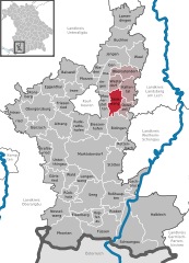
Unterthingau
- municipality of Germany
Hiking in Unterthingau
Unterthingau is a picturesque area in Bavaria, Germany, known for its beautiful landscapes, rolling hills, and access to the Allgäu region. When hiking in Unterthingau, you can expect a mix of scenic trails, charming villages, and the opportunity to enjoy local flora and fauna....
- Country:
- Postal Code: 87647
- Local Dialing Code: 08377
- Licence Plate Code: OAL
- Coordinates: 47° 46' 0" N, 10° 30' 0" E
- GPS tracks (wikiloc): [Link]
- AboveSeaLevel: 773 м m
- Area: 45.23 sq km
- Population: 2354
- Web site: [Link]

Stöttwang
- municipality of Germany
Hiking in Stöttwang
Stöttwang is a small municipality located in Bavaria, Germany, near the city of Kaufbeuren. It might not be as widely recognized as some other hiking destinations, but the surrounding region offers some lovely trails and scenic views that can be enjoyed by hikers of varying skill levels. Here’s what you can expect from hiking in and around Stöttwang:...
- Country:
- Postal Code: 87677
- Local Dialing Code: 08345
- Licence Plate Code: OAL
- Coordinates: 47° 53' 0" N, 10° 43' 0" E
- GPS tracks (wikiloc): [Link]
- AboveSeaLevel: 726 м m
- Area: 19.79 sq km
- Population: 1350
- Web site: [Link]
Jengen
- municipality of Germany
Hiking in Jengen
Jengen is a small town in Bavaria, Germany, situated near the larger cities of Kaufbeuren and Füssen. It's surrounded by beautiful landscapes that offer various opportunities for hiking and outdoor activities. Here are some highlights and tips for hiking in and around Jengen:...
- Country:
- Postal Code: 86860
- Local Dialing Code: 08241
- Licence Plate Code: OAL
- Coordinates: 48° 0' 0" N, 10° 44' 0" E
- GPS tracks (wikiloc): [Link]
- AboveSeaLevel: 635 м m
- Area: 33.74 sq km
- Population: 1709
- Web site: [Link]
Kraftisried
- municipality of Germany
Hiking in Kraftisried
Kraftisried is a picturesque area located in Bavaria, Germany, known for its beautiful landscapes and outdoor recreational opportunities, including hiking. Here are some key points for hiking in and around Kraftisried:...
- Country:
- Postal Code: 87647
- Local Dialing Code: 08377
- Licence Plate Code: OAL
- Coordinates: 47° 47' 0" N, 10° 28' 0" E
- GPS tracks (wikiloc): [Link]
- AboveSeaLevel: 822 м m
- Area: 16.24 sq km
- Population: 722
- Web site: [Link]


Görisried
- municipality of Germany
Hiking in Görisried
Görisried is a charming village located in the Bavarian Alps of Germany. The region is known for its picturesque landscapes, rolling hills, and beautiful forests, making it an excellent destination for hiking enthusiasts. Here are some highlights and tips for hiking in and around Görisried:...
- Country:
- Postal Code: 87657
- Local Dialing Code: 08302
- Licence Plate Code: OAL
- Coordinates: 47° 42' 0" N, 10° 30' 0" E
- GPS tracks (wikiloc): [Link]
- AboveSeaLevel: 803 м m
- Area: 23.14 sq km
- Population: 1011
- Web site: [Link]


Obergünzburg
- municipality of Germany
Hiking in Obergünzburg
Obergünzburg is a picturesque town in the Allgäu region of Bavaria, Germany, known for its beautiful landscapes and outdoor activities, including hiking. Here are some highlights for hiking enthusiasts visiting Obergünzburg:...
- Country:
- Postal Code: 87634
- Local Dialing Code: 08372
- Licence Plate Code: OAL
- Coordinates: 47° 51' 0" N, 10° 25' 0" E
- GPS tracks (wikiloc): [Link]
- AboveSeaLevel: 737 м m
- Area: 46.69 sq km
- Population: 5476
- Web site: [Link]


Oberostendorf
- municipality of Germany
Hiking in Oberostendorf
Oberostendorf is located in the Allgäu region of Bavaria, Germany, and offers a range of hiking opportunities suitable for all levels of experience. Here are some key points about hiking in Oberostendorf:...
- Country:
- Postal Code: 86869
- Local Dialing Code: 08344
- Licence Plate Code: OAL
- Coordinates: 47° 56' 0" N, 10° 45' 0" E
- GPS tracks (wikiloc): [Link]
- AboveSeaLevel: 674 м m
- Area: 21.04 sq km
- Population: 1158
- Web site: [Link]

Mauerstetten
- municipality of Germany
Hiking in Mauerstetten
Mauerstetten, a small village in Bavaria, Germany, offers a picturesque environment perfect for hiking enthusiasts. With its proximity to the scenic landscapes of the Allgäu region, hikers can enjoy a variety of trails that range from easy walks to more challenging hikes....
- Country:
- Postal Code: 87665
- Local Dialing Code: 08341
- Licence Plate Code: OAL
- Coordinates: 47° 53' 0" N, 10° 40' 0" E
- GPS tracks (wikiloc): [Link]
- AboveSeaLevel: 716 м m
- Area: 16.55 sq km
- Population: 2355
- Web site: [Link]


Halblech
- municipality of Germany
Hiking in Halblech
Halblech is a charming village located in Bavaria, Germany, and it serves as a great base for hiking enthusiasts. Nestled in the foothills of the Alps, Halblech offers stunning views, diverse terrain, and a variety of trails that cater to different skill levels....
- Country:
- Postal Code: 87642
- Local Dialing Code: 08368
- Licence Plate Code: OAL
- Coordinates: 47° 38' 0" N, 10° 49' 0" E
- GPS tracks (wikiloc): [Link]
- AboveSeaLevel: 800 м m
- Area: 125.50 sq km
- Population: 3477
- Web site: [Link]


Osterzell
- municipality of Germany
Hiking in Osterzell
Osterzell is a charming village located in the Allgäu region of Bavaria, Germany. It offers a variety of hiking opportunities that cater to different skill levels and preferences. Here’s an overview of hiking in and around Osterzell:...
- Country:
- Postal Code: 87662
- Local Dialing Code: 08345
- Licence Plate Code: OAL
- Coordinates: 47° 52' 59" N, 10° 45' 0" E
- GPS tracks (wikiloc): [Link]
- AboveSeaLevel: 729 м m
- Area: 10.82 sq km
- Population: 615
- Web site: [Link]


Eggenthal
- municipality of Germany
Hiking in Eggenthal
Eggenthal is a beautiful village in Bavaria, Germany, surrounded by picturesque landscapes, making it an excellent destination for hiking enthusiasts. Nestled in the foothills of the Alps, Eggenthal offers a variety of hiking trails that cater to different skill levels, from easy walks to more challenging routes. Here are some highlights of hiking in the area:...
- Country:
- Postal Code: 87653
- Local Dialing Code: 08347
- Licence Plate Code: OAL
- Coordinates: 47° 55' 0" N, 10° 31' 0" E
- GPS tracks (wikiloc): [Link]
- AboveSeaLevel: 713 м m
- Area: 28.10 sq km
- Population: 1329
- Web site: [Link]

Pforzen
- municipality of Germany
Hiking in Pforzen
Pforzen is a small town located in Bavaria, Germany, and while it may not be a well-known hiking destination compared to larger areas, it can still offer a charming experience for hikers who appreciate scenic countryside and outdoor activities. The surrounding region features a mix of flat fields, wooded areas, and gentle hills, providing opportunities for both leisurely walks and more challenging trails....
- Country:
- Postal Code: 87666
- Local Dialing Code: 08346
- Licence Plate Code: OAL
- Coordinates: 47° 56' 0" N, 10° 37' 0" E
- GPS tracks (wikiloc): [Link]
- AboveSeaLevel: 656 м m
- Area: 23.69 sq km
- Population: 1714
- Web site: [Link]


Nesselwang
- municipality of Germany
Hiking in Nesselwang
Nesselwang is a beautiful village located in the Allgäu region of Bavaria, Germany, known for its stunning natural landscapes and outdoor activities, particularly hiking. Here are some key points to consider about hiking in Nesselwang:...
- Country:
- Postal Code: 87484
- Local Dialing Code: 08361
- Coordinates: 47° 37' 0" N, 10° 30' 0" E
- GPS tracks (wikiloc): [Link]
- AboveSeaLevel: 867 м m
- Area: 29.53 sq km
- Population: 3567
- Web site: [Link]


Untrasried
- municipality of Germany
Hiking in Untrasried
It seems there might be a typographical error in your question, as "Untrasried" does not appear to correspond to a known hiking destination. If you meant "Utrásried" or another location, please clarify the name, and I would be happy to provide information about hiking in that area....
- Country:
- Postal Code: 87496
- Local Dialing Code: 08372
- Licence Plate Code: OAL
- Coordinates: 47° 50' 0" N, 10° 23' 0" E
- GPS tracks (wikiloc): [Link]
- AboveSeaLevel: 819 м m
- Area: 25.75 sq km
- Population: 1231
- Web site: [Link]

Lengenwang
- municipality of Germany
Hiking in Lengenwang
Lengenwang, located in Bavaria, Germany, offers a picturesque setting for hikers and outdoor enthusiasts. The area is characterized by its rolling hills, lush forests, and stunning views of the Alps. Here are some points to consider if you're planning a hiking trip to Lengenwang:...
- Country:
- Postal Code: 87663
- Local Dialing Code: 08364
- Licence Plate Code: OAL
- Coordinates: 47° 42' 0" N, 10° 36' 0" E
- GPS tracks (wikiloc): [Link]
- AboveSeaLevel: 807 м m
- Area: 19.62 sq km
- Population: 1226
- Web site: [Link]

Friesenried
- municipality of Germany
Hiking in Friesenried
Friesenried, located in Bavaria, Germany, is a picturesque village that offers access to beautiful hiking trails and natural landscapes. Here are some highlights and recommendations for hiking in the Friesenried area:...
- Country:
- Postal Code: 87654
- Local Dialing Code: 08347
- Licence Plate Code: OAL
- Coordinates: 47° 52' 29" N, 10° 31' 59" E
- GPS tracks (wikiloc): [Link]
- AboveSeaLevel: 736 м m
- Area: 22.24 sq km
- Population: 1399
- Web site: [Link]


Biessenhofen
- municipality of Germany
Hiking in Biessenhofen
Biessenhofen is a small village located in Bavaria, Germany, surrounded by beautiful landscapes and a variety of hiking opportunities. While not as widely known as some of the more famous hiking regions in Bavaria, it offers tranquil trails suitable for hikers of all levels....
- Country:
- Postal Code: 87640
- Local Dialing Code: 08341
- Licence Plate Code: OAL
- Coordinates: 47° 50' 0" N, 10° 38' 0" E
- GPS tracks (wikiloc): [Link]
- AboveSeaLevel: 710 м m
- Area: 27.02 sq km
- Population: 3806
- Web site: [Link]


Germaringen
- municipality of Germany
Hiking in Germaringen
Germaringen, a charming village located in Bavaria, Germany, is surrounded by picturesque landscapes that are great for hiking enthusiasts. The region offers a variety of trails that cater to different skill levels, making it suitable for families, beginners, and experienced hikers alike....
- Country:
- Postal Code: 87656
- Local Dialing Code: 08341
- Licence Plate Code: OAL
- Coordinates: 47° 56' 0" N, 10° 40' 0" E
- GPS tracks (wikiloc): [Link]
- AboveSeaLevel: 660 м m
- Area: 22.88 sq km
- Population: 2814
- Web site: [Link]


Lamerdingen
- municipality of Germany
Hiking in Lamerdingen
Lamerdingen, a picturesque area in Germany, offers a variety of beautiful hiking trails that cater to different skill levels and preferences. While details specific to Lamerdingen may not be widely documented, hiking in this region typically showcases stunning natural landscapes, including rolling hills, forests, and meandering streams....
- Country:
- Postal Code: 86862
- Local Dialing Code: 08248; 08241
- Licence Plate Code: OAL
- Coordinates: 48° 5' 0" N, 10° 44' 0" E
- GPS tracks (wikiloc): [Link]
- AboveSeaLevel: 596 м m
- Area: 34.24 sq km
- Population: 1589
- Web site: [Link]


Eisenberg
- municipality of Germany
Hiking in Eisenberg
Eisenberg, located in Bavaria, Germany, is a great destination for hiking enthusiasts. Nestled in the picturesque Allgäu region, it offers a mix of beautiful scenery, charming countryside, and well-marked hiking trails suitable for various skill levels. Here are some highlights of hiking in Eisenberg:...
- Country:
- Postal Code: 87637
- Local Dialing Code: 08364
- Licence Plate Code: OAL
- Coordinates: 47° 36' 0" N, 10° 36' 0" E
- GPS tracks (wikiloc): [Link]
- AboveSeaLevel: 818 м m
- Area: 13.65 sq km
- Population: 1180
- Web site: [Link]

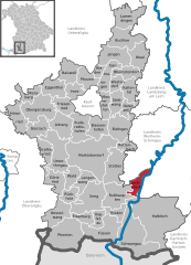
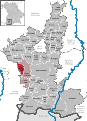
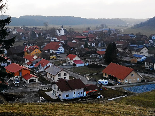
Rieden
- human settlement in Germany
Hiking in Rieden
Rieden, located in Swabia, Germany, is a charming area that offers a variety of hiking opportunities amidst beautiful landscapes. The region is characterized by its rolling hills, lush forests, and picturesque fields, making it ideal for outdoor enthusiasts....
- Country:
- Postal Code: 87668
- Local Dialing Code: 08346
- Licence Plate Code: OAL
- Coordinates: 47° 57' 0" N, 10° 39' 0" E
- GPS tracks (wikiloc): [Link]
- AboveSeaLevel: 659 м m
- Area: 8.41 sq km
- Population: 1431
- Web site: [Link]

Westendorf
- in the Ostallgäu district, Bavaria
Hiking in Westendorf
Westendorf is a picturesque village located in the Allgäu region of Bavaria, Germany. Nestled in the foothills of the Alps, it offers stunning landscapes, lush meadows, and panoramic views, making it a fantastic destination for hikers of all levels....
- Country:
- Postal Code: 87679
- Local Dialing Code: 08344
- Licence Plate Code: OAL
- Coordinates: 47° 56' 0" N, 10° 43' 0" E
- GPS tracks (wikiloc): [Link]
- AboveSeaLevel: 688 м m
- Area: 11.93 sq km
- Population: 1389
- Web site: [Link]


Bidingen
- municipality of Germany
Hiking in Bidingen
Bidingen, located in Bavaria, Germany, is surrounded by picturesque landscapes and offers several hiking opportunities that showcase the region’s natural beauty. Here are some key points about hiking in Bidingen:...
- Country:
- Postal Code: 87651
- Local Dialing Code: 08348
- Licence Plate Code: OAL
- Coordinates: 47° 50' 0" N, 10° 44' 0" E
- GPS tracks (wikiloc): [Link]
- AboveSeaLevel: 768 м m
- Area: 36.33 sq km
- Population: 1383
- Web site: [Link]


Waal
- municipality of Germany
Hiking in Waal
Waal, located in Bavaria, Germany, is a charming village that offers some delightful hiking opportunities amidst scenic landscapes. The region is characterized by rolling hills, lush forests, and picturesque farmland, making it a pleasant destination for outdoor enthusiasts....
- Country:
- Postal Code: 86875
- Local Dialing Code: 08246
- Licence Plate Code: OAL
- Coordinates: 48° 0' 0" N, 10° 47' 0" E
- GPS tracks (wikiloc): [Link]
- AboveSeaLevel: 635 м m
- Area: 27.93 sq km
- Population: 1784
- Web site: [Link]

Wald
- municipality in Bavaria, Germany
Hiking in Wald
Wald is a charming village located in the Allgäu region of Bavaria, Germany. It's known for its stunning landscapes, rolling hills, and proximity to the Alps, making it a wonderful destination for hiking enthusiasts....
- Country:
- Postal Code: 87616
- Local Dialing Code: 08302
- Licence Plate Code: OAL
- Coordinates: 47° 43' 0" N, 10° 33' 0" E
- GPS tracks (wikiloc): [Link]
- AboveSeaLevel: 800 м m
- Area: 17.97 sq km
- Population: 946
- Web site: [Link]
Shares border with regions:
Oberallgäu
- district in Bavaria, Germany
Hiking in Oberallgäu
Oberallgäu, located in Bavaria, Germany, is a stunning region known for its breathtaking landscapes, rolling hills, and majestic Alps. It offers a wide range of hiking opportunities suitable for all levels of experience, from leisurely walks to challenging mountain ascents. Here are some highlights and tips for hiking in Oberallgäu:...
- Country:
- Capital: Sonthofen
- Licence Plate Code: OA
- Coordinates: 47° 34' 48" N, 10° 15' 0" E
- GPS tracks (wikiloc): [Link]
- AboveSeaLevel: 711 м m
- Area: 1528.00 sq km
- Population: 128665
- Web site: [Link]

Unterallgäu
- district in Bavaria, Germany
Hiking in Unterallgäu
Unterallgäu is a beautiful region in Bavaria, Germany, known for its picturesque landscapes, charming villages, and extensive hiking trails. Located in the Allgäu, it's characterized by rolling hills, lush meadows, and stunning views of the Alpine foothills. Here are some highlights if you're considering hiking in Unterallgäu:...
- Country:
- Capital: Mindelheim
- Licence Plate Code: MN
- Coordinates: 48° 0' 0" N, 10° 30' 0" E
- GPS tracks (wikiloc): [Link]
- Area: 1230.24 sq km
- Population: 115770
- Web site: [Link]
Augsburg
- district in Bavaria, Germany
Hiking in Augsburg
Augsburg is a city in Bavaria, Germany, known for its rich history and beautiful surroundings, making it a great base for hiking enthusiasts. While the city itself offers various parks and local trails, the surrounding district provides a variety of hiking options for different skill levels. Here are some highlights:...
- Country:
- Capital: Augsburg
- Licence Plate Code: A
- Coordinates: 48° 25' 12" N, 10° 49' 48" E
- GPS tracks (wikiloc): [Link]
- AboveSeaLevel: 521 м m
- Area: 1071.00 sq km
- Population: 191469
- Web site: [Link]

Landsberg
- district of Bavaria, Germany
Hiking in Landsberg
Landsberg district, located in Bavaria, Germany, is a beautiful area that offers a variety of hiking opportunities amidst stunning natural landscapes. The region is characterized by its rolling hills, lush forests, and picturesque lakes, making it an ideal destination for outdoor enthusiasts. Here are some key points about hiking in Landsberg district:...
- Country:
- Capital: Landsberg am Lech
- Licence Plate Code: LL
- Coordinates: 48° 1' 12" N, 10° 57' 0" E
- GPS tracks (wikiloc): [Link]
- AboveSeaLevel: 636 м m
- Area: 804.00 sq km
- Population: 83612
- Web site: [Link]

Weilheim-Schongau
- district of Bavaria, Germany
Hiking in Weilheim-Schongau
Weilheim-Schongau, located in Bavaria, Germany, is a fantastic area for hiking enthusiasts. The region is characterized by its stunning landscapes, which include rolling hills, lush forests, and the picturesque foothills of the Alps. Here are some highlights and recommendations for hiking in this beautiful region:...
- Country:
- Capital: Weilheim in Oberbayern
- Licence Plate Code: SOG; WM
- Coordinates: 47° 49' 48" N, 11° 0' 0" E
- GPS tracks (wikiloc): [Link]
- AboveSeaLevel: 647 м m
- Area: 966.22 sq km
- Population: 106376
- Web site: [Link]


Garmisch-Partenkirchen
- district of Bavaria, Germany
Hiking in Garmisch-Partenkirchen
Garmisch-Partenkirchen is a beautiful district located in Bavaria, Germany, and is renowned for its stunning alpine scenery and outdoor recreational activities, making it a popular destination for hikers. Here are some key points about hiking in this picturesque area:...
- Country:
- Capital: Garmisch-Partenkirchen
- Licence Plate Code: GAP
- Coordinates: 47° 34' 48" N, 11° 10' 12" E
- GPS tracks (wikiloc): [Link]
- AboveSeaLevel: 1296 м m
- Area: 1012.00 sq km
- Population: 78782
- Web site: [Link]
Kaufbeuren
- city in Bavaria, Germany
Hiking in Kaufbeuren
Kaufbeuren, situated in Bavaria, Germany, is a charming town with a rich history and beautiful landscapes, making it a great base for hiking enthusiasts. Here are some key points about hiking in the Kaufbeuren area:...
- Country:
- Postal Code: 87600
- Local Dialing Code: 08341
- Licence Plate Code: KF
- Coordinates: 47° 52' 48" N, 10° 37' 21" E
- GPS tracks (wikiloc): [Link]
- AboveSeaLevel: 678 м m
- Area: 40 sq km
- Population: 41759
- Web site: [Link]
Reutte District
- district of Austria
Hiking in Reutte District
The Reutte District, located in the Tyrol region of Austria, is known for its stunning natural landscapes, charming villages, and a variety of hiking trails suitable for all levels of hikers. Here are some key aspects of hiking in this area:...
- Country:

- Capital: Reutte
- Licence Plate Code: RE
- Coordinates: 47° 24' 0" N, 10° 30' 0" E
- GPS tracks (wikiloc): [Link]
- AboveSeaLevel: 1222 м m
- Area: 1236.82 sq km
- Population: 32023
- Web site: [Link]