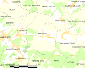
Steinsoultz (Steinsoultz)

- commune in Haut-Rhin, France
 Hiking in Steinsoultz
Steinsoultz, located in the Alsace region of France near the Vosges mountains, offers a picturesque setting for hiking enthusiasts. The region is known for its stunning landscapes, charming villages, and diverse trails that cater to various skill levels.
Hiking Trails and Routes:
-
Local Trails: Steinsoultz features several well-marked hiking trails that take you through lush forests, vineyards, and rolling hills. You can explore a variety of terrains, from gentle slopes to more challenging paths.
-
GR5 Trail: This European long-distance hiking path runs through the Vosges and offers segments near Steinsoultz. It provides an excellent opportunity for multi-day trekking with stunning views of the surrounding countryside.
-
Waterfalls and Scenic Views: The area is dotted with small waterfalls and viewpoints that are perfect for rest stops and photography. Trails often wind alongside streams, enhancing the experience of nature's tranquility.
Flora and Fauna:
Hikers can enjoy rich biodiversity in the region. Keep an eye out for local wildlife, including deer, foxes, and a variety of birds. The floral diversity is remarkable, especially during the spring and summer months when wildflowers bloom.
Preparation Tips:
- Trail Maps: Make sure to grab a local trail map or download hiking apps that provide GPS support.
- Clothing and Gear: Wear appropriate gear considering the weather, and bring layers as temperatures can change quickly in the mountains.
- Hydration and Snacks: Always carry enough water and some energy snacks to keep your stamina up during hikes.
Accessibility:
Steinsoultz can be easily accessed by car or public transportation from larger cities like Mulhouse. There are parking areas available for hikers to start their adventures.
Safety Considerations:
- Stay on Marked Trails: To preserve the local ecosystem, stick to marked trails and paths.
- Weather Awareness: Check the weather forecast before heading out, as conditions can change rapidly in mountainous areas.
Exploring the hiking trails around Steinsoultz not only offers a chance to connect with nature but also allows you to experience the cultural heritage of the Alsace region. Enjoy your hiking adventures!
- Country:

- Postal Code: 68640
- Coordinates: 47° 33' 14" N, 7° 20' 15" E


- GPS tracks (wikiloc): [Link]
- Area: 4.06 sq km
- Population: 788
- Wikipedia en: wiki(en)
- Wikipedia: wiki(fr)
- Wikidata storage: Wikidata: Q636160
- Wikipedia Commons Category: [Link]
- Freebase ID: [/m/03nstym]
- Freebase ID: [/m/03nstym]
- Freebase ID: [/m/03nstym]
- GeoNames ID: Alt: [6441634]
- GeoNames ID: Alt: [6441634]
- GeoNames ID: Alt: [6441634]
- SIREN number: [216803254]
- SIREN number: [216803254]
- SIREN number: [216803254]
- BnF ID: [152720275]
- BnF ID: [152720275]
- BnF ID: [152720275]
- INSEE municipality code: 68325
- INSEE municipality code: 68325
- INSEE municipality code: 68325
Shares border with regions:


Oberdorf
- former commune in Haut-Rhin, France
Hiking in Oberdorf
Oberdorf in the Haut-Rhin region of France is a beautiful area that offers various hiking opportunities, thanks to its scenic landscapes and proximity to the Vosges mountains. Here’s what you can expect when hiking in and around Oberdorf:...
- Country:
- Postal Code: 68960
- Coordinates: 47° 33' 32" N, 7° 18' 27" E
- GPS tracks (wikiloc): [Link]
- Area: 4.13 sq km
- Population: 598

Muespach
- commune in Haut-Rhin, France
Hiking in Muespach
Muespach is a charming village located in the Alsace region of France, close to the border with Switzerland. This picturesque area offers several hiking opportunities for various skill levels, and the surrounding nature is known for its stunning landscapes, lush forests, and rolling hills....
- Country:
- Postal Code: 68640
- Coordinates: 47° 32' 51" N, 7° 22' 50" E
- GPS tracks (wikiloc): [Link]
- AboveSeaLevel: 400 м m
- Area: 11.37 sq km
- Population: 873
- Web site: [Link]


Roppentzwiller
- commune in Haut-Rhin, France
Hiking in Roppentzwiller
Roppentzwiller is a small village located in the Alsace region of France, near the border with Switzerland. This area boasts beautiful landscapes and offers a variety of hiking opportunities for outdoor enthusiasts. Here are some key points to consider when hiking in and around Roppentzwiller:...
- Country:
- Postal Code: 68480
- Coordinates: 47° 32' 25" N, 7° 19' 55" E
- GPS tracks (wikiloc): [Link]
- Area: 4.15 sq km
- Population: 696
Illtal
- commune in Haut-Rhin, France
Hiking in Illtal
Illtal, located in the Alsace region of France near the border with Germany, is known for its picturesque landscapes, charming villages, and diverse hiking trails. Here are some highlights and tips for hiking in the Illtal area:...
- Country:
- Postal Code: 68960
- Licence Plate Code: 68
- Coordinates: 47° 33' 34" N, 7° 18' 29" E
- GPS tracks (wikiloc): [Link]
- Area: 11.96 sq km


Franken
- commune in Haut-Rhin, France
Hiking in Franken
Hiking in the Haut-Rhin area of Alsace, particularly around the village of Franken, offers a delightful experience in both natural beauty and cultural heritage. The region is known for its picturesque landscapes, charming villages, and rich history. Here are some key highlights for hiking in Franken and its surroundings:...
- Country:
- Postal Code: 68130
- Coordinates: 47° 36' 10" N, 7° 21' 18" E
- GPS tracks (wikiloc): [Link]
- Area: 6.22 sq km
- Population: 324


Berentzwiller
- commune in Haut-Rhin, France
Hiking in Berentzwiller
Berentzwiller is a small village located in the Alsace region of France, near the border with Switzerland. While it might not be as widely known as some larger hiking destinations, the surrounding area offers some beautiful trails and a chance to explore the picturesque landscape of Alsace....
- Country:
- Postal Code: 68130
- Coordinates: 47° 35' 9" N, 7° 23' 1" E
- GPS tracks (wikiloc): [Link]
- Area: 6.08 sq km
- Population: 322

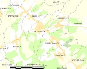
Waldighofen
- commune in Haut-Rhin, France
Hiking in Waldighofen
Waldighofen is a charming village located in the Alsace region of France, known for its picturesque landscapes and outdoor activities, including hiking. When hiking in Waldighofen, you can expect scenic views, a mix of forests, fields, and vineyards, as well as a mild climate suitable for year-round exploration....
- Country:
- Postal Code: 68640
- Coordinates: 47° 33' 3" N, 7° 19' 0" E
- GPS tracks (wikiloc): [Link]
- Area: 4.14 sq km
- Population: 1544
- Web site: [Link]


Willer
- commune in Haut-Rhin, France
Hiking in Willer
Willer, a small community nestled in a scenic area, offers a variety of hiking opportunities that cater to different skill levels. While specific trails and conditions may vary, here are some key points to consider for hiking in or around Willer:...
- Country:
- Postal Code: 68960
- Coordinates: 47° 35' 9" N, 7° 19' 11" E
- GPS tracks (wikiloc): [Link]
- Area: 6.21 sq km
- Population: 324


Jettingen
- commune in Haut-Rhin, France
Hiking in Jettingen
Jettingen, located in the Haut-Rhin department of the Grand Est region of France, offers a beautiful setting for hiking, nestled among picturesque landscapes and the natural beauty of the Alsace region. Here are some points of interest and information for hiking in and around Jettingen:...
- Country:
- Postal Code: 68130
- Coordinates: 47° 35' 52" N, 7° 22' 17" E
- GPS tracks (wikiloc): [Link]
- Area: 6.3 sq km
- Population: 511