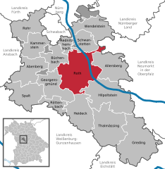
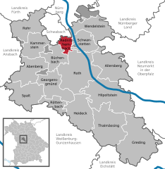
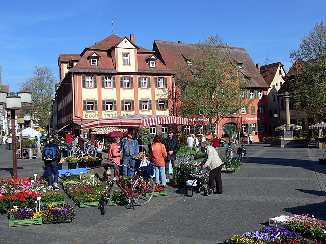
Roth (Landkreis Roth)

- district in Bavaria, Germany
 Hiking in Roth
Roth district, located in Bavaria, Germany, offers a variety of beautiful landscapes and hiking opportunities that appeal to both novice and experienced hikers. The area is characterized by rolling hills, forests, and picturesque views. Here are some highlights and tips for hiking in Roth:
Trails and Routes:
-
Franconian Switzerland: The nearby Franconian Switzerland region offers stunning hiking paths with rock formations, caves, and dense forests. While not directly in Roth, it's within a reasonable distance for a day trip.
-
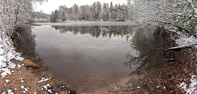
Nature Reserves: Explore local nature reserves and parks such as the Rothsee, providing scenic trails along the lake and opportunities for birdwatching.
-
Local Trails: The Roth district features local marked hiking trails. The "Roth Valley Trail" is a good option, guiding hikers through the scenic landscapes that the area is known for.
-
Cultural Routes: Some trails connect you with historical sites, traditional Bavarian villages, and local culture, allowing you to enjoy not only nature but also Bavarian heritage.
Difficulty Levels:
Hiking paths in the Roth district vary in difficulty from easy family-friendly routes to more challenging hikes. Ensure you check trail descriptions beforehand.
Best Seasons for Hiking:
- Spring: Flowers bloom, and the weather is mild, making it ideal for hiking.
- Summer: Warm temperatures and longer days provide ample opportunity for outdoor activities.
- Autumn: The fall foliage offers breathtaking views.
Preparation Tips:
- Maps and Guides: It's helpful to have a physical map or a hiking app since some trails may not be well-marked.
- Footwear: Wear sturdy hiking boots, especially if you're planning to tackle rough terrain.
- Safety: Carry plenty of water, snacks, a first-aid kit, and inform someone about your hiking plans.
Local Amenities:
Many towns in and around Roth provide lodges, guesthouses, or even campsites if you wish to extend your stay. Local restaurants offer delicious Bavarian cuisine to refuel after a day of hiking.
Whether you're looking for a quiet stroll by the water or a challenging trek through beautiful landscapes, Roth district has something for every hiking enthusiast. Enjoy your adventure!
- Country:

- Capital: Roth
- Licence Plate Code: RH; HIP
- Coordinates: 49° 15' 0" N, 11° 4' 48" E


- GPS tracks (wikiloc): [Link]
- AboveSeaLevel: 355 м m
- Area: 895.00 sq km
- Population: 103944
- Web site: http://www.landratsamt-roth.de/
- Wikipedia en: wiki(en)
- Wikipedia: wiki(de)
- Wikidata storage: Wikidata: Q10451
- Wikipedia Commons Category: [Link]
- Wikipedia Commons Maps Category: [Link]
- Freebase ID: [/m/02c_z9]
- GeoNames ID: Alt: [3220805]
- VIAF ID: Alt: [312810781]
- OSM relation ID: [62431]
- GND ID: Alt: [4050682-4]
- archINFORM location ID: [5682]
- Library of Congress authority ID: Alt: [n83136941]
- TGN ID: [7077313]
- Bavarikon ID: [ODB_A00000179]
- ISNI: Alt: [0000 0004 4910 6017]
- NUTS code: [DE25B]
- German district key: 09576
Includes regions:

Forst Kleinschwarzenlohe
- unincorporated area in Germany
Hiking in Forst Kleinschwarzenlohe
Forst Kleinschwarzenlohe is a beautiful natural area located in Bavaria, Germany, known for its stunning landscapes and diverse flora and fauna. As a hiking instructor, I can give you an overview of what you can expect when hiking in this area....
- Country:
- Coordinates: 49° 22' 39" N, 11° 8' 11" E
- GPS tracks (wikiloc): [Link]
Abenberger Wald
- unincorporated area in Germany
Hiking in Abenberger Wald
Abenberger Wald, located in Bavaria, Germany, is a beautiful forested area that offers a variety of hiking opportunities for both novice and experienced hikers. Here's what you need to know about hiking in Abenberger Wald:...
- Country:
- Coordinates: 49° 13' 0" N, 10° 58' 0" E
- GPS tracks (wikiloc): [Link]
Dechenwald
- unincorporated area in Germany
Hiking in Dechenwald
Dechenwald, located in Germany, is not typically known for a distinct hiking destination on its own but is part of the broader region of the Sauerland, which is known for its beautiful landscapes and hiking opportunities. The area features lush forests, rolling hills, and scenic vistas that make it an attractive choice for outdoor enthusiasts....
- Country:
- Coordinates: 49° 18' 0" N, 10° 54' 0" E
- GPS tracks (wikiloc): [Link]
Soos
- unincorporated area in Landkreis Roth in Germany
Hiking in Soos
Soos is a picturesque area located in the Czech Republic, known for its beautiful landscapes, unique geological features, and tranquil environment. It serves as a great destination for hiking enthusiasts looking to explore nature. Here are some key points to consider when hiking in Soos:...
- Country:
- Coordinates: 49° 17' 44" N, 11° 6' 0" E
- GPS tracks (wikiloc): [Link]


Heidenberg
- unincorporated area in Germany
Hiking in Heidenberg
Heidenberg, situated in a gemeindefreies Gebiet (administratively unincorporated area) in Germany, offers a unique and tranquil hiking experience for outdoor enthusiasts. Although it may not be as well known as some of the larger hiking destinations, the region provides beautiful natural landscapes and opportunities for exploration. Here are some key points about hiking in and around Heidenberg:...
- Country:
- Coordinates: 49° 17' 7" N, 10° 59' 46" E
- GPS tracks (wikiloc): [Link]


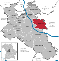
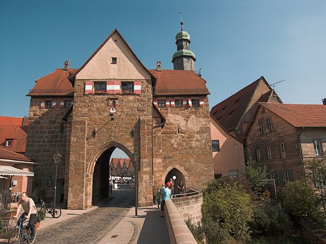
Abenberg
- municipality of Germany
Hiking in Abenberg
Abenberg is a charming town located in Bavaria, Germany, known for its picturesque landscapes, historical sites, and outdoor activities, including hiking. Here are some highlights for hiking enthusiasts considering Abenberg as their destination:...
- Country:
- Postal Code: 91183
- Local Dialing Code: 09178
- Licence Plate Code: RH
- Coordinates: 49° 15' 0" N, 10° 58' 0" E
- GPS tracks (wikiloc): [Link]
- AboveSeaLevel: 374 м m
- Area: 48.39 sq km
- Population: 5554
- Web site: [Link]


Spalt
- municipality of Germany
Hiking in Spalt
Spalt is a charming town located in Bavaria, Germany, known for its picturesque landscapes and rich cultural heritage. It is a great base for hiking enthusiasts, offering various trails that cater to different skill levels. Here are some highlights about hiking in and around Spalt:...
- Country:
- Postal Code: 91174
- Local Dialing Code: 09175
- Licence Plate Code: RH
- Coordinates: 49° 10' 26" N, 10° 55' 39" E
- GPS tracks (wikiloc): [Link]
- AboveSeaLevel: 309 м m
- Area: 55.67 sq km
- Population: 4937
- Web site: [Link]


Heideck
- human settlement in Germany
Hiking in Heideck
Heideck, located in Bavaria, Germany, offers some enjoyable hiking opportunities that are popular among outdoor enthusiasts. The area is characterized by its beautiful natural landscapes, rolling hills, and lush forests. Here are some highlights of hiking in and around Heideck:...
- Country:
- Postal Code: 91180
- Local Dialing Code: 09177
- Licence Plate Code: RH
- Coordinates: 49° 7' 0" N, 11° 7' 0" E
- GPS tracks (wikiloc): [Link]
- AboveSeaLevel: 407 м m
- Area: 58.64 sq km
- Population: 4688
- Web site: [Link]

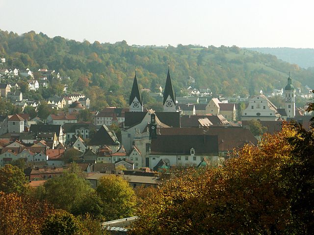
Roth
- town in Bavaria, Germany
Hiking in Roth
Roth, located in Bavaria, Germany, is a lovely region that offers a variety of hiking opportunities for enthusiasts of all skill levels. Here are some highlights and tips for hiking in and around Roth:...
- Country:
- Postal Code: 91154
- Local Dialing Code: 09171
- Licence Plate Code: RH
- Coordinates: 49° 14' 46" N, 11° 5' 28" E
- GPS tracks (wikiloc): [Link]
- AboveSeaLevel: 339 м m
- Area: 96.33 sq km
- Population: 24819
- Web site: [Link]


Röttenbach, Roth
- municipality of Germany
Hiking in Röttenbach, Roth
Röttenbach, located in the Roth district of Bavaria, Germany, offers a variety of hiking opportunities for outdoor enthusiasts. The region is characterized by its picturesque landscapes, rolling hills, and lush forests, making it an ideal spot for both leisurely walks and more challenging hikes....
- Country:
- Postal Code: 91187
- Local Dialing Code: 09172
- Licence Plate Code: RH
- Coordinates: 49° 9' 7" N, 11° 1' 5" E
- GPS tracks (wikiloc): [Link]
- AboveSeaLevel: 372 м m
- Area: 21.64 sq km
- Population: 2328
- Web site: [Link]


Hilpoltstein
- municipality of Germany
Hiking in Hilpoltstein
Hilpoltstein is a charming town located in Bavaria, Germany, and is surrounded by beautiful natural landscapes that are ideal for hiking enthusiasts. Here are some key aspects of hiking in and around Hilpoltstein:...
- Country:
- Postal Code: 91161
- Local Dialing Code: 09174
- Coordinates: 49° 11' 0" N, 11° 11' 0" E
- GPS tracks (wikiloc): [Link]
- AboveSeaLevel: 380 м m
- Area: 91.42 sq km
- Population: 10127
- Web site: [Link]


Wendelstein
- municipality of Germany
Hiking in Wendelstein
Wendelstein, located in Bavaria, Germany, is a popular destination for hikers offering stunning views, diverse trails, and a variety of landscapes. The Wendelstein mountain stands at an elevation of about 1,838 meters (6,030 feet) and is part of the Mangfall Range, which is known for its scenic beauty and accessibility....
- Country:
- Postal Code: 90530
- Local Dialing Code: 09129
- Licence Plate Code: RH
- Coordinates: 49° 21' 13" N, 11° 8' 54" E
- GPS tracks (wikiloc): [Link]
- AboveSeaLevel: 330 м m
- Area: 51.08 sq km
- Population: 13809
- Web site: [Link]


Büchenbach
- municipality of Germany
Hiking in Büchenbach
Büchenbach is a small community located in the state of Bavaria, Germany. While it may not be widely known as a hiking destination, the surrounding region offers beautiful natural landscapes and various trails, perfect for hiking enthusiasts....
- Country:
- Postal Code: 91186
- Local Dialing Code: 09171
- Licence Plate Code: RH
- Coordinates: 49° 16' 0" N, 11° 4' 0" E
- GPS tracks (wikiloc): [Link]
- AboveSeaLevel: 366 м m
- Area: 30.78 sq km
- Population: 4242
- Web site: [Link]

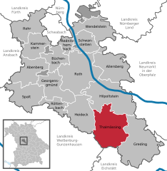
Thalmässing
- municipality in the district of Roth, in Bavaria, Germany
Hiking in Thalmässing
Thalmässing is a charming municipality located in Bavaria, Germany, offering a variety of hiking opportunities that cater to different skill levels and interests. The area is characterized by its picturesque landscapes, wooded hills, fertile fields, and quaint villages, making it a great destination for nature lovers and outdoor enthusiasts....
- Country:
- Postal Code: 91177
- Local Dialing Code: 09173
- Licence Plate Code: RH
- Coordinates: 49° 5' 0" N, 11° 13' 0" E
- GPS tracks (wikiloc): [Link]
- AboveSeaLevel: 418 м m
- Area: 80.57 sq km
- Population: 5010
- Web site: [Link]


Kammerstein
- municipality of Germany
Hiking in Kammerstein
Kammerstein, located in Bavaria, Germany, offers a variety of hiking opportunities that cater to different skill levels and preferences. The region is characterized by its lush landscapes, rolling hills, and scenic views, making it a great destination for outdoor enthusiasts....
- Country:
- Postal Code: 91126
- Local Dialing Code: 09871; 09178; 09122
- Licence Plate Code: RH
- Coordinates: 49° 17' 0" N, 10° 58' 0" E
- GPS tracks (wikiloc): [Link]
- AboveSeaLevel: 424 м m
- Area: 37.11 sq km
- Population: 2266
- Web site: [Link]


Schwanstetten
- municipality of Germany
Hiking in Schwanstetten
Schwanstetten is a small municipality in Bavaria, Germany, located near Nuremberg. While it's not as famous for hiking as larger national parks, it does offer some beautiful trails and natural scenery for those looking to explore the outdoors....
- Country:
- Postal Code: 90596
- Local Dialing Code: 09170
- Licence Plate Code: RH
- Coordinates: 49° 18' 40" N, 11° 7' 40" E
- GPS tracks (wikiloc): [Link]
- AboveSeaLevel: 350 м m
- Area: 32.41 sq km
- Population: 6111
- Web site: [Link]

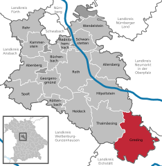
Greding
- municipality of Germany
Hiking in Greding
Greding, located in Bavaria, Germany, offers a variety of hiking opportunities amidst picturesque landscapes, rich history, and nature. Here are some highlights you can expect when hiking in and around Greding:...
- Country:
- Postal Code: 91171
- Local Dialing Code: 08463
- Licence Plate Code: RH
- Coordinates: 49° 3' 7" N, 11° 21' 38" E
- GPS tracks (wikiloc): [Link]
- AboveSeaLevel: 397 м m
- Area: 103.8 sq km
- Population: 6366
- Web site: [Link]

Rednitzhembach
- municipality of Germany
Hiking in Rednitzhembach
Rednitzhembach is a charming municipality in Bavaria, Germany, known for its picturesque landscapes and proximity to nature, making it a lovely destination for hiking enthusiasts. Here are some key details about hiking in and around Rednitzhembach:...
- Country:
- Postal Code: 91126
- Local Dialing Code: 09122
- Licence Plate Code: RH
- Coordinates: 49° 18' 19" N, 11° 4' 13" E
- GPS tracks (wikiloc): [Link]
- AboveSeaLevel: 327 м m
- Area: 13.01 sq km
- Population: 6812
- Web site: [Link]


Georgensgmünd
- municipality of Germany
Hiking in Georgensgmünd
Georgensgmünd is a lovely village located in Bavaria, Germany, known for its picturesque landscapes and natural beauty, making it a great destination for hiking enthusiasts. The area offers several trails that cater to various skill levels, allowing hikers to enjoy the serene countryside and forested areas....
- Country:
- Postal Code: 91166
- Local Dialing Code: 09172
- Licence Plate Code: RH
- Coordinates: 49° 11' 0" N, 11° 0' 0" E
- GPS tracks (wikiloc): [Link]
- AboveSeaLevel: 358 м m
- Area: 46.96 sq km
- Population: 5167
- Web site: [Link]


Rohr
- municipality of Germany
Hiking in Rohr
Rohr, a small town located in Middle Franconia, Germany, is an excellent base for hiking enthusiasts looking to explore the scenic beauty of the region. The area is characterized by picturesque landscapes, including rolling hills, lush forests, and charming Franconian villages....
- Country:
- Postal Code: 91189
- Local Dialing Code: 09876
- Licence Plate Code: RH
- Coordinates: 49° 20' 0" N, 10° 53' 0" E
- GPS tracks (wikiloc): [Link]
- AboveSeaLevel: 350 м m
- Area: 46.51 sq km
- Population: 2809
- Web site: [Link]

Allersberg
- municipality of Germany
Hiking in Allersberg
Allersberg, located in Bavaria, Germany, is a charming town surrounded by beautiful landscapes that offer a variety of hiking opportunities. The region is characterized by picturesque hills, lush forests, and scenic views, making it a great destination for both novice and experienced hikers....
- Country:
- Postal Code: 90584
- Local Dialing Code: 09176
- Licence Plate Code: RH
- Coordinates: 49° 15' 5" N, 11° 14' 12" E
- GPS tracks (wikiloc): [Link]
- AboveSeaLevel: 387 м m
- Area: 59.64 sq km
- Population: 6898
- Web site: [Link]
Shares border with regions:

Neumarkt
- district of Bavaria, Germany
Hiking in Neumarkt
Neumarkt in der Oberpfalz, a district in Bavaria, Germany, is known for its picturesque landscapes and varied hiking opportunities. Set against a backdrop of rolling hills, lush forests, and charming villages, this area is ideal for both casual walkers and seasoned hikers....
- Country:
- Capital: Neumarkt in der Oberpfalz
- Licence Plate Code: PAR; NM
- Coordinates: 49° 15' 0" N, 11° 30' 0" E
- GPS tracks (wikiloc): [Link]
- AboveSeaLevel: 445 м m
- Area: 1344.00 sq km
- Population: 105346
- Web site: [Link]
Nürnberger Land
- district in Bavaria, Germany
Hiking in Nürnberger Land
Nürnberger Land, located in Bavaria, Germany, is a fantastic area for hiking enthusiasts. It features a diverse landscape that includes forests, hills, and picturesque valleys, making it ideal for both casual walkers and seasoned hikers. Here are some key points about hiking in Nürnberger Land:...
- Country:
- Capital: Lauf an der Pegnitz
- Licence Plate Code: PEG; N; LAU; HEB; ESB
- Coordinates: 49° 30' 0" N, 11° 22' 0" E
- GPS tracks (wikiloc): [Link]
- AboveSeaLevel: 355 м m
- Area: 800.00 sq km
- Population: 149127
- Web site: [Link]

Weißenburg-Gunzenhausen
- district of Bavaria, Germany
Hiking in Weißenburg-Gunzenhausen
Weißenburg-Gunzenhausen, located in Bavaria, Germany, is a great destination for hiking enthusiasts. This region is known for its beautiful landscapes, including hills, lakes, and forests, making it perfect for various outdoor activities....
- Country:
- Capital: Weißenburg in Bayern
- Licence Plate Code: WUG; GUN
- Coordinates: 49° 4' 48" N, 10° 49' 48" E
- GPS tracks (wikiloc): [Link]
- AboveSeaLevel: 452 м m
- Area: 970.83 sq km
- Population: 92331
- Web site: [Link]

Ansbach
- district in Bavaria, Germany
Hiking in Ansbach
Ansbach district, located in the region of Bavaria, Germany, offers a variety of hiking opportunities suitable for different skill levels. The region is characterized by its picturesque landscapes, including rolling hills, forests, and historical sites, making it a great destination for outdoor enthusiasts....
- Country:
- Capital: Ansbach
- Licence Plate Code: ROT; FEU; DKB; AN
- Coordinates: 49° 19' 48" N, 10° 30' 0" E
- GPS tracks (wikiloc): [Link]
- AboveSeaLevel: 426 м m
- Area: 1972.00 sq km
- Population: 157632
- Web site: [Link]

Fürth
- district in Bavaria, Germany
Hiking in Fürth
Fürth, located in Bavaria, Germany, offers a variety of hiking opportunities that cater to different skill levels and preferences. The area is characterized by beautiful hills, forests, and rivers, making it a great spot for outdoor enthusiasts....
- Country:
- Capital: Zirndorf
- Licence Plate Code: FÜ
- Coordinates: 49° 25' 0" N, 10° 50' 0" E
- GPS tracks (wikiloc): [Link]
- AboveSeaLevel: 397 м m
- Area: 308.00 sq km
- Population: 116193
- Web site: [Link]
Eichstätt
- district of Bavaria, Germany
Hiking in Eichstätt
Eichstätt, located in Bavaria, Germany, is known for its scenic landscapes, historical towns, and rich natural beauty, making it a fantastic destination for hiking enthusiasts. Here are some highlights and tips for hiking in the Eichstätt district:...
- Country:
- Capital: Eichstätt
- Licence Plate Code: EI
- Coordinates: 48° 55' 12" N, 11° 19' 48" E
- GPS tracks (wikiloc): [Link]
- AboveSeaLevel: 475 м m
- Area: 1214.00 sq km
- Population: 97347
- Web site: [Link]
Schwabach
- town in Bavaria, Germany
Hiking in Schwabach
Schwabach, located in the state of Bavaria, Germany, offers a variety of hiking opportunities that showcase the natural beauty and cultural heritage of the region. Here are some highlights for hiking in and around Schwabach:...
- Country:
- Postal Code: 91126
- Local Dialing Code: 0911; 09122
- Licence Plate Code: SC
- Coordinates: 49° 19' 45" N, 11° 1' 15" E
- GPS tracks (wikiloc): [Link]
- AboveSeaLevel: 326 м m
- Area: 40.71 sq km
- Population: 39546
- Web site: [Link]

Nuremberg
- city in the German state of Bavaria
Hiking in Nuremberg
Hiking in and around Nuremberg can offer a remarkable blend of urban exploration and natural beauty. Though Nuremberg itself is a city with a rich history, it is surrounded by picturesque landscapes that are perfect for hiking enthusiasts. Here are some highlights and tips for hiking in the region:...
- Country:
- Postal Code: 90402–90491
- Local Dialing Code: 0911
- Licence Plate Code: N
- Coordinates: 49° 27' 10" N, 11° 4' 40" E
- GPS tracks (wikiloc): [Link]
- AboveSeaLevel: 209 м m
- Area: 186.45 sq km
- Population: 515201
- Web site: [Link]