Régny (Régny)

- commune in Loire, France
- Country:

- Postal Code: 42630
- Coordinates: 45° 59' 27" N, 4° 12' 53" E


- GPS tracks (wikiloc): [Link]
- Area: 13.8 sq km
- Population: 1543
- Wikipedia en: wiki(en)
- Wikipedia: wiki(fr)
- Wikidata storage: Wikidata: Q1107311
- Wikipedia Commons Category: [Link]
- Freebase ID: [/m/03nw9r6]
- Freebase ID: [/m/03nw9r6]
- GeoNames ID: Alt: [6614008]
- GeoNames ID: Alt: [6614008]
- SIREN number: [214201816]
- SIREN number: [214201816]
- BnF ID: [15259749p]
- BnF ID: [15259749p]
- VIAF ID: Alt: [244320617]
- VIAF ID: Alt: [244320617]
- Library of Congress authority ID: Alt: [no2013019439]
- Library of Congress authority ID: Alt: [no2013019439]
- INSEE municipality code: 42181
- INSEE municipality code: 42181
Shares border with regions:

Saint-Symphorien-de-Lay
- commune in Loire, France
- Country:
- Postal Code: 42470
- Coordinates: 45° 56' 52" N, 4° 12' 42" E
- GPS tracks (wikiloc): [Link]
- Area: 33.57 sq km
- Population: 1897

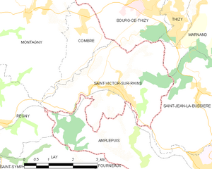
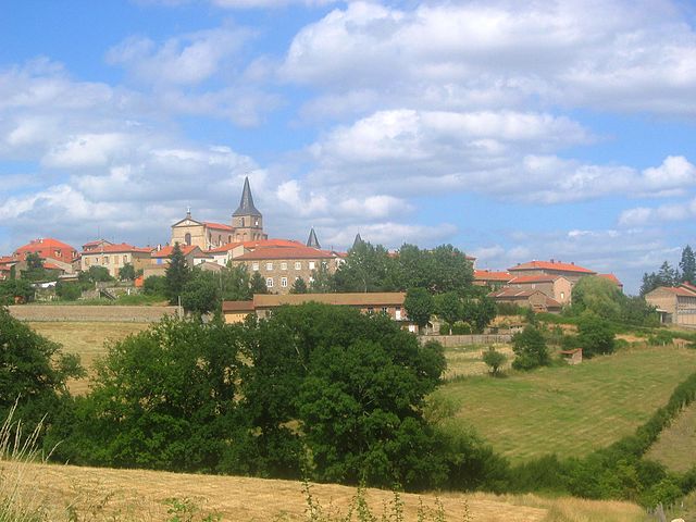
Saint-Victor-sur-Rhins
- commune in Loire, France
- Country:
- Postal Code: 42630
- Coordinates: 46° 0' 15" N, 4° 16' 54" E
- GPS tracks (wikiloc): [Link]
- Area: 11.43 sq km
- Population: 1174


Lay
- commune in Loire, France
- Country:
- Postal Code: 42470
- Coordinates: 45° 57' 20" N, 4° 13' 7" E
- GPS tracks (wikiloc): [Link]
- Area: 12.85 sq km
- Population: 739


Montagny
- commune in Loire, France
- Country:
- Postal Code: 42840
- Coordinates: 46° 1' 58" N, 4° 14' 9" E
- GPS tracks (wikiloc): [Link]
- AboveSeaLevel: 490 м m
- Area: 25.57 sq km
- Population: 1071
- Web site: [Link]

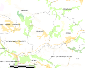
Pradines
- commune in Loire, France
- Country:
- Postal Code: 42630
- Coordinates: 45° 59' 54" N, 4° 10' 35" E
- GPS tracks (wikiloc): [Link]
- Area: 11.6 sq km
- Population: 785


Amplepuis
- commune in Rhône, France
- Country:
- Postal Code: 69550
- Coordinates: 45° 58' 21" N, 4° 19' 49" E
- GPS tracks (wikiloc): [Link]
- Area: 38.44 sq km
- Population: 5072
- Web site: [Link]

Neaux
- commune in Loire, France
- Country:
- Postal Code: 42470
- Coordinates: 45° 57' 44" N, 4° 10' 48" E
- GPS tracks (wikiloc): [Link]
- Area: 17.36 sq km
- Population: 488