Primelles (Primelles)

- commune in Cher, France
- Country:

- Postal Code: 18400
- Coordinates: 46° 55' 42" N, 2° 12' 47" E


- GPS tracks (wikiloc): [Link]
- Area: 26.57 sq km
- Population: 250
- Wikipedia en: wiki(en)
- Wikipedia: wiki(fr)
- Wikidata storage: Wikidata: Q1173560
- Wikipedia Commons Category: [Link]
- Freebase ID: [/m/03mfdpl]
- GeoNames ID: Alt: [6428253]
- SIREN number: [211801881]
- BnF ID: [15249534w]
- VIAF ID: Alt: [239643367]
- INSEE municipality code: 18188
Shares border with regions:


Saint-Ambroix
- commune in Cher, France
- Country:
- Postal Code: 18290
- Coordinates: 46° 55' 54" N, 2° 7' 13" E
- GPS tracks (wikiloc): [Link]
- Area: 31.22 sq km
- Population: 374


Mareuil-sur-Arnon
- commune in Cher, France
- Country:
- Postal Code: 18290
- Coordinates: 46° 52' 52" N, 2° 9' 33" E
- GPS tracks (wikiloc): [Link]
- Area: 25.89 sq km
- Population: 545


Lunery
- commune in Cher, France
- Country:
- Postal Code: 18400
- Coordinates: 46° 56' 7" N, 2° 16' 16" E
- GPS tracks (wikiloc): [Link]
- Area: 32.87 sq km
- Population: 1512


Saint-Baudel
- commune in Cher, France
- Country:
- Postal Code: 18160
- Coordinates: 46° 50' 18" N, 2° 12' 25" E
- GPS tracks (wikiloc): [Link]
- Area: 30.09 sq km
- Population: 248


Civray
- commune in Cher, France
- Country:
- Postal Code: 18290
- Coordinates: 46° 58' 2" N, 2° 10' 28" E
- GPS tracks (wikiloc): [Link]
- Area: 40.87 sq km
- Population: 979
Lapan
- commune in Cher, France
- Country:
- Postal Code: 18340
- Coordinates: 46° 55' 24" N, 2° 17' 59" E
- GPS tracks (wikiloc): [Link]
- Area: 10.5 sq km
- Population: 200

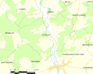
Corquoy
- commune in Cher, France
- Country:
- Postal Code: 18190
- Coordinates: 46° 53' 50" N, 2° 17' 31" E
- GPS tracks (wikiloc): [Link]
- Area: 22.62 sq km
- Population: 205


Venesmes
- commune in Cher, France
- Country:
- Postal Code: 18190
- Coordinates: 46° 50' 21" N, 2° 18' 48" E
- GPS tracks (wikiloc): [Link]
- Area: 31.76 sq km
- Population: 847