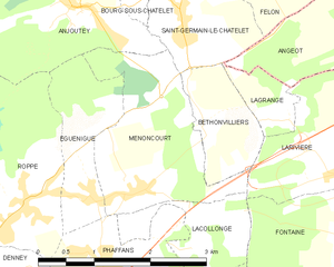
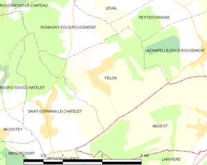
Saint-Germain-le-Châtelet (Saint-Germain-le-Châtelet)
- commune in Territoire de Belfort, France
- Country:

- Postal Code: 90110
- Coordinates: 47° 41' 46" N, 6° 57' 31" E


- GPS tracks (wikiloc): [Link]
- Area: 3.36 sq km
- Population: 640
- Wikipedia en: wiki(en)
- Wikipedia: wiki(fr)
- Wikidata storage: Wikidata: Q836726
- Wikipedia Commons Category: [Link]
- Freebase ID: [/m/03mhh1h]
- Freebase ID: [/m/03mhh1h]
- Freebase ID: [/m/03mhh1h]
- SIREN number: [219000916]
- SIREN number: [219000916]
- SIREN number: [219000916]
- BnF ID: [15280032g]
- BnF ID: [15280032g]
- BnF ID: [15280032g]
- INSEE municipality code: 90091
- INSEE municipality code: 90091
- INSEE municipality code: 90091
Shares border with regions:


Bourg-sous-Châtelet
- commune in Territoire de Belfort, France
- Country:

- Postal Code: 90110
- Coordinates: 47° 42' 7" N, 6° 56' 51" E


- GPS tracks (wikiloc): [Link]
- Area: 0.84 sq km
- Population: 109


Menoncourt
- commune in Territoire de Belfort, France
Menoncourt is a charming commune located in the Doubs department in eastern France, close to the border with Switzerland. While it may not be widely recognized as a hiking destination, the surrounding region offers a variety of trails and scenic landscapes ideal for outdoor enthusiasts....
- Country:

- Postal Code: 90150
- Coordinates: 47° 40' 14" N, 6° 56' 38" E


- GPS tracks (wikiloc): [Link]
- Area: 4.7 sq km
- Population: 397
- Web site: [Link]


Angeot
- commune in Territoire de Belfort, France
It seems there might be a typo or confusion regarding "Angeot." If you meant "Angiot," it’s not a recognized location for hiking that I'm aware of up to 2023. However, if you meant to refer to a specific region or area known for hiking, such as a national park or a famous trail, please clarify so I can provide more tailored information....
- Country:

- Postal Code: 90150
- Coordinates: 47° 41' 47" N, 7° 0' 50" E


- GPS tracks (wikiloc): [Link]
- Area: 6.56 sq km
- Population: 336
- Web site: [Link]

Anjoutey
- commune in Territoire de Belfort, France
- Country:

- Postal Code: 90170
- Coordinates: 47° 42' 4" N, 6° 55' 57" E


- GPS tracks (wikiloc): [Link]
- Area: 7.69 sq km
- Population: 618


Romagny-sous-Rougemont
- commune in Territoire de Belfort, France
- Country:

- Postal Code: 90110
- Coordinates: 47° 43' 6" N, 6° 58' 6" E


- GPS tracks (wikiloc): [Link]
- Area: 2.47 sq km
- Population: 211


Bethonvilliers
- commune in Territoire de Belfort, France
Bethonvilliers, a picturesque village in the French countryside, offers beautiful hiking opportunities for both beginners and experienced hikers. The surrounding area is characterized by rolling hills, lush forests, and charming rural landscapes, making it an ideal location for outdoor activities....
- Country:

- Postal Code: 90150
- Coordinates: 47° 40' 50" N, 6° 57' 44" E


- GPS tracks (wikiloc): [Link]
- Area: 1.9 sq km
- Population: 254

Felon
- commune in Territoire de Belfort, France
- Country:

- Postal Code: 90110
- Coordinates: 47° 42' 25" N, 6° 58' 31" E


- GPS tracks (wikiloc): [Link]
- Area: 4.11 sq km
- Population: 246
- Web site: [Link]

Lagrange
- commune in Territoire de Belfort, France
Lagrange, located in the Territoire de Belfort region in France, offers a serene hiking experience amidst beautiful natural landscapes. This area is characterized by rolling hills, dense forests, and picturesque countryside, making it a wonderful destination for outdoor enthusiasts....
- Country:

- Postal Code: 90150
- Coordinates: 47° 40' 50" N, 6° 58' 45" E


- GPS tracks (wikiloc): [Link]
- Area: 0.93 sq km
- Population: 125

