Vizille (Vizille)

- commune in Isère, France
 Hiking in Vizille
Vizille, located in the Isère department of southeastern France, is a lovely area known for its picturesque landscapes, rich history, and access to the stunning scenery of the French Alps. Hiking in and around Vizille offers various trails that cater to different skill levels, from leisurely walks to more challenging hikes.
Highlights of Hiking in Vizille:
-
Parc du Château de Vizille:
- This beautiful park surrounds the Château de Vizille, a historic site that dates back to the 17th century. The park features well-maintained paths, gardens, and scenic views, making it perfect for a relaxed hike or picnic.
-
Massif de Belledonne:
- Just a short drive from Vizille, the Belledonne mountain range offers numerous hiking routes with varying difficulty. The trails provide breathtaking views of the Alps and the surrounding valleys. Popular routes might include hikes to Mont Aiguille or along the many alpine lakes.
-
The Gorges de la Romanche:
- This area is known for its dramatic landscapes, featuring steep cliffs and the clear waters of the Romanche River. There are several trails that follow the river, offering both scenic views and the experience of the local flora and fauna.
-
Discovering Local Flora and Fauna:
- The region is rich in biodiversity, making it a fantastic spot for nature enthusiasts. As you hike, you may encounter various plants, wildlife, and possibly some breathtaking views of mountain peaks.
-
Accessibility:
- Many trails around Vizille are accessible for families and beginners, with clear markings and varying lengths. For those looking for a challenge, there are advanced trails with steeper inclines and rugged terrain.
-
Safety Tips:
- Always check weather conditions before heading out, wear appropriate hiking shoes, carry sufficient water, and have a map or GPS device. If you're new to hiking in the area, consider joining local hiking groups or guided tours for a safer experience.
-
Cultural Elements:
- While hiking, take the time to explore the local culture, including charming villages, historic sites, and the distinct Alpine architecture.
Whether you're an experienced hiker or just enjoy leisurely walks in beautiful settings, Vizille and its surrounding areas provide a fantastic hiking experience in the heart of the French Alps. Be sure to pack accordingly and enjoy the natural beauty!
- Country:

- Postal Code: 38220
- Coordinates: 45° 4' 42" N, 5° 46' 19" E


- GPS tracks (wikiloc): [Link]
- Area: 10.51 sq km
- Population: 7468
- Web site: http://www.ville-vizille.fr
- Wikipedia en: wiki(en)
- Wikipedia: wiki(fr)
- Wikidata storage: Wikidata: Q636262
- Wikipedia Commons Category: [Link]
- Freebase ID: [/m/0fqh2v]
- GeoNames ID: Alt: [2967796]
- SIREN number: [213805625]
- BnF ID: [15258362j]
- VIAF ID: Alt: [128272944]
- GND ID: Alt: [4217083-7]
- Library of Congress authority ID: Alt: [nr88012263]
- PACTOLS thesaurus ID: [pcrtg7A2T1Uzf5]
- MusicBrainz area ID: [3402d207-4b1f-4c64-bfc5-4fb4587245bf]
- INSEE municipality code: 38562
Shares border with regions:

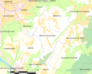
Brié-et-Angonnes
- commune in Isère, France
Hiking in Brié-et-Angonnes
Brié-et-Angonnes is a charming commune located in the Auvergne-Rhône-Alpes region of France, situated near the city of Grenoble. The area offers a variety of hiking opportunities that cater to different skill levels, making it a great destination for both beginners and experienced hikers....
- Country:
- Postal Code: 38320
- Coordinates: 45° 6' 41" N, 5° 47' 12" E
- GPS tracks (wikiloc): [Link]
- Area: 9.7 sq km
- Population: 2531
- Web site: [Link]


Notre-Dame-de-Mésage
- commune in Isère, France
Hiking in Notre-Dame-de-Mésage
Notre-Dame-de-Mésage, located in the Isère department in the Auvergne-Rhône-Alpes region of southeastern France, offers a variety of hiking opportunities that cater to different skill levels. This picturesque area is surrounded by natural beauty, including mountains, forests, and breathtaking views, making it an ideal location for outdoor enthusiasts....
- Country:
- Postal Code: 38220
- Coordinates: 45° 4' 13" N, 5° 45' 28" E
- GPS tracks (wikiloc): [Link]
- Area: 4.53 sq km
- Population: 1180
- Web site: [Link]


Montchaboud
- commune in Isère, France
Hiking in Montchaboud
Montchaboud is a picturesque mountain located in the French Alps, specifically in the Isère department. It is known for its stunning landscapes, diverse flora and fauna, and a variety of hiking trails suitable for different skill levels. Here are some key details about hiking in Montchaboud:...
- Country:
- Postal Code: 38220
- Coordinates: 45° 5' 43" N, 5° 45' 45" E
- GPS tracks (wikiloc): [Link]
- Area: 1.96 sq km
- Population: 360
- Web site: [Link]


Saint-Pierre-de-Mésage
- commune in Isère, France
Hiking in Saint-Pierre-de-Mésage
Saint-Pierre-de-Mésage is a charming town located in the Isère department of the Auvergne-Rhône-Alpes region in southeastern France. It is nestled at the foothills of the French Alps, making it a fantastic destination for hiking enthusiasts....
- Country:
- Postal Code: 38220
- Coordinates: 45° 3' 7" N, 5° 45' 52" E
- GPS tracks (wikiloc): [Link]
- Area: 7.03 sq km
- Population: 757
- Web site: [Link]


Saint-Barthélemy-de-Séchilienne
- commune in Isère, France
Hiking in Saint-Barthélemy-de-Séchilienne
Saint-Barthélemy-de-Séchilienne is a charming commune situated in the Isère department of the Auvergne-Rhône-Alpes region in southeastern France. Nestled in the foothills of the French Alps, this area offers beautiful scenery and a range of hiking opportunities for outdoor enthusiasts. Here's what you can expect when hiking in this region:...
- Country:
- Postal Code: 38220
- Coordinates: 45° 2' 39" N, 5° 49' 34" E
- GPS tracks (wikiloc): [Link]
- AboveSeaLevel: 450 м m
- Area: 12.1 sq km
- Population: 454


Séchilienne
- commune in Isère, France
Hiking in Séchilienne
Séchilienne is a charming village located in the Isère department of the Auvergne-Rhône-Alpes region in southeastern France. Nestled in the mountains, it offers beautiful hiking opportunities with stunning views of the surrounding landscapes....
- Country:
- Postal Code: 38220
- Coordinates: 45° 3' 17" N, 5° 50' 6" E
- GPS tracks (wikiloc): [Link]
- Area: 21.47 sq km
- Population: 1021

Vaulnaveys-le-Bas
- commune in Isère, France
Hiking in Vaulnaveys-le-Bas
Vaulnaveys-le-Bas is a charming village located in the Isère department of the Auvergne-Rhône-Alpes region in southeastern France. The area is surrounded by beautiful natural landscapes, making it an excellent destination for hiking enthusiasts. Here are some insights and tips for hiking in and around Vaulnaveys-le-Bas:...
- Country:
- Postal Code: 38410
- Coordinates: 45° 6' 22" N, 5° 48' 20" E
- GPS tracks (wikiloc): [Link]
- Area: 11.9 sq km
- Population: 1247
- Web site: [Link]