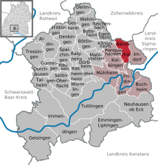
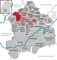
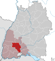
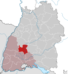
Tuttlingen (Landkreis Tuttlingen)

- district of Baden-Württemberg, Germany
 Hiking in Tuttlingen
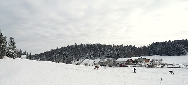
Tuttlingen district, located in the southwestern part of Germany, is a beautiful region known for its diverse landscapes, including hills, forests, and rivers. This area is part of the Swabian Jura (Schwäbische Alb), making it an excellent destination for hiking enthusiasts.
Hiking Highlights in Tuttlingen District:
-
Scenic Trails: The region offers many well-marked hiking trails that cater to all skill levels, from easy walks to challenging hikes. Popular trails often include picturesque views of the surrounding landscapes, including valleys, forests, and natural rock formations.
-
Danube River: The district is traversed by the Danube River, providing opportunities for riverside hikes and lovely picnic spots. The trails along the river often feature serene views and are great for leisurely hikes.
-
Historical Sites: Many hiking routes lead to historical landmarks, including castles, ancient ruins, and towns with rich cultural heritage. Exploring these sites adds an educational aspect to your hiking experience.
-
Natural Parks: Nearby natural parks, such as the Swabian Jura Nature Park, offer a variety of trails that showcase the region's biodiversity. The park is home to unique geological formations, caves, and diverse flora and fauna.
-
Outdoor Activities: In addition to hiking, the Tuttlingen district provides opportunities for other outdoor activities, such as cycling, climbing, and even water sports along the Danube.
Tips for Hiking in Tuttlingen:
- Trail Maps: Make sure to pick up trail maps or use hiking apps to navigate the trails effectively.
- Weather Conditions: Check the weather forecasts before heading out, as conditions can change quickly in mountainous areas.
- Adequate Gear: Wear comfortable hiking shoes and dress in layers. Bring along essentials like water, snacks, and a basic first-aid kit.
- Respect Nature: Follow the Leave No Trace principles to minimize your impact on the environment.
Whether you're a seasoned hiker or a beginner, the Tuttlingen district offers a variety of trails and experiences to explore the natural beauty and cultural richness of this unique region. Enjoy your hiking adventure!
- Country:

- Capital: Tuttlingen
- Licence Plate Code: TUT
- Coordinates: 48° 0' 0" N, 8° 48' 0" E


- GPS tracks (wikiloc): [Link]
- AboveSeaLevel: 831 м m
- Area: 734.40 sq km
- Population: 132476
- Web site: http://www.landkreis-tuttlingen.de/
- Wikipedia en: wiki(en)
- Wikipedia: wiki(de)
- Wikidata storage: Wikidata: Q8208
- Wikipedia Commons Category: [Link]
- Freebase ID: [/m/01lbmd]
- GeoNames ID: Alt: [3214111]
- VIAF ID: Alt: [147748522]
- OSM relation ID: [62682]
- GND ID: Alt: [4061294-6]
- archINFORM location ID: [5915]
- Library of Congress authority ID: Alt: [n80125746]
- Quora topic ID: [Tuttlingen]
- TGN ID: [7075011]
- NUTS code: [DE137]
- German district key: 08327
Includes regions:


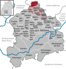
Wehingen
- municipality in Germany
Hiking in Wehingen
Wehingen is a charming town located in the Swabian Alps region of Germany, known for its beautiful landscapes and extensive hiking opportunities. Here are some highlights of hiking in and around Wehingen:...
- Country:
- Postal Code: 78564
- Local Dialing Code: 07426
- Licence Plate Code: TUT
- Coordinates: 48° 8' 43" N, 8° 47' 29" E
- GPS tracks (wikiloc): [Link]
- AboveSeaLevel: 777 м m
- Area: 14.59 sq km
- Population: 3604
- Web site: [Link]


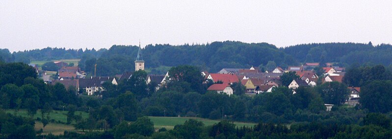
Tuttlingen
- town in Baden-Württemberg
Hiking in Tuttlingen
Tuttlingen, located in the Baden-Württemberg region of Germany, offers a variety of hiking opportunities amidst beautiful natural landscapes. The region is characterized by its scenic views of the Swabian Jura and the nearby Danube River, making it an excellent destination for outdoor activities....
- Country:
- Postal Code: 78532
- Local Dialing Code: 07461
- Licence Plate Code: TUT
- Coordinates: 47° 59' 6" N, 8° 49' 24" E
- GPS tracks (wikiloc): [Link]
- AboveSeaLevel: 644 м m
- Area: 90.49 sq km
- Population: 34586
- Web site: [Link]

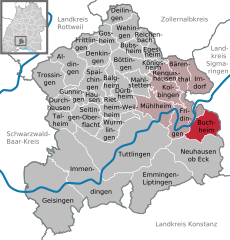
Buchheim
- municipality in Germany
Hiking in Buchheim
Buchheim is a picturesque region located in Germany, known for its beautiful landscapes and serene hiking trails. While it's not as widely known as some larger hiking destinations, it offers various opportunities for outdoor enthusiasts to explore nature....
- Country:
- Postal Code: 78567; 88637
- Local Dialing Code: 07777
- Licence Plate Code: TUT
- Coordinates: 48° 0' 37" N, 8° 59' 12" E
- GPS tracks (wikiloc): [Link]
- AboveSeaLevel: 793 м m
- Area: 18.3 sq km
- Population: 667
- Web site: [Link]
Talheim
- municipality in the district of Tuttlingen, Baden-Württemberg, Germany
Hiking in Talheim
Talheim, located near Tuttlingen in Germany, is surrounded by beautiful landscapes that are perfect for hiking enthusiasts. The area is characterized by its diverse geography, including rolling hills, forests, and picturesque valleys, which offer a variety of trails for different skill levels....
- Country:
- Postal Code: 78607
- Local Dialing Code: 07464
- Licence Plate Code: TUT
- Coordinates: 48° 0' 36" N, 8° 39' 51" E
- GPS tracks (wikiloc): [Link]
- AboveSeaLevel: 755 м m
- Area: 13.12 sq km
- Population: 1183
- Web site: [Link]


Neuhausen ob Eck
- municipality in Germany
Hiking in Neuhausen ob Eck
Neuhausen ob Eck, located in the picturesque region of Baden-Württemberg in Germany, is a fantastic destination for hiking enthusiasts. The area is known for its beautiful landscapes, which feature rolling hills, dense forests, and scenic views, particularly at the edge of the Swabian Jura....
- Country:
- Postal Code: 78579
- Local Dialing Code: 07777; 07467
- Licence Plate Code: TUT
- Coordinates: 47° 58' 0" N, 8° 56' 0" E
- GPS tracks (wikiloc): [Link]
- AboveSeaLevel: 745 м m
- Area: 46.25 sq km
- Population: 3796
- Web site: [Link]

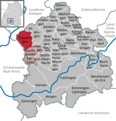
Trossingen
- municipality in Germany
Hiking in Trossingen
Trossingen, located in the picturesque region of Baden-Württemberg, Germany, offers a variety of hiking opportunities that showcase its beautiful natural landscapes, rolling hills, and rich cultural heritage....
- Country:
- Postal Code: 78647
- Local Dialing Code: 07425
- Licence Plate Code: TUT
- Coordinates: 48° 4' 32" N, 8° 38' 10" E
- GPS tracks (wikiloc): [Link]
- AboveSeaLevel: 699 м m
- Area: 24.2 sq km
- Population: 16710
- Web site: [Link]


Fridingen an der Donau
- municipality in Germany
Hiking in Fridingen an der Donau
Fridingen is a picturesque town located in the Swabian Jura of Germany, along the banks of the Danube River. It's known for its stunning landscapes, making it an excellent destination for hiking enthusiasts. Here are some key aspects of hiking in and around Fridingen:...
- Country:
- Postal Code: 78567
- Local Dialing Code: 07463
- Licence Plate Code: TUT
- Coordinates: 48° 1' 14" N, 8° 55' 58" E
- GPS tracks (wikiloc): [Link]
- AboveSeaLevel: 626 м m
- Area: 22.47 sq km
- Population: 3122
- Web site: [Link]


Geisingen
- municipality in Germany
Hiking in Geisingen
Geisingen, located in Germany, is a charming area offering a variety of hiking opportunities that appeal to both novice and experienced hikers. The surrounding natural landscapes are characterized by forests, hills, and scenic views, making it a great destination for outdoor enthusiasts....
- Country:
- Postal Code: 78187
- Local Dialing Code: 07708; 07704
- Licence Plate Code: TUT
- Coordinates: 47° 55' 20" N, 8° 38' 47" E
- GPS tracks (wikiloc): [Link]
- AboveSeaLevel: 667 м m
- Area: 73.75 sq km
- Population: 6230
- Web site: [Link]


Spaichingen
- municipality in Germany
Hiking in Spaichingen
Spaichingen, located in the beautiful region of Baden-Württemberg, Germany, is known for its picturesque landscapes and diverse hiking opportunities. The area features a mix of forests, hills, and meadows, making it a great destination for nature enthusiasts....
- Country:
- Postal Code: 78549
- Local Dialing Code: 07424
- Licence Plate Code: TUT
- Coordinates: 48° 4' 33" N, 8° 44' 16" E
- GPS tracks (wikiloc): [Link]
- AboveSeaLevel: 660 м m
- Area: 18.5 sq km
- Population: 12520
- Web site: [Link]


Immendingen
- municipality in Germany
Hiking in Immendingen
Immendingen is a picturesque town located in the southern part of Germany, specifically in the state of Baden-Württemberg. It’s a great destination for hiking enthusiasts due to its stunning natural landscapes, diverse trails, and rich cultural history. Here are some highlights and recommendations for hiking in the Immendingen area:...
- Country:
- Postal Code: 78194
- Local Dialing Code: 07462
- Licence Plate Code: TUT
- Coordinates: 47° 56' 0" N, 8° 44' 0" E
- GPS tracks (wikiloc): [Link]
- AboveSeaLevel: 660 м m
- Area: 74.03 sq km
- Population: 6237
- Web site: [Link]
Bubsheim
- municipality in Germany
Hiking in Bubsheim
Bubsheim is a small village located in the Baden-Württemberg region of Germany, known for its natural beauty and outdoor recreational opportunities. While it may not be as well-known as some larger hiking destinations, the surrounding area offers a variety of hiking trails that cater to different skill levels....
- Country:
- Postal Code: 78585
- Local Dialing Code: 07429
- Licence Plate Code: TUT
- Coordinates: 48° 7' 0" N, 8° 50' 0" E
- GPS tracks (wikiloc): [Link]
- AboveSeaLevel: 913 м m
- Area: 8.29 sq km
- Population: 1348
- Web site: [Link]


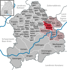
Mühlheim an der Donau
- municipality in Germany
Hiking in Mühlheim an der Donau
Mühlheim an der Donau, a charming town in Baden-Württemberg, Germany, is surrounded by picturesque landscapes and offers a range of hiking opportunities. Here are some highlights for hikers in the area:...
- Country:
- Postal Code: 78570
- Local Dialing Code: 07463
- Licence Plate Code: TUT
- Coordinates: 48° 1' 50" N, 8° 53' 9" E
- GPS tracks (wikiloc): [Link]
- AboveSeaLevel: 645 м m
- Area: 21.73 sq km
- Population: 3569
- Web site: [Link]

Bärenthal
- municipality in Germany
Hiking in Bärenthal
Bärenthal, located in the scenic region of Baden-Württemberg, Germany, offers several hiking opportunities that cater to different skill levels amidst beautiful landscapes. The area is characterized by its rolling hills, dense forests, and picturesque villages, making it a great destination for outdoor enthusiasts....
- Country:
- Postal Code: 78580
- Local Dialing Code: 07466
- Licence Plate Code: TUT
- Coordinates: 48° 4' 25" N, 8° 55' 40" E
- GPS tracks (wikiloc): [Link]
- AboveSeaLevel: 778 м m
- Area: 12.69 sq km
- Population: 467
- Web site: [Link]
Balgheim
- municipality in Germany
Hiking in Balgheim
Balgheim is a small village located in the Swabian region of Germany, known for its beautiful landscapes and accessible hiking trails. While it may not be as widely recognized as other hiking destinations, Balgheim offers a quaint and tranquil environment for those looking to explore nature. Here are some highlights about hiking in and around Balgheim:...
- Country:
- Postal Code: 78582
- Local Dialing Code: 07424
- Licence Plate Code: TUT
- Coordinates: 48° 4' 0" N, 8° 46' 0" E
- GPS tracks (wikiloc): [Link]
- AboveSeaLevel: 697 м m
- Area: 7.61 sq km
- Population: 1246
- Web site: [Link]
Gunningen
- municipality in Germany
Hiking in Gunningen
Gunningen, a quaint village located in Germany, offers picturesque hiking opportunities amidst rolling hills and beautiful natural scenery. While it may not be one of the most well-known hiking destinations, it has its charm and can be a great spot for those looking to enjoy the serenity of the countryside. Here are some highlights of hiking in and around Gunningen:...
- Country:
- Postal Code: 78594
- Local Dialing Code: 07424
- Licence Plate Code: TUT
- Coordinates: 48° 2' 46" N, 8° 41' 59" E
- GPS tracks (wikiloc): [Link]
- AboveSeaLevel: 729 м m
- Area: 5.44 sq km
- Population: 705
- Web site: [Link]

Dürbheim
- municipality in Germany
Hiking in Dürbheim
Dürbheim is a small village located in the Baden-Württemberg region of Germany, surrounded by beautiful countryside and lush landscapes that are perfect for hiking. While it may not be as widely known for hiking as some major destinations, there are still several trails and scenic areas to explore in and around Dürbheim....
- Country:
- Postal Code: 78589
- Local Dialing Code: 07424
- Licence Plate Code: TUT
- Coordinates: 48° 3' 22" N, 8° 47' 36" E
- GPS tracks (wikiloc): [Link]
- AboveSeaLevel: 727 м m
- Area: 14.82 sq km
- Population: 1616
- Web site: [Link]
Egesheim
- municipality in Germany
Hiking in Egesheim
Egesheim, a picturesque village in the Baden-Württemberg region of Germany, is nestled in the rolling hills of the Swabian Jura. This charming area offers a range of hiking opportunities for both novice and experienced hikers....
- Country:
- Postal Code: 78592
- Local Dialing Code: 07429
- Licence Plate Code: TUT
- Coordinates: 48° 7' 1" N, 8° 51' 21" E
- GPS tracks (wikiloc): [Link]
- AboveSeaLevel: 783 м m
- Area: 7.67 sq km
- Population: 640
- Web site: [Link]

Irndorf
- municipality in Germany
Hiking in Irndorf
Irndorf is a small village located in the rural heart of Germany, known for its beautiful landscapes and serene environments that attract hikers and outdoor enthusiasts. While it may not be as well-known as larger hiking destinations, it offers a unique experience for those looking to explore the natural beauty of the region....
- Country:
- Postal Code: 78597
- Local Dialing Code: 07466
- Licence Plate Code: TUT
- Coordinates: 48° 4' 0" N, 8° 58' 0" E
- GPS tracks (wikiloc): [Link]
- AboveSeaLevel: 838 м m
- Area: 14.56 sq km
- Population: 689
- Web site: [Link]


Durchhausen
- municipality in Germany
Hiking in Durchhausen
Durchhausen is a small municipality located in Baden-Württemberg, Germany. While it may not be as well-known for hiking as some of its larger neighbors, it offers access to beautiful natural landscapes typical of the region, including rolling hills, forests, and quaint countryside views....
- Country:
- Postal Code: 78591
- Local Dialing Code: 07464
- Licence Plate Code: TUT
- Coordinates: 48° 2' 0" N, 8° 41' 0" E
- GPS tracks (wikiloc): [Link]
- AboveSeaLevel: 754 м m
- Area: 8.99 sq km
- Population: 938
- Web site: [Link]

Aldingen
- municipality in Germany
Hiking in Aldingen
Aldingen is a picturesque village located in the Baden-Württemberg region of Germany. It's surrounded by beautiful landscapes, making it an excellent destination for hiking enthusiasts. Here are some highlights about hiking in Aldingen:...
- Country:
- Postal Code: 78554
- Local Dialing Code: 07424
- Licence Plate Code: TUT
- Coordinates: 48° 6' 0" N, 8° 42' 0" E
- GPS tracks (wikiloc): [Link]
- AboveSeaLevel: 644 м m
- Area: 22.17 sq km
- Population: 7578
- Web site: [Link]

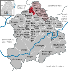
Deilingen
- municipality in Germany
Hiking in Deilingen
Deilingen is a charming village located in the region of Baden-Württemberg, Germany, surrounded by picturesque landscapes that are ideal for hiking enthusiasts. Here are some key points about hiking in and around Deilingen:...
- Country:
- Postal Code: 78586
- Local Dialing Code: 07426
- Licence Plate Code: TUT
- Coordinates: 48° 10' 37" N, 8° 46' 59" E
- GPS tracks (wikiloc): [Link]
- AboveSeaLevel: 826 м m
- Area: 10.92 sq km
- Population: 1722
- Web site: [Link]

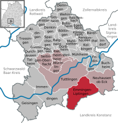
Emmingen-Liptingen
- municipality in Germany
Hiking in Emmingen-Liptingen
Emmingen-Liptingen, located in the Baden-Württemberg region of Germany, is surrounded by beautiful landscapes that are perfect for hiking enthusiasts. The area offers a variety of trails that cater to different skill levels, providing a chance to explore its natural beauty and local flora and fauna....
- Country:
- Postal Code: 78576
- Local Dialing Code: 07465
- Licence Plate Code: TUT
- Coordinates: 47° 56' 0" N, 8° 53' 0" E
- GPS tracks (wikiloc): [Link]
- AboveSeaLevel: 742 м m
- Area: 54.57 sq km
- Population: 4693
- Web site: [Link]
Hausen ob Verena
- municipality in Germany
Hiking in Hausen ob Verena
Hausen ob Verena is a charming village located in the Swabian Jura, a region known for its scenic landscapes, rolling hills, and lush forests in southern Germany. Hiking in this area offers a variety of trails suitable for different fitness levels and interests, making it an excellent destination for outdoor enthusiasts....
- Country:
- Postal Code: 78595
- Local Dialing Code: 07424
- Licence Plate Code: TUT
- Coordinates: 48° 3' 14" N, 8° 43' 30" E
- GPS tracks (wikiloc): [Link]
- AboveSeaLevel: 806 м m
- Area: 5.87 sq km
- Population: 775
- Web site: [Link]

Gosheim
- municipality in Germany
Hiking in Gosheim
Gosheim is a charming town located in the Swabian Jura region of Germany, known for its beautiful landscapes, picturesque villages, and outdoor activities. Hiking in and around Gosheim offers a blend of scenic views, well-marked trails, and varied terrain, making it suitable for hikers of all levels....
- Country:
- Postal Code: 78559
- Local Dialing Code: 07426
- Licence Plate Code: TUT
- Coordinates: 48° 8' 3" N, 8° 45' 15" E
- GPS tracks (wikiloc): [Link]
- AboveSeaLevel: 849 м m
- Area: 9.32 sq km
- Population: 3922
- Web site: [Link]


Denkingen
- municipality in Germany
Hiking in Denkingen
Denkingen, located in the Baden-Württemberg region of Germany, is a charming village that provides access to some beautiful hiking opportunities. Nestled in the Swabian Jura, the area around Denkingen offers a mix of scenic landscapes, rolling hills, and dense forests, making it perfect for outdoor enthusiasts....
- Country:
- Postal Code: 78554; 78588
- Local Dialing Code: 07424
- Licence Plate Code: TUT
- Coordinates: 48° 6' 0" N, 8° 44' 0" E
- GPS tracks (wikiloc): [Link]
- AboveSeaLevel: 688 м m
- Area: 15.02 sq km
- Population: 2633
- Web site: [Link]


Wurmlingen
- municipality in Germany
Hiking in Wurmlingen
Wurmlingen, a picturesque village in Germany, is situated near the town of Tübingen in the Swabian region. It offers a variety of hiking opportunities for both beginners and experienced hikers, showcasing the natural beauty of the surrounding landscape....
- Country:
- Postal Code: 78573
- Local Dialing Code: 07461
- Licence Plate Code: TUT
- Coordinates: 48° 0' 12" N, 8° 46' 35" E
- GPS tracks (wikiloc): [Link]
- AboveSeaLevel: 665 м m
- Area: 15.43 sq km
- Population: 3837
- Web site: [Link]


Böttingen
- municipality in Germany
Hiking in Böttingen
Böttingen, a small village in the southern part of Germany, located in the state of Baden-Württemberg, offers a range of beautiful hiking opportunities. The landscape consists of rolling hills, forests, and fields, providing a picturesque setting for outdoor enthusiasts. Here are some key points about hiking in and around Böttingen:...
- Country:
- Postal Code: 78583
- Local Dialing Code: 07429
- Licence Plate Code: TUT
- Coordinates: 48° 6' 0" N, 8° 48' 0" E
- GPS tracks (wikiloc): [Link]
- AboveSeaLevel: 915 м m
- Area: 16.31 sq km
- Population: 1400
- Web site: [Link]

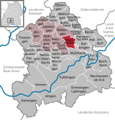
Kolbingen
- municipality in Germany
Hiking in Kolbingen
Kolbingen is a charming small village in the Baden-Württemberg region of Germany, surrounded by picturesque landscapes that make it an appealing destination for hiking enthusiasts. Here are some highlights:...
- Country:
- Postal Code: 78600
- Local Dialing Code: 07463
- Licence Plate Code: TUT
- Coordinates: 48° 3' 0" N, 8° 53' 0" E
- GPS tracks (wikiloc): [Link]
- AboveSeaLevel: 843 м m
- Area: 16.49 sq km
- Population: 1229
- Web site: [Link]


Reichenbach am Heuberg
- municipality in Germany
Hiking in Reichenbach am Heuberg
Reichenbach am Heuberg, located in the Swabian Jura region of Germany, is a picturesque destination for hiking enthusiasts. The area offers a mix of lush forests, rolling hills, and scenic views, making it an excellent choice for both casual walkers and experienced hikers....
- Country:
- Postal Code: 78564
- Local Dialing Code: 07429
- Licence Plate Code: TUT
- Coordinates: 48° 7' 57" N, 8° 50' 32" E
- GPS tracks (wikiloc): [Link]
- AboveSeaLevel: 748 м m
- Area: 6.1 sq km
- Population: 500
- Web site: [Link]

Mahlstetten
- municipality in Germany
Hiking in Mahlstetten
Mahlstetten, a picturesque village located in the Baden-Württemberg region of Germany, is surrounded by beautiful landscapes that offer various hiking opportunities. The area is part of the Swabian Jura, known for its striking limestone formations, dense forests, and scenic vistas....
- Country:
- Postal Code: 78601
- Local Dialing Code: 07429
- Licence Plate Code: TUT
- Coordinates: 48° 4' 29" N, 8° 50' 16" E
- GPS tracks (wikiloc): [Link]
- AboveSeaLevel: 879 м m
- Area: 12.19 sq km
- Population: 760
- Web site: [Link]


Königsheim
- municipality in Germany
Hiking in Königsheim
Königsheim, located in the picturesque region of Bavaria, Germany, is an excellent destination for hiking enthusiasts. Surrounded by beautiful landscapes, forests, and hills, it offers a variety of trails that cater to all levels of hikers, from beginners to advanced....
- Country:
- Postal Code: 78598
- Local Dialing Code: 07429
- Licence Plate Code: TUT
- Coordinates: 48° 6' 0" N, 8° 52' 0" E
- GPS tracks (wikiloc): [Link]
- AboveSeaLevel: 897 м m
- Area: 4.37 sq km
- Population: 550
- Web site: [Link]
Frittlingen
- municipality in Germany
Hiking in Frittlingen
Frittlingen is a charming municipality located in the district of Tuttlingen in Baden-Württemberg, Germany. It offers beautiful hiking opportunities, particularly for those who enjoy nature, scenic views, and exploring the countryside. Here are some points to consider if you're planning to hike in and around Frittlingen:...
- Country:
- Postal Code: 78665
- Local Dialing Code: 07426
- Licence Plate Code: TUT
- Coordinates: 48° 7' 38" N, 8° 42' 28" E
- GPS tracks (wikiloc): [Link]
- AboveSeaLevel: 647 м m
- Area: 8.79 sq km
- Population: 2068
- Web site: [Link]


Rietheim-Weilheim
- municipality in Germany
Hiking in Rietheim-Weilheim
Rietheim-Weilheim, located in the Swabian Jura region of Germany, offers a picturesque setting for hiking enthusiasts. The area is characterized by its rolling hills, dense forests, and scenic views, making it an excellent destination for a variety of hiking experiences....
- Country:
- Postal Code: 78604
- Local Dialing Code: 07424
- Licence Plate Code: TUT
- Coordinates: 48° 1' 0" N, 8° 46' 0" E
- GPS tracks (wikiloc): [Link]
- AboveSeaLevel: 760 м m
- Area: 11.98 sq km
- Population: 2683
- Web site: [Link]


Renquishausen
- municipality in Germany
Hiking in Renquishausen
Renquishausen, a charming village located in the Swabian Jura region of Germany, offers a variety of hiking opportunities amidst scenic landscapes, rich natural beauty, and cultural heritage. Here are some highlights and tips if you're considering hiking in the area:...
- Country:
- Postal Code: 78603
- Local Dialing Code: 07429
- Licence Plate Code: TUT
- Coordinates: 48° 4' 57" N, 8° 53' 49" E
- GPS tracks (wikiloc): [Link]
- AboveSeaLevel: 892 м m
- Area: 7.71 sq km
- Population: 734
- Web site: [Link]


Seitingen-Oberflacht
- municipality in Germany
Hiking in Seitingen-Oberflacht
Seitingen-Oberflacht is a charming village located in the Baden-Württemberg region of Germany, offering picturesque landscapes, lush greenery, and some beautiful hiking trails for nature enthusiasts. Here are some highlights for hiking in and around Seitingen-Oberflacht:...
- Country:
- Postal Code: 78606
- Local Dialing Code: 07464
- Licence Plate Code: TUT
- Coordinates: 48° 1' 8" N, 8° 43' 33" E
- GPS tracks (wikiloc): [Link]
- AboveSeaLevel: 728 м m
- Area: 19.65 sq km
- Population: 2323
- Web site: [Link]
Shares border with regions:

Schwarzwald-Baar
- district of Baden-Württemberg, Germany
Hiking in Schwarzwald-Baar
The Schwarzwald-Baar-Kreis in Baden-Württemberg, Germany, offers a diverse range of hiking opportunities, with its stunning landscapes characterized by dense forests, rolling hills, and picturesque villages. Here are some highlights and tips for hiking in the Schwarzwald-Baar-Kreis:...
- Country:
- Capital: Villingen-Schwenningen
- Licence Plate Code: VS
- Coordinates: 48° 1' 0" N, 8° 26' 0" E
- GPS tracks (wikiloc): [Link]
- AboveSeaLevel: 749 м m
- Area: 1025.24 sq km
- Web site: [Link]


Konstanz
- district in Baden-Württemberg, Germany
Hiking in Konstanz
Hiking in the Konstanz district, located in the southern part of Germany near the borders with Switzerland and Austria, offers a blend of stunning natural beauty and cultural experiences. The area is characterized by the presence of Lake Constance (Bodensee), rolling hills, scenic vineyards, and picturesque towns. Here are some highlights and popular hiking options in the Konstanz district:...
- Country:
- Capital: Konstanz
- Licence Plate Code: KN
- Coordinates: 47° 49' 0" N, 8° 53' 0" E
- GPS tracks (wikiloc): [Link]
- AboveSeaLevel: 437 м m
- Area: 817.95 sq km
- Population: 270568
- Web site: [Link]

Rottweil
- district of Baden-Württemberg, Germany
Hiking in Rottweil
Rottweil, located in the Baden-Württemberg region of Germany, offers a range of hiking opportunities that cater to various skill levels. The district boasts beautiful landscapes, including forests, hills, and rivers, along with rich historical sites. Here are some highlights for hikers in the area:...
- Country:
- Capital: Rottweil
- Licence Plate Code: RW
- Coordinates: 48° 10' 12" N, 8° 37' 48" E
- GPS tracks (wikiloc): [Link]
- AboveSeaLevel: 667 м m
- Area: 769.48 sq km
- Population: 135553
- Web site: [Link]

Landkreis Sigmaringen
- district of Baden-Württemberg, Germany
Hiking in Landkreis Sigmaringen
Sigmaringen, located in the southwestern part of Germany in the state of Baden-Württemberg, offers a beautiful and diverse landscape for hiking enthusiasts. The region is characterized by its stunning natural scenery, which includes rolling hills, dense forests, and picturesque valleys along the Danube River. Here are some highlights for hiking in the Sigmaringen district:...
- Country:
- Capital: Sigmaringen
- Licence Plate Code: SIG
- Coordinates: 48° 4' 48" N, 9° 10' 12" E
- GPS tracks (wikiloc): [Link]
- AboveSeaLevel: 626 м m
- Area: 1204.36 sq km
- Population: 127272
- Web site: [Link]

Zollernalb
- district of Baden-Württemberg, Germany
Hiking in Zollernalb
Zollernalbkreis, located in the state of Baden-Württemberg in Germany, offers a variety of hiking opportunities for outdoor enthusiasts. The region is characterized by its picturesque landscapes, rolling hills, dense forests, and charming villages. Here are some highlights and tips for hiking in Zollernalbkreis:...
- Country:
- Capital: Balingen
- Licence Plate Code: BL
- Coordinates: 48° 17' 0" N, 8° 56' 0" E
- GPS tracks (wikiloc): [Link]
- Population: 188170
- Web site: [Link]