Pruniers-en-Sologne (Pruniers-en-Sologne)

- commune in Loir-et-Cher, France
- Country:

- Postal Code: 41200
- Coordinates: 47° 19' 22" N, 1° 40' 16" E


- GPS tracks (wikiloc): [Link]
- Area: 43.84 sq km
- Population: 2424
- Wikipedia en: wiki(en)
- Wikipedia: wiki(fr)
- Wikidata storage: Wikidata: Q752901
- Wikipedia Commons Category: [Link]
- Freebase ID: [/m/03nw1_q]
- GeoNames ID: Alt: [2985177]
- SIREN number: [214101859]
- BnF ID: [152594595]
- INSEE municipality code: 41185
Shares border with regions:
Gy-en-Sologne
- commune in Loir-et-Cher, France
- Country:
- Postal Code: 41230
- Coordinates: 47° 20' 42" N, 1° 35' 0" E
- GPS tracks (wikiloc): [Link]
- Area: 35.92 sq km
- Population: 505


Veilleins
- commune in Loir-et-Cher, France
- Country:
- Postal Code: 41230
- Coordinates: 47° 25' 15" N, 1° 40' 13" E
- GPS tracks (wikiloc): [Link]
- Area: 43.26 sq km
- Population: 159


Mur-de-Sologne
- commune in Loir-et-Cher, France
- Country:
- Postal Code: 41230
- Coordinates: 47° 24' 45" N, 1° 36' 30" E
- GPS tracks (wikiloc): [Link]
- Area: 50.5 sq km
- Population: 1510
- Web site: [Link]


Lassay-sur-Croisne
- commune in Loir-et-Cher, France
- Country:
- Postal Code: 41230
- Coordinates: 47° 22' 25" N, 1° 37' 22" E
- GPS tracks (wikiloc): [Link]
- Area: 16.92 sq km
- Population: 253


Billy
- commune in Loir-et-Cher, France
- Country:
- Postal Code: 41130
- Coordinates: 47° 18' 44" N, 1° 32' 19" E
- GPS tracks (wikiloc): [Link]
- Area: 26.47 sq km
- Population: 1013


Gièvres
- commune in Loir-et-Cher, France
- Country:
- Postal Code: 41130
- Coordinates: 47° 16' 35" N, 1° 40' 8" E
- GPS tracks (wikiloc): [Link]
- Area: 38.05 sq km
- Population: 2556
- Web site: [Link]


Romorantin-Lanthenay
- commune in Loir-et-Cher, France
- Country:
- Postal Code: 41200
- Coordinates: 47° 21' 30" N, 1° 44' 34" E
- GPS tracks (wikiloc): [Link]
- Area: 45.31 sq km
- Population: 17748
- Web site: [Link]

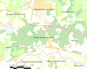
Villefranche-sur-Cher
- commune in Loir-et-Cher, France
- Country:
- Postal Code: 41200
- Coordinates: 47° 18' 0" N, 1° 46' 0" E
- GPS tracks (wikiloc): [Link]
- AboveSeaLevel: 98 м m
- Area: 27.23 sq km
- Population: 2731


Selles-sur-Cher
- commune in Loir-et-Cher, France
- Country:
- Postal Code: 41130
- Coordinates: 47° 16' 32" N, 1° 33' 17" E
- GPS tracks (wikiloc): [Link]
- Area: 25.74 sq km
- Population: 4625
- Web site: [Link]