Soest (Kreis Soest)

- district in North Rhine-Westphalia, Germany
 Hiking in Soest
Soest is a district located in North Rhine-Westphalia, Germany, known for its scenic landscapes, historical sites, and outdoor recreational opportunities. Hiking in the Soest area can be a delightful experience due to its diverse terrain, including forests, hills, and waterways.
Popular Hiking Areas:
-
Soest Forest (Soester Wald): This expansive forest offers numerous trails that are suitable for hikers of all levels. You’ll find well-marked paths that meander through dense woods, providing an immersive natural experience.
-
Möhnesee: Located nearby, Möhnesee (Möhne Lake) is a popular destination for hiking and offers beautiful views of the lake. The trails around the lake are easy to moderate and suitable for families.
-
Wäldchen an der Lippe: This area features picturesque routes along the Lippe River, where hikers can enjoy gentle paths and the serene beauty of nature. It’s a great spot for leisurely walks.
-
Historic Town Center: While not a traditional hiking trail, a stroll through the historic center of Soest, with its medieval buildings and streets, can be an enriching experience, combining history and culture with your hiking adventures.
Tips for Hiking in Soest:
-
Trail Maps: It’s beneficial to obtain local trail maps or guides. Many trails are well-marked, but having a map can help you plan your route effectively.
-
Weather: Check the weather forecast before heading out. The region can have varying conditions, so dress appropriately.
-
Safety: Always inform someone of your hiking plans, especially if you are navigating more remote trails. Carry enough water, snacks, and a basic first-aid kit.
-
Respect Nature: Follow Leave No Trace principles, stay on designated paths, and respect wildlife.
Best Times to Hike:
The best seasons for hiking in the Soest district are spring and fall when temperatures are mild, and the scenery is particularly beautiful due to flowering plants or autumn foliage. Summer can be pleasant too, but be aware of potential heat.
Overall, Soest offers a range of hiking experiences that cater to nature lovers and outdoor enthusiasts. Whether you're looking for a tranquil walk in the woods or a more challenging hike, there are options available for everyone. Enjoy your adventure!
- Country:

- Licence Plate Code: SO
- Coordinates: 51° 34' 48" N, 8° 15' 0" E


- GPS tracks (wikiloc): [Link]
- AboveSeaLevel: 137 м m
- Web site: http://www.kreis-soest.de
- Wikipedia en: wiki(en)
- Wikipedia: wiki(de)
- Wikidata storage: Wikidata: Q5965
- Wikipedia Commons Gallery: [Link]
- Wikipedia Commons Category: [Link]
- Wikipedia Commons Maps Category: [Link]
- Freebase ID: [/m/0194sy]
- GeoNames ID: Alt: [3221124]
- VIAF ID: Alt: [246524786]
- OSM relation ID: [62440]
- GND ID: Alt: [4055375-9]
- archINFORM location ID: [2]
- NUTS code: [DEA5B]
- GNS Unique Feature ID: 115819
- German district key: 05974
Shares border with regions:
Warendorf District
- district in North Rhine-Westphalia, Germany
Hiking in Warendorf District
Warendorf, located in the North Rhine-Westphalia region of Germany, is known for its picturesque landscapes, charming villages, and lush countryside, making it a delightful destination for hiking enthusiasts....
- Country:
- Licence Plate Code: WAF
- Coordinates: 51° 55' 12" N, 7° 55' 12" E
- GPS tracks (wikiloc): [Link]
- AboveSeaLevel: 65 м m
- Web site: [Link]


Hamm
- town in North Rhine-Westphalia, Germany
Hiking in Hamm
Hamm, located in the North Rhine-Westphalia region of Germany, offers a variety of hiking opportunities that cater to different skill levels and interests. While it may not be as famous for hiking as some other regions in Germany, it features several trails that allow hikers to enjoy the natural beauty and cultural landscapes of the area....
- Country:
- Postal Code: 59001–59077
- Local Dialing Code: 02389; 02388; 02307
- Licence Plate Code: HAM
- Coordinates: 51° 40' 19" N, 7° 49' 30" E
- GPS tracks (wikiloc): [Link]
- AboveSeaLevel: 63 м m
- Area: 226.43 sq km
- Population: 179571
- Web site: [Link]
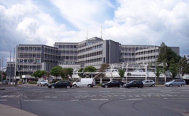

Märkischer Kreis
- district in central North Rhine-Westphalia, Germany
Hiking in Märkischer Kreis
Märkischer Kreis, located in North Rhine-Westphalia, Germany, is a beautiful region for hiking enthusiasts. It offers a blend of natural landscapes, charming small towns, and cultural heritage. Here are some highlights and things to know about hiking in this area:...
- Country:
- Capital: Lüdenscheid
- Licence Plate Code: MK
- Coordinates: 51° 13' 30" N, 7° 36' 52" E
- GPS tracks (wikiloc): [Link]
- AboveSeaLevel: 186 м m
- Area: 1058.95 sq km
- Population: 416171
- Web site: [Link]
Hochsauerlandkreis
- district in North Rhine-Westphalia, Germany
Hiking in Hochsauerlandkreis
Hochsauerlandkreis, located in North Rhine-Westphalia, Germany, is known for its stunning natural landscapes and well-marked hiking trails. The area is characterized by rolling hills, dense forests, and picturesque villages, making it a great destination for hikers of all experience levels....
- Country:
- Licence Plate Code: HSK
- Coordinates: 51° 17' 57" N, 8° 20' 33" E
- GPS tracks (wikiloc): [Link]
- AboveSeaLevel: 577 м m
- Area: 1958.78 sq km
- Population: 268851
- Web site: [Link]


Unna
- district in North Rhine-Westphalia, Germany
Hiking in Unna
Unna is a district located in North Rhine-Westphalia, Germany, known for its beautiful landscapes and diverse recreational opportunities, including hiking. The region attracts outdoors enthusiasts due to its varied terrains, which can range from gentle hills to river valleys and forests....
- Country:
- Capital: Unna
- Licence Plate Code: UN
- Coordinates: 51° 34' 48" N, 7° 40' 12" E
- GPS tracks (wikiloc): [Link]
- AboveSeaLevel: 70 м m
- Web site: [Link]

Gütersloh
- district of North Rhine-Westphalia
Hiking in Gütersloh
Gütersloh district in North Rhine-Westphalia, Germany, offers a variety of hiking opportunities set against a picturesque backdrop of nature and charming landscapes. Here are some highlights for hiking in this area:...
- Country:
- Licence Plate Code: GT
- Coordinates: 51° 55' 0" N, 8° 20' 0" E
- GPS tracks (wikiloc): [Link]
- AboveSeaLevel: 70 м m
- Web site: [Link]
Paderborn
- German district of North Rhine-Westphalia
Hiking in Paderborn
Paderborn, located in North Rhine-Westphalia, Germany, offers a variety of hiking opportunities, combining natural beauty with cultural landmarks. The region is characterized by its mix of forests, parks, and scenic countryside, making it a pleasant destination for both casual walkers and more experienced hikers....
- Country:
- Licence Plate Code: PB
- Coordinates: 51° 42' 36" N, 8° 44' 24" E
- GPS tracks (wikiloc): [Link]
- AboveSeaLevel: 221 м m
- Area: 1246.8 sq km
- Web site: [Link]