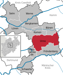
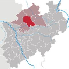
Unna (Kreis Unna)


- district in North Rhine-Westphalia, Germany
 Hiking in Unna
Unna is a district located in North Rhine-Westphalia, Germany, known for its beautiful landscapes and diverse recreational opportunities, including hiking. The region attracts outdoors enthusiasts due to its varied terrains, which can range from gentle hills to river valleys and forests.
Hiking Options in Unna:
-
Emscher Park: This area features designated hiking trails that connect parks and recreational zones. The paths are typically well-marked and suited for families and casual walkers.
-
The Ruhrgebiet Region: While not solely in Unna, the nearby Ruhr area has extensive trails that can be accessed, providing urban and industrial landscapes interspersed with nature. The walks often include historical insights into the region's industrial past.
-
Wälder und Naturparks: Unna is surrounded by several forests and natural parks, ideal for hiking. The nearby Sauerland region offers impressive trails with natural beauty, especially known for its hills and woodlands.
-
Landschaftswege (Scenic Trails): Various scenic trails cross through the district, which often feature historical landmarks, scenic views, and connecting paths to other regional areas. These trails vary in difficulty, catering to different levels of hiking experience.
-
Local Hiking Clubs: There are several clubs and organizations that promote hiking in the region, often organizing group hikes, events, and guided tours which can provide insight into the local flora and fauna.
Preparation for Hiking in Unna:
- Trail Map: It's advisable to get a local trail map or download hiking apps with offline access to ensure you stay on track.
- Clothing: Dress in layers, as the weather can change quickly. Waterproof gear is recommended, especially in the autumn and spring months.
- Footwear: Good hiking boots with excellent traction are essential for comfort, especially on uneven terrain.
- Safety: Always inform someone of your hiking plans, especially if you’re heading into lesser-traveled areas. Carry a mobile phone, and consider having a whistle or whistle on your person for emergencies.
Conclusion:
Hiking in the Unna district offers a great way to experience the natural beauty of North Rhine-Westphalia while enjoying the rich cultural history of the area. Whether you’re looking for easy day-hikes or more challenging routes, there are plenty of options to explore. Always check local resources for trail conditions and any updates on accessibility before heading out. Enjoy your hike!
- Country:

- Capital: Unna
- Licence Plate Code: UN
- Coordinates: 51° 34' 48" N, 7° 40' 12" E


- GPS tracks (wikiloc): [Link]
- AboveSeaLevel: 70 м m
- Web site: http://www.kreis-unna.de/
- Wikipedia en: wiki(en)
- Wikipedia: wiki(de)
- Wikidata storage: Wikidata: Q6163
- Wikipedia Commons Gallery: [Link]
- Wikipedia Commons Category: [Link]
- Wikipedia Commons Maps Category: [Link]
- Freebase ID: [/m/0196f_]
- GeoNames ID: Alt: [2820086]
- VIAF ID: Alt: [146903411]
- OSM relation ID: [62420]
- GND ID: Alt: [4061851-1]
- archINFORM location ID: [2647]
- Library of Congress authority ID: Alt: [n80097444]
- ISNI: Alt: [0000 0001 2110 8369]
- NUTS code: [DEA5C]
- GNS Unique Feature ID: -1876964
- German district key: 05978
Includes regions:

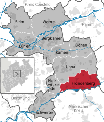
Fröndenberg
- town in the district of Unna, in North Rhine-Westphalia, Germany
Hiking in Fröndenberg
Fröndenberg, located in North Rhine-Westphalia, Germany, is a charming town surrounded by picturesque nature, making it a great destination for hiking enthusiasts. The area boasts a variety of hiking trails that cater to different skill levels, from leisurely walks to more challenging hikes....
- Country:
- Postal Code: 58730
- Local Dialing Code: 02378; 02377; 02373; 02303
- Licence Plate Code: UN
- Coordinates: 51° 28' 19" N, 7° 45' 57" E
- GPS tracks (wikiloc): [Link]
- AboveSeaLevel: 130 м m
- Area: 56.21 sq km
- Population: 20843
- Web site: [Link]


Selm
- town in the district of Unna, in North Rhine-Westphalia, Germany
Hiking in Selm
Selm, located in North Rhine-Westphalia, Germany, is not one of the most prominent hiking destinations but offers some pleasant trails and natural areas for outdoor enthusiasts looking for a quieter experience. Here are some key points about hiking in and around Selm:...
- Country:
- Postal Code: 59379
- Local Dialing Code: 02592
- Licence Plate Code: UN
- Coordinates: 51° 41' 0" N, 7° 29' 0" E
- GPS tracks (wikiloc): [Link]
- AboveSeaLevel: 111 м m
- Area: 60.34 sq km
- Population: 25811
- Web site: [Link]


Werne
- town in Unna District, in North Rhine-Westphalia, Germany
Hiking in Werne
Werne, located in North Rhine-Westphalia, Germany, offers a charming landscape for hiking enthusiasts. The area is characterized by picturesque countryside, scenic trails, and a mix of natural and historical sights. Here’s an overview of what you can expect when hiking in and around Werne:...
- Country:
- Postal Code: 59368
- Local Dialing Code: 02389
- Licence Plate Code: UN
- Coordinates: 51° 40' 0" N, 7° 37' 0" E
- GPS tracks (wikiloc): [Link]
- AboveSeaLevel: 60 м m
- Area: 76.14 sq km
- Population: 29721
- Web site: [Link]


Bönen
- municipality in the district of Unna, in North Rhine-Westphalia, Germany
Hiking in Bönen
Bönen, a small town located in North Rhine-Westphalia, Germany, is not widely recognized as a major hiking destination but offers some appealing spots for nature enthusiasts. The surrounding areas provide opportunities for hiking, particularly in the nearby regions....
- Country:
- Postal Code: 59199
- Local Dialing Code: 0 23 83
- Licence Plate Code: UN
- Coordinates: 51° 36' 0" N, 7° 46' 0" E
- GPS tracks (wikiloc): [Link]
- AboveSeaLevel: 73 м m
- Area: 38.02 sq km
- Population: 18108
- Web site: [Link]


Holzwickede
- municipality in the district of Unna in North Rhine-Westphalia, Germany
Hiking in Holzwickede
Holzwickede, located in North Rhine-Westphalia, Germany, offers various opportunities for hiking enthusiasts. The area is characterized by beautiful rural landscapes, parks, and green spaces that make it an excellent destination for nature walks and hikes....
- Country:
- Postal Code: 59439; 4755
- Local Dialing Code: 02301
- Licence Plate Code: UN
- Coordinates: 51° 30' 0" N, 7° 37' 0" E
- GPS tracks (wikiloc): [Link]
- AboveSeaLevel: 125 м m
- Area: 22.36 sq km
- Population: 17083
- Web site: [Link]


Lünen
- town in Unna District, in North Rhine-Westphalia, Germany
Hiking in Lünen
Lünen is a town located in North Rhine-Westphalia, Germany, and while it may not be typically known as a hiking hotspot, there are some lovely opportunities for outdoor enthusiasts in and around the area....
- Country:
- Postal Code: 44536; 44534; 44532
- Local Dialing Code: 02306; 0231
- Licence Plate Code: UN, LH, LÜN
- Coordinates: 51° 37' 0" N, 7° 31' 0" E
- GPS tracks (wikiloc): [Link]
- AboveSeaLevel: 58 м m
- Area: 59 sq km
- Population: 86465
- Web site: [Link]

Unna
- town in Unna District, in North Rhine-Westphalia, Germany
Hiking in Unna
Unna, located in North Rhine-Westphalia, Germany, offers a variety of outdoor activities, including hiking. While it may not be as widely recognized for hiking as some other regions in Germany, there are several trails and natural areas nearby that can provide a rewarding hiking experience. Here are some highlights:...
- Country:
- Postal Code: 59427; 59425; 59423
- Local Dialing Code: 02308; 02303
- Licence Plate Code: UN
- Coordinates: 51° 32' 5" N, 7° 41' 20" E
- GPS tracks (wikiloc): [Link]
- AboveSeaLevel: 100 м m
- Area: 88.52 sq km
- Population: 57158
- Web site: [Link]


Bergkamen
- town in Unna District, in North Rhine-Westphalia, Germany
Hiking in Bergkamen
Bergkamen, located in North Rhine-Westphalia, Germany, is not as well-known for hiking as some other regions, but it does offer opportunities for outdoor enthusiasts to explore nature and enjoy scenic routes. Here are some highlights and tips for hiking in and around Bergkamen:...
- Country:
- Postal Code: 59192
- Local Dialing Code: 02307
- Licence Plate Code: UN
- Coordinates: 51° 37' 0" N, 7° 38' 0" E
- GPS tracks (wikiloc): [Link]
- AboveSeaLevel: 65 м m
- Area: 44.8 sq km
- Population: 48829
- Web site: [Link]


Schwerte
- town in the district of Unna, in North Rhine-Westphalia, Germany
Hiking in Schwerte
Schwerte, located in North Rhine-Westphalia, Germany, is a charming town that offers a variety of hiking opportunities, set within scenic landscapes characterized by forests, rivers, and hills. Here are some highlights and tips for hiking in the area:...
- Country:
- Postal Code: 58239
- Local Dialing Code: 02304
- Licence Plate Code: UN
- Coordinates: 51° 26' 45" N, 7° 33' 55" E
- GPS tracks (wikiloc): [Link]
- AboveSeaLevel: 120 м m
- Area: 56.2 sq km
- Population: 46641
- Web site: [Link]


Kamen
- town in Unna District, in North Rhine-Westphalia, Germany
Hiking in Kamen
Kamen, a city located in North Rhine-Westphalia, Germany, offers various hiking opportunities for both beginners and experienced hikers. Though it might not be as famous as some of Germany's larger nature reserves, the surrounding region features scenic landscapes and trails worth exploring....
- Country:
- Postal Code: 59174
- Local Dialing Code: 02307
- Licence Plate Code: UN
- Coordinates: 51° 35' 30" N, 7° 39' 55" E
- GPS tracks (wikiloc): [Link]
- AboveSeaLevel: 67 м m
- Area: 40.93 sq km
- Population: 43275
- Web site: [Link]
Shares border with regions:


Dortmund
- town in North Rhine-Westphalia, Germany
Hiking in Dortmund
Dortmund, located in the North Rhine-Westphalia region of Germany, is not only known for its industrial heritage but also offers various opportunities for hiking and enjoying nature. Here are some highlights and tips for hiking in Dortmund:...
- Country:
- Postal Code: 44135–44388
- Local Dialing Code: 02304; 0231
- Licence Plate Code: DO
- Coordinates: 51° 30' 50" N, 7° 27' 55" E
- GPS tracks (wikiloc): [Link]
- AboveSeaLevel: 86 м m
- Area: 280.71 sq km
- Population: 585813
- Web site: [Link]

Hagen
- German city in North Rhine-Westphalia
Hiking in Hagen
Hagen, located in North Rhine-Westphalia, Germany, offers a variety of hiking opportunities that showcase the area's natural beauty and diverse landscapes. Here are some highlights and tips for hiking in and around Hagen:...
- Country:
- Postal Code: 58000–58135
- Local Dialing Code: 02331; 02304; 02337; 02334
- Licence Plate Code: HA
- Coordinates: 51° 21' 34" N, 7° 28' 30" E
- GPS tracks (wikiloc): [Link]
- AboveSeaLevel: 106 м m
- Area: 160.45 sq km
- Population: 188266
- Web site: [Link]


Hamm
- town in North Rhine-Westphalia, Germany
Hiking in Hamm
Hamm, located in the North Rhine-Westphalia region of Germany, offers a variety of hiking opportunities that cater to different skill levels and interests. While it may not be as famous for hiking as some other regions in Germany, it features several trails that allow hikers to enjoy the natural beauty and cultural landscapes of the area....
- Country:
- Postal Code: 59001–59077
- Local Dialing Code: 02389; 02388; 02307
- Licence Plate Code: HAM
- Coordinates: 51° 40' 19" N, 7° 49' 30" E
- GPS tracks (wikiloc): [Link]
- AboveSeaLevel: 63 м m
- Area: 226.43 sq km
- Population: 179571
- Web site: [Link]

Märkischer Kreis
- district in central North Rhine-Westphalia, Germany
Hiking in Märkischer Kreis
Märkischer Kreis, located in North Rhine-Westphalia, Germany, is a beautiful region for hiking enthusiasts. It offers a blend of natural landscapes, charming small towns, and cultural heritage. Here are some highlights and things to know about hiking in this area:...
- Country:
- Capital: Lüdenscheid
- Licence Plate Code: MK
- Coordinates: 51° 13' 30" N, 7° 36' 52" E
- GPS tracks (wikiloc): [Link]
- AboveSeaLevel: 186 м m
- Area: 1058.95 sq km
- Population: 416171
- Web site: [Link]
Soest
- district in North Rhine-Westphalia, Germany
Hiking in Soest
Soest is a district located in North Rhine-Westphalia, Germany, known for its scenic landscapes, historical sites, and outdoor recreational opportunities. Hiking in the Soest area can be a delightful experience due to its diverse terrain, including forests, hills, and waterways....
- Country:
- Licence Plate Code: SO
- Coordinates: 51° 34' 48" N, 8° 15' 0" E
- GPS tracks (wikiloc): [Link]
- AboveSeaLevel: 137 м m
- Web site: [Link]

Coesfeld
- German district of North Rhine-Westphalia
Hiking in Coesfeld
Coesfeld district, located in the North Rhine-Westphalia region of Germany, is not as widely known for hiking as other parts of the country, but it offers several scenic trails and outdoor opportunities that can appeal to nature lovers and hikers. Here are some highlights:...
- Country:
- Licence Plate Code: COE
- Coordinates: 51° 52' 0" N, 7° 23' 0" E
- GPS tracks (wikiloc): [Link]
- AboveSeaLevel: 64 м m
- Web site: [Link]


Recklinghausen
- German district of North Rhine-Westphalia
Hiking in Recklinghausen
Recklinghausen, located in the state of North Rhine-Westphalia in Germany, offers a variety of hiking opportunities, primarily in the form of trails that showcase the region's natural beauty and cultural heritage. Here are some aspects to consider when planning a hike in and around Recklinghausen:...
- Country:
- Licence Plate Code: RE
- Coordinates: 51° 40' 12" N, 7° 10' 12" E
- GPS tracks (wikiloc): [Link]
- AboveSeaLevel: 52 м m
- Web site: [Link]