Souligné-Flacé (Souligné-Flacé)

- commune in Sarthe, France
- Country:

- Postal Code: 72210
- Coordinates: 47° 58' 27" N, 0° 0' 54" E


- GPS tracks (wikiloc): [Link]
- Area: 16.49 sq km
- Population: 692
- Wikipedia en: wiki(en)
- Wikipedia: wiki(fr)
- Wikidata storage: Wikidata: Q1234931
- Wikipedia Commons Category: [Link]
- Freebase ID: [/m/03qj0_j]
- GeoNames ID: Alt: [6442743]
- SIREN number: [217203397]
- BnF ID: [15273891q]
- INSEE municipality code: 72339
Shares border with regions:

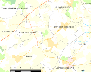
Étival-lès-le-Mans
- commune in Sarthe, France
- Country:
- Postal Code: 72700
- Coordinates: 47° 57' 23" N, 0° 5' 22" E
- GPS tracks (wikiloc): [Link]
- Area: 10.34 sq km
- Population: 1953
- Web site: [Link]


Fay
- commune in Sarthe, France
- Country:
- Postal Code: 72550
- Coordinates: 48° 0' 29" N, 0° 4' 14" E
- GPS tracks (wikiloc): [Link]
- Area: 9.48 sq km
- Population: 617
- Web site: [Link]

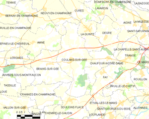
Coulans-sur-Gée
- commune in Sarthe, France
- Country:
- Postal Code: 72550
- Coordinates: 48° 1' 18" N, 0° 0' 35" E
- GPS tracks (wikiloc): [Link]
- Area: 27.48 sq km
- Population: 1660
- Web site: [Link]


Chemiré-le-Gaudin
- commune in Sarthe, France
- Country:
- Postal Code: 72210
- Coordinates: 47° 55' 42" N, 0° 0' 54" E
- GPS tracks (wikiloc): [Link]
- Area: 22.79 sq km
- Population: 958


Brains-sur-Gée
- commune in Sarthe, France
- Country:
- Postal Code: 72550
- Coordinates: 48° 0' 58" N, 0° 1' 34" E
- GPS tracks (wikiloc): [Link]
- Area: 15.9 sq km
- Population: 805


Crannes-en-Champagne
- commune in Sarthe, France
- Country:
- Postal Code: 72540
- Coordinates: 47° 58' 51" N, 0° 3' 7" E
- GPS tracks (wikiloc): [Link]
- Area: 11.97 sq km
- Population: 352


Louplande
- commune in Sarthe, France
- Country:
- Postal Code: 72210
- Coordinates: 47° 56' 36" N, 0° 2' 30" E
- GPS tracks (wikiloc): [Link]
- Area: 18.47 sq km
- Population: 1472
- Web site: [Link]


Chaufour-Notre-Dame
- commune in Sarthe, France
- Country:
- Postal Code: 72550
- Coordinates: 48° 1' 31" N, 0° 4' 30" E
- GPS tracks (wikiloc): [Link]
- Area: 11.19 sq km
- Population: 1059