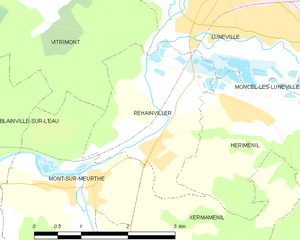
Xermaménil (Xermaménil)

- commune in Meurthe-et-Moselle, France
- Country:

- Postal Code: 54300
- Coordinates: 48° 31' 56" N, 6° 27' 46" E


- GPS tracks (wikiloc): [Link]
- Area: 10.84 sq km
- Population: 546
- Web site: http://www.xerma.fr/
- Wikipedia en: wiki(en)
- Wikipedia: wiki(fr)
- Wikidata storage: Wikidata: Q668721
- Wikipedia Commons Gallery: [Link]
- Wikipedia Commons Category: [Link]
- Freebase ID: [/m/03qdp5x]
- Freebase ID: [/m/03qdp5x]
- GeoNames ID: Alt: [6436939]
- GeoNames ID: Alt: [6436939]
- SIREN number: [215405952]
- SIREN number: [215405952]
- BnF ID: [15264662m]
- BnF ID: [15264662m]
- INSEE municipality code: 54595
- INSEE municipality code: 54595
Shares border with regions:

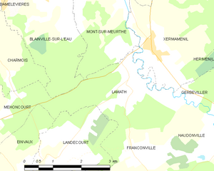
Lamath
- commune in Meurthe-et-Moselle, France
- Country:
- Postal Code: 54300
- Coordinates: 48° 31' 47" N, 6° 26' 59" E
- GPS tracks (wikiloc): [Link]
- Area: 5.6 sq km
- Population: 197

Hériménil
- commune in Meurthe-et-Moselle, France
- Country:
- Postal Code: 54300
- Coordinates: 48° 34' 1" N, 6° 29' 59" E
- GPS tracks (wikiloc): [Link]
- Area: 12.48 sq km
- Population: 956

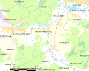
Mont-sur-Meurthe
- commune in Meurthe-et-Moselle, France
- Country:
- Postal Code: 54360
- Coordinates: 48° 33' 18" N, 6° 26' 34" E
- GPS tracks (wikiloc): [Link]
- Area: 9.51 sq km
- Population: 1114


Gerbéviller
- commune in Meurthe-et-Moselle, France
- Country:
- Postal Code: 54830
- Coordinates: 48° 29' 43" N, 6° 30' 36" E
- GPS tracks (wikiloc): [Link]
- Area: 23.94 sq km
- Population: 1355
Rehainviller
- commune in Meurthe-et-Moselle, France
- Country:
- Postal Code: 54300
- Coordinates: 48° 33' 39" N, 6° 28' 8" E
- GPS tracks (wikiloc): [Link]
- Area: 5.64 sq km
- Population: 1036