canton of Mennetou-sur-Cher (canton de Mennetou-sur-Cher)
- canton of France
- Country:

- Capital: Mennetou-sur-Cher
- Coordinates: 47° 16' 20" N, 1° 49' 35" E


- GPS tracks (wikiloc): [Link]
- Wikidata storage: Wikidata: Q1726205
- INSEE canton code: [4109]
Includes regions:


Langon-sur-Cher
- commune in Loir-et-Cher, France
- Country:
- Postal Code: 41320
- Coordinates: 47° 17' 4" N, 1° 49' 37" E
- GPS tracks (wikiloc): [Link]
- Area: 38.82 sq km
- Population: 813

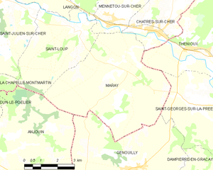
Maray
- commune in Loir-et-Cher, France
- Country:
- Postal Code: 41320
- Coordinates: 47° 14' 50" N, 1° 53' 6" E
- GPS tracks (wikiloc): [Link]
- Area: 27.8 sq km
- Population: 232


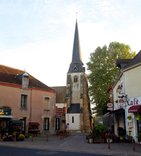
Mennetou-sur-Cher
- commune in Loir-et-Cher, France
- Country:
- Postal Code: 41320
- Coordinates: 47° 16' 10" N, 1° 51' 57" E
- GPS tracks (wikiloc): [Link]
- Area: 16.26 sq km
- Population: 902

Châtres-sur-Cher
- commune in Loir-et-Cher, France
- Country:
- Postal Code: 41320
- Coordinates: 47° 15' 54" N, 1° 54' 22" E
- GPS tracks (wikiloc): [Link]
- Area: 35.33 sq km
- Population: 1104
La Chapelle-Montmartin
- commune in Loir-et-Cher, France
- Country:
- Postal Code: 41320
- Coordinates: 47° 16' 13" N, 1° 44' 23" E
- GPS tracks (wikiloc): [Link]
- AboveSeaLevel: 124 м m
- Area: 10.72 sq km
- Population: 436


Saint-Loup
- commune in Loir-et-Cher, France
- Country:
- Postal Code: 41320
- Coordinates: 47° 15' 55" N, 1° 50' 22" E
- GPS tracks (wikiloc): [Link]
- AboveSeaLevel: 120 м m
- Area: 14.7 sq km
- Population: 372
Saint-Julien-sur-Cher
- commune in Loir-et-Cher, France
- Country:
- Postal Code: 41320
- Coordinates: 47° 16' 55" N, 1° 46' 26" E
- GPS tracks (wikiloc): [Link]
- Area: 15.99 sq km
- Population: 772

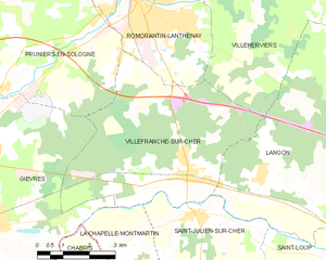
Villefranche-sur-Cher
- commune in Loir-et-Cher, France
- Country:
- Postal Code: 41200
- Coordinates: 47° 18' 0" N, 1° 46' 0" E
- GPS tracks (wikiloc): [Link]
- AboveSeaLevel: 98 м m
- Area: 27.23 sq km
- Population: 2731