La Chapelle-Montmartin (La Chapelle-Montmartin)

- commune in Loir-et-Cher, France
- Country:

- Postal Code: 41320
- Coordinates: 47° 16' 13" N, 1° 44' 23" E


- GPS tracks (wikiloc): [Link]
- AboveSeaLevel: 124 м m
- Area: 10.72 sq km
- Population: 436
- Wikipedia en: wiki(en)
- Wikipedia: wiki(fr)
- Wikidata storage: Wikidata: Q1326473
- Wikipedia Commons Category: [Link]
- Freebase ID: [/m/03nv_9m]
- GeoNames ID: Alt: [3010302]
- SIREN number: [214100380]
- BnF ID: [15259314x]
- INSEE municipality code: 41038
Shares border with regions:


Anjouin
- commune in Indre, France
- Country:
- Postal Code: 36210
- Coordinates: 47° 11' 22" N, 1° 48' 4" E
- GPS tracks (wikiloc): [Link]
- Area: 28.91 sq km
- Population: 335


Chabris
- commune in Indre, France
- Country:
- Postal Code: 36210
- Coordinates: 47° 15' 18" N, 1° 39' 12" E
- GPS tracks (wikiloc): [Link]
- Area: 41.22 sq km
- Population: 2737


Dun-le-Poëlier
- commune in Indre, France
- Country:
- Postal Code: 36210
- Coordinates: 47° 12' 14" N, 1° 45' 13" E
- GPS tracks (wikiloc): [Link]
- Area: 22.56 sq km
- Population: 447


Gièvres
- commune in Loir-et-Cher, France
- Country:
- Postal Code: 41130
- Coordinates: 47° 16' 35" N, 1° 40' 8" E
- GPS tracks (wikiloc): [Link]
- Area: 38.05 sq km
- Population: 2556
- Web site: [Link]


Saint-Loup
- commune in Loir-et-Cher, France
- Country:
- Postal Code: 41320
- Coordinates: 47° 15' 55" N, 1° 50' 22" E
- GPS tracks (wikiloc): [Link]
- AboveSeaLevel: 120 м m
- Area: 14.7 sq km
- Population: 372
Saint-Julien-sur-Cher
- commune in Loir-et-Cher, France
- Country:
- Postal Code: 41320
- Coordinates: 47° 16' 55" N, 1° 46' 26" E
- GPS tracks (wikiloc): [Link]
- Area: 15.99 sq km
- Population: 772

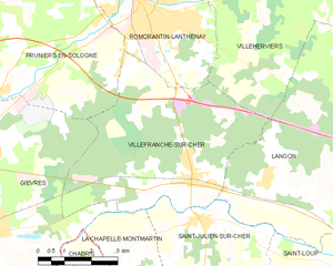
Villefranche-sur-Cher
- commune in Loir-et-Cher, France
- Country:
- Postal Code: 41200
- Coordinates: 47° 18' 0" N, 1° 46' 0" E
- GPS tracks (wikiloc): [Link]
- AboveSeaLevel: 98 м m
- Area: 27.23 sq km
- Population: 2731