canton of Saint-Hippolyte-du-Fort (canton de Saint-Hippolyte-du-Fort)
- canton of France
- Country:

- Capital: Saint-Hippolyte-du-Fort
- Coordinates: 43° 58' 0" N, 3° 51' 0" E


- GPS tracks (wikiloc): [Link]
- Wikidata storage: Wikidata: Q1727196
- Wikipedia Commons Category: [Link]
- INSEE canton code: [3028]
Includes regions:


Cros
- commune in Gard, France
- Country:
- Postal Code: 30170
- Coordinates: 43° 59' 37" N, 3° 49' 30" E
- GPS tracks (wikiloc): [Link]
- Area: 16.94 sq km
- Population: 257
- Web site: [Link]


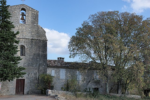
Saint-Hippolyte-du-Fort
- commune in Gard, France
- Country:
- Postal Code: 30170
- Coordinates: 43° 57' 57" N, 3° 51' 21" E
- GPS tracks (wikiloc): [Link]
- Area: 29.38 sq km
- Population: 3937
- Web site: [Link]


La Cadière-et-Cambo
- commune in Gard, France
- Country:
- Postal Code: 30170
- Coordinates: 43° 57' 27" N, 3° 48' 29" E
- GPS tracks (wikiloc): [Link]
- AboveSeaLevel: 240 м m
- Area: 11.97 sq km
- Population: 208

Conqueyrac
- commune in Gard, France
- Country:
- Postal Code: 30170
- Coordinates: 43° 56' 48" N, 3° 54' 31" E
- GPS tracks (wikiloc): [Link]
- Area: 27.18 sq km
- Population: 105

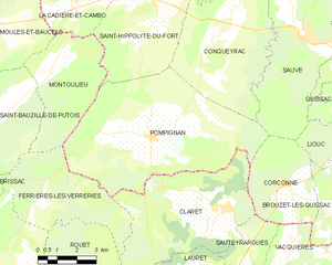
Pompignan
- commune in Gard, France
- Country:
- Postal Code: 30170
- Coordinates: 43° 53' 38" N, 3° 51' 22" E
- GPS tracks (wikiloc): [Link]
- Area: 41.31 sq km
- Population: 922