Conqueyrac (Conqueyrac)

- commune in Gard, France
- Country:

- Postal Code: 30170
- Coordinates: 43° 56' 48" N, 3° 54' 31" E


- GPS tracks (wikiloc): [Link]
- Area: 27.18 sq km
- Population: 105
- Wikipedia en: wiki(en)
- Wikipedia: wiki(fr)
- Wikidata storage: Wikidata: Q844956
- Wikipedia Commons Category: [Link]
- Freebase ID: [/m/03c0tx4]
- GeoNames ID: Alt: [6448235]
- SIREN number: [213000938]
- BnF ID: [152547333]
- PACTOLS thesaurus ID: [pcrtTam4Md5Jhk]
- INSEE municipality code: 30093
Shares border with regions:

Sauve
- commune in Gard, France
- Country:
- Postal Code: 30610
- Coordinates: 43° 56' 33" N, 3° 56' 55" E
- GPS tracks (wikiloc): [Link]
- Area: 31.56 sq km
- Population: 1943


Durfort-et-Saint-Martin-de-Sossenac
- commune in Gard, France
- Country:
- Postal Code: 30170
- Coordinates: 43° 59' 26" N, 3° 57' 19" E
- GPS tracks (wikiloc): [Link]
- Area: 16.28 sq km
- Population: 689


Saint-Hippolyte-du-Fort
- commune in Gard, France
- Country:
- Postal Code: 30170
- Coordinates: 43° 57' 57" N, 3° 51' 21" E
- GPS tracks (wikiloc): [Link]
- Area: 29.38 sq km
- Population: 3937
- Web site: [Link]


Monoblet
- commune in Gard, France
- Country:
- Postal Code: 30170
- Coordinates: 44° 0' 2" N, 3° 53' 11" E
- GPS tracks (wikiloc): [Link]
- Area: 21.33 sq km
- Population: 688
- Web site: [Link]

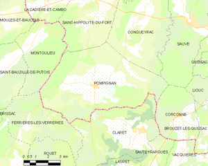
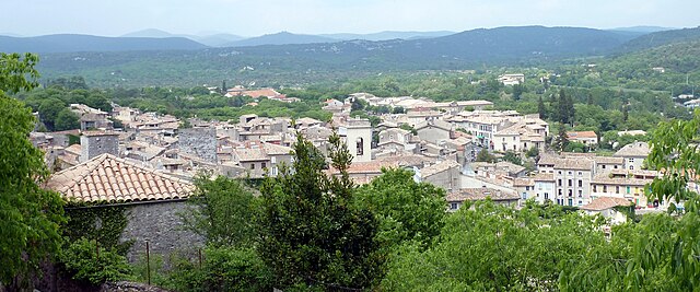
Pompignan
- commune in Gard, France
- Country:
- Postal Code: 30170
- Coordinates: 43° 53' 38" N, 3° 51' 22" E
- GPS tracks (wikiloc): [Link]
- Area: 41.31 sq km
- Population: 922