
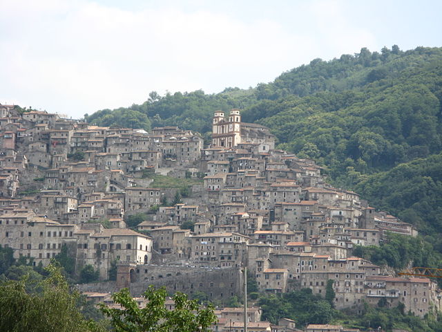
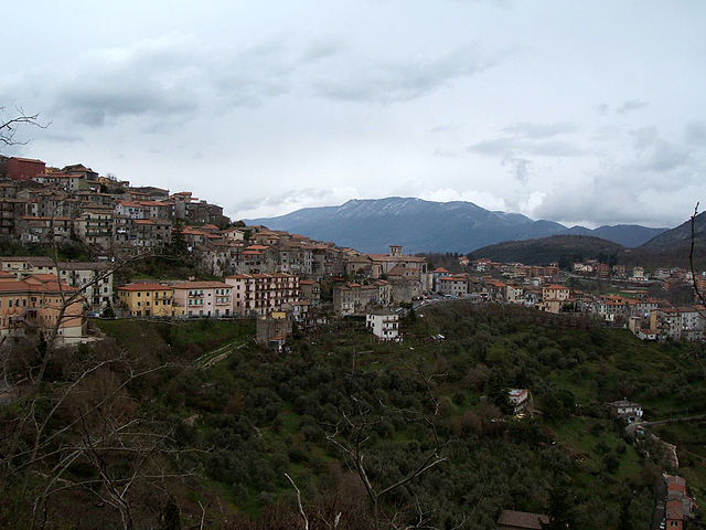
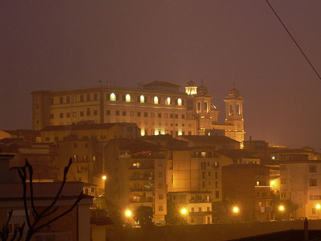
Colleferro (Colleferro)

.svg)
- Italian comune
 Hiking in Colleferro
Colleferro, located in the Lazio region of Italy, offers a variety of hiking opportunities thanks to its picturesque landscapes and proximity to the beautiful Monti Lepini mountain range. Here’s a breakdown of what you can expect when hiking in and around Colleferro:
Trails and Natural Attractions
-
Monte Artemisio: This area offers scenic views and well-marked trails. The summit provides a panoramic vista of the surrounding countryside, making it a popular destination for both beginners and experienced hikers.
-
Monti Lepini: The nearby Lepini mountains offer a range of trails with varying difficulty levels. You can explore lush forests, rocky paths, and historical sites. Trails here are well-maintained and offer encounters with local flora and fauna.
-
Cascate di Trevi: If you’re looking for a mix of hiking and nature sightseeing, the waterfalls near Trevi are a beautiful destination. The hike to the falls offers stunning scenery and the chance to enjoy the sound of cascading water.
Seasonal Considerations
- Spring and Fall: These seasons are ideal for hiking, with moderate temperatures and blooming vegetation in spring or the colorful foliage in fall.
- Summer: While summer hikes can be enjoyable, it's advisable to start early in the day to avoid the heat.
- Winter: Hiking in winter can be beautiful, but be prepared for colder conditions and check trail accessibility, as some paths may be snow-covered.
Equipment
- Footwear: Sturdy hiking boots or shoes are recommended for the varied terrain.
- Clothing: Wear layers, as temperatures can fluctuate. Waterproof clothing may also be beneficial.
- Safety Gear: Always carry a first-aid kit, enough water, snacks, and a map or GPS device.
Local Culture and Enjoyment
- Food: After a hike, indulge in local cuisine at nearby restaurants or agriturismos. Try regional specialties that reflect the rich culinary heritage of Lazio.
- Wildlife: Keep an eye out for local wildlife; the region is home to diverse species and the chance to see them can enhance your hiking experience.
Conclusion
Hiking in Colleferro allows you to immerse yourself in nature, enjoy stunning vistas, and experience the local culture. Whether you’re an experienced hiker or a beginner, there are options to suit your level and interests. Always remember to plan accordingly, respect the environment, and enjoy your outdoor adventures!
- Country:

- Postal Code: 00034
- Local Dialing Code: 06
- Licence Plate Code: ROMA
- Coordinates: 41° 43' 43" N, 13° 0' 11" E


- GPS tracks (wikiloc): [Link]
- AboveSeaLevel: 218 м m
- Area: 27 sq km
- Population: 21394
- Web site: http://www.comune.colleferro.rm.it/
- Wikipedia en: wiki(en)
- Wikipedia: wiki(it)
- Wikidata storage: Wikidata: Q242553
- Wikipedia Commons Category: [Link]
- Freebase ID: [/m/08nn1t]
- GeoNames ID: Alt: [6541652]
- VIAF ID: Alt: [240901851]
- OSM relation ID: [41523]
- MusicBrainz area ID: [86ed50e3-7b07-45cd-bbbf-adb5b394b8ad]
- Quora topic ID: [Colleferro]
- UN/LOCODE: [ITCFO]
- ISTAT ID: 058034
- Italian cadastre code: C858
Shares border with regions:


Anagni
- Italian comune
Hiking in Anagni
Anagni, located in the province of Frosinone in Italy, is a historic town with a rich cultural heritage and beautiful natural landscapes, making it an excellent destination for hiking enthusiasts. Here are some highlights and tips for hiking in the Anagni area:...
- Country:
- Postal Code: 03012
- Local Dialing Code: 0775
- Licence Plate Code: FR
- Coordinates: 41° 45' 0" N, 13° 9' 0" E
- GPS tracks (wikiloc): [Link]
- AboveSeaLevel: 475 м m
- Area: 112.82 sq km
- Population: 21404
- Web site: [Link]
Paliano
- Italian comune
Hiking in Paliano
Paliano, located in the province of Frosinone in the Lazio region of Italy, is an area known for its picturesque landscapes and historical significance. Hiking in Paliano can provide an excellent opportunity to explore both natural beauty and cultural sites....
- Country:
- Postal Code: 03018
- Local Dialing Code: 0775
- Licence Plate Code: FR
- Coordinates: 41° 48' 0" N, 13° 3' 0" E
- GPS tracks (wikiloc): [Link]
- AboveSeaLevel: 471 м m
- Area: 70.64 sq km
- Population: 8163
- Web site: [Link]
Rocca Massima
- Italian comune
Hiking in Rocca Massima
Rocca Massima is a small town located in the province of Latina, in the Lazio region of Italy. Nestled in the charming landscapes of the Lepini Mountains, it offers stunning views and a variety of hiking opportunities for both beginners and experienced hikers....
- Country:
- Postal Code: 04010
- Local Dialing Code: 06
- Licence Plate Code: LT
- Coordinates: 41° 41' 0" N, 12° 55' 0" E
- GPS tracks (wikiloc): [Link]
- AboveSeaLevel: 735 м m
- Area: 18.17 sq km
- Population: 1135
- Web site: [Link]

Artena
- Italian comune
Hiking in Artena
Artena is a charming hilltop town located in the province of Rome, Italy. It is set in the beautiful landscape of the Lazio region, surrounded by hills, forests, and panoramic views, making it a great destination for hiking enthusiasts. Here are a few highlights about hiking in and around Artena:...
- Country:
- Postal Code: 00031
- Local Dialing Code: 06
- Licence Plate Code: RM
- Coordinates: 41° 44' 0" N, 12° 55' 0" E
- GPS tracks (wikiloc): [Link]
- AboveSeaLevel: 420 м m
- Area: 54.8 sq km
- Population: 14107
- Web site: [Link]


Gavignano
- Italian comune
Hiking in Gavignano
Gavignano, a charming village in the province of Rome, Italy, offers some beautiful hiking opportunities thanks to its picturesque landscapes and proximity to the Monti Simbruini National Park. Here are some highlights for hiking in and around Gavignano:...
- Country:
- Postal Code: 00030
- Local Dialing Code: 06
- Licence Plate Code: RM
- Coordinates: 41° 42' 0" N, 13° 3' 0" E
- GPS tracks (wikiloc): [Link]
- AboveSeaLevel: 404 м m
- Area: 15.04 sq km
- Population: 1905
- Web site: [Link]
Genazzano
- Italian comune
Hiking in Genazzano
Genazzano, a charming medieval town in the Lazio region of Italy, offers wonderful opportunities for hiking and exploring the surrounding landscapes. Nestled in the hills near the Aniene Valley, Genazzano is known for its picturesque views, historic architecture, and lush natural surroundings....
- Country:
- Postal Code: 00030
- Local Dialing Code: 06
- Licence Plate Code: ROMA
- Coordinates: 41° 50' 0" N, 12° 58' 0" E
- GPS tracks (wikiloc): [Link]
- AboveSeaLevel: 375 м m
- Area: 32.07 sq km
- Population: 5949
- Web site: [Link]

Segni
- Italian comune
Hiking in Segni
Segni, located in the province of Rome, Italy, offers a range of hiking opportunities with its beautiful landscapes, historical sites, and varied terrain. Nestled in the foothills of the Lepini Mountains, this area is perfect for outdoor enthusiasts looking to explore nature while appreciating the rich cultural heritage of the region....
- Country:
- Postal Code: 00037
- Local Dialing Code: 06
- Licence Plate Code: RM
- Coordinates: 41° 41' 0" N, 13° 1' 0" E
- GPS tracks (wikiloc): [Link]
- AboveSeaLevel: 668 м m
- Area: 60.86 sq km
- Population: 9192
- Web site: [Link]

Valmontone
- Italian comune
Hiking in Valmontone
Valmontone, located in the Lazio region of Italy, is not only known for its historical sites and proximity to the Rainbow Magicland amusement park but also offers some inviting hiking opportunities. Here are some aspects to consider if you're planning to hike in and around Valmontone:...
- Country:
- Postal Code: 00038
- Local Dialing Code: 06
- Licence Plate Code: ROMA
- Coordinates: 41° 46' 24" N, 12° 55' 7" E
- GPS tracks (wikiloc): [Link]
- AboveSeaLevel: 303 м m
- Area: 40.91 sq km
- Population: 16073
- Web site: [Link]