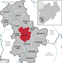
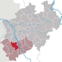
Düren (Kreis Düren)


- German district of North Rhine-Westphalia
 Hiking in Düren
Düren district, located in North Rhine-Westphalia, Germany, offers a variety of hiking opportunities that cater to different skill levels and preferences. The region is characterized by its lush landscapes, rolling hills, and scenic views, making it an excellent destination for outdoor enthusiasts.
Popular Hiking Areas:
-
Eifel National Park: Though a bit farther from Düren itself, the Eifel National Park is accessible and offers well-marked trails with stunning natural beauty, including forests, rivers, and rich wildlife. The park features several long-distance trails and shorter loops suitable for day hikes.
-
Rur River: The Rur River offers picturesque trails that run along the riverbanks. This area is perfect for a more leisurely hike and allows hikers to enjoy the serene waterscapes and the surrounding nature.
-
Düren City Parks: Within the district, you can explore local parks such as the Düren Stadtgarten, which provides shorter walking paths, gardens, and a chance to enjoy some nature within the city.
Suggested Hiking Trails:
-
Wanderweg Düren: A designated hiking route that can take several hours to complete, this trail showcases the beautiful countryside of Düren, with options to connect to other trails in the region.
-
The Eifelsteig: This long-distance trail starts in Aachen and runs into the Eifel, offering portions that are accessible from Düren. It passes through various landscapes, including forests, mountains, and valleys.
Tips for Hiking in Düren:
-
Weather Considerations: Always check the weather forecast before heading out. The region can experience varying weather conditions.
-
Appropriate Gear: Wear sturdy hiking boots and bring along sufficient water, snacks, and a basic first-aid kit.
-
Map and Navigation: Although many trails are marked, having a map or GPS app can be helpful for navigating more remote paths.
-
Respect Nature: Follow the Leave No Trace principles to protect the environment.
Local Amenities:
Düren has various amenities, including restaurants and accommodations where hikers can rest and enjoy local cuisine after a day on the trails. Local tourist information centers can provide maps and up-to-date information on trails and conditions.
Whether you're an experienced hiker or just looking for a leisurely stroll in nature, Düren district offers appealing options for enjoying the great outdoors.
- Country:

- Licence Plate Code: DN
- Coordinates: 50° 49' 48" N, 6° 30' 0" E


- GPS tracks (wikiloc): [Link]
- AboveSeaLevel: 118 м m
- Web site: http://www.kreis-dueren.de/
- Wikipedia en: wiki(en)
- Wikipedia: wiki(de)
- Wikidata storage: Wikidata: Q6275
- Wikipedia Commons Gallery: [Link]
- Wikipedia Commons Category: [Link]
- Wikipedia Commons Maps Category: [Link]
- Freebase ID: [/m/0194n0]
- GeoNames ID: Alt: [3247453]
- VIAF ID: Alt: [141897490]
- OSM relation ID: [62452]
- GND ID: Alt: [4013238-9]
- archINFORM location ID: [2391]
- Library of Congress authority ID: Alt: [n80162577]
- National Library of Israel ID: [000982431]
- NUTS code: [DEA26]
- German district key: 05358
Includes regions:

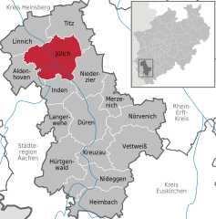
Jülich
- town in the Düren district, in North Rhine-Westphalia, Germany
Hiking in Jülich
Jülich, a charming town in North Rhine-Westphalia, Germany, offers a variety of hiking opportunities for those looking to explore the region's natural beauty. While Jülich itself may not be a major hiking destination, its vicinity boasts beautiful landscapes and trails perfect for hiking and outdoor activities....
- Country:
- Postal Code: 52428
- Local Dialing Code: 02463; 02461
- Coordinates: 50° 55' 20" N, 6° 21' 30" E
- GPS tracks (wikiloc): [Link]
- AboveSeaLevel: 83 м m
- Area: 90.4 sq km
- Population: 32505
- Web site: [Link]
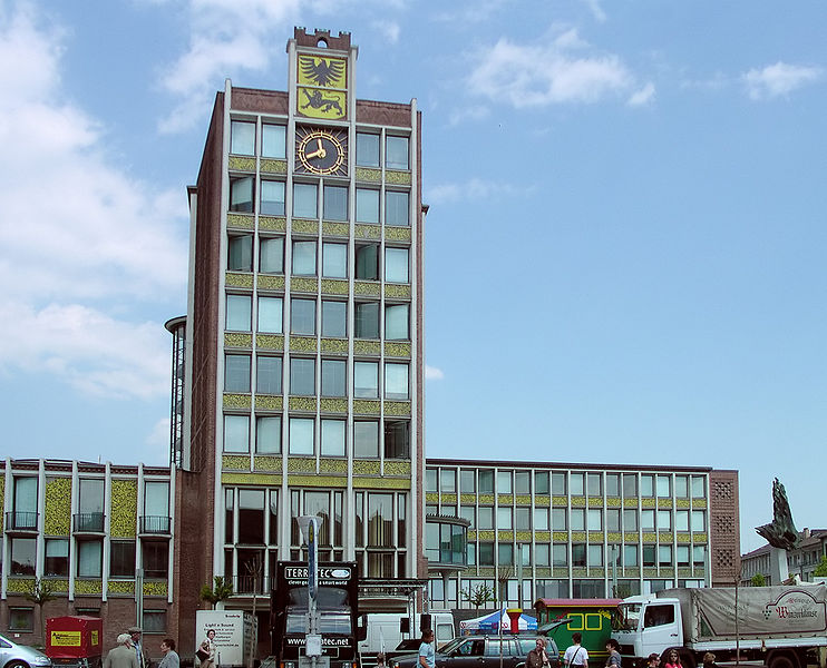
Düren
- town in the Düren district, in North Rhine-Westphalia, Germany
Hiking in Düren
Düren, a town in North Rhine-Westphalia, Germany, offers several hiking opportunities that allow you to explore the surrounding landscape and enjoy nature. Here’s an overview of what you can expect when hiking in and around Düren:...
- Country:
- Postal Code: 52355; 52353; 52349; 52351
- Local Dialing Code: 02421
- Licence Plate Code: DN
- Coordinates: 50° 48' 0" N, 6° 29' 0" E
- GPS tracks (wikiloc): [Link]
- AboveSeaLevel: 125 м m
- Area: 85 sq km
- Population: 90502
- Web site: [Link]
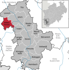
Aldenhoven
- municipality in the Düren district, in North Rhine-Westphalia, Germany
Hiking in Aldenhoven
Aldenhoven, located in the state of North Rhine-Westphalia in Germany, offers a variety of hiking opportunities for nature enthusiasts. The region is characterized by its picturesque landscapes, charming villages, and extensive trail networks that cater to hikers of all experience levels. Here are some aspects to consider when hiking in Aldenhoven and the surrounding areas:...
- Country:
- Postal Code: 52457
- Local Dialing Code: 02464
- Licence Plate Code: DN
- Coordinates: 50° 54' 0" N, 6° 17' 0" E
- GPS tracks (wikiloc): [Link]
- AboveSeaLevel: 111 м m
- Area: 44.26 sq km
- Population: 13877
- Web site: [Link]
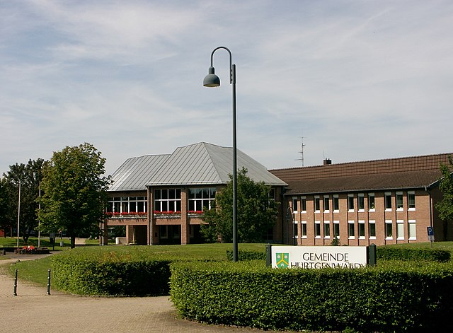

Hürtgenwald
- municipality in the Düren district, in North Rhine-Westphalia, Germany
Hiking in Hürtgenwald
Hürtgenwald, located in North Rhine-Westphalia, Germany, is known for its lush forests, rolling hills, and rich history, making it a fantastic destination for hikers. The area is characterized by its dense woodlands and diverse flora and fauna, offering a peaceful environment for outdoor enthusiasts. Here’s what you need to know about hiking in Hürtgenwald:...
- Country:
- Postal Code: 52393
- Local Dialing Code: 02429
- Licence Plate Code: DN
- Coordinates: 50° 43' 0" N, 6° 22' 0" E
- GPS tracks (wikiloc): [Link]
- AboveSeaLevel: 380 м m
- Area: 88.05 sq km
- Population: 8644
- Web site: [Link]

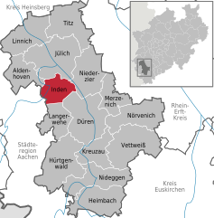
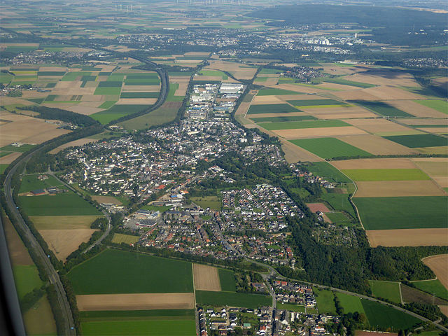
Inden
- municipality in the Düren district, in North Rhine-Westphalia, Germany
Hiking in Inden
Inden, a charming village in North Rhine-Westphalia, Germany, is surrounded by scenic landscapes that make it an appealing destination for hikers. While Inden itself may not be a well-known hiking hotspot, there are several trails and natural areas nearby that offer excellent hiking experiences....
- Country:
- Postal Code: 52459
- Local Dialing Code: 02465; 02423
- Licence Plate Code: DN
- Coordinates: 50° 50' 48" N, 6° 21' 28" E
- GPS tracks (wikiloc): [Link]
- AboveSeaLevel: 106 м m
- Area: 35.92 sq km
- Population: 7426
- Web site: [Link]

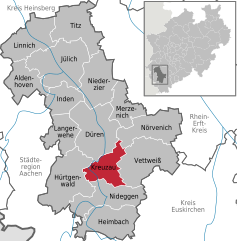
Kreuzau
- municipality in the Düren district, in North Rhine-Westphalia, Germany
Hiking in Kreuzau
Kreuzau, located in Germany’s North Rhine-Westphalia region, offers a variety of outdoor activities, including hiking. While it may not be as widely known for hiking as some larger national parks, it does have beautiful landscapes and scenic routes that nature enthusiasts can enjoy. Here are some key points to consider for hiking in and around Kreuzau:...
- Country:
- Postal Code: 52372
- Local Dialing Code: 02427; 02422; 02421
- Licence Plate Code: DN
- Coordinates: 50° 44' 49" N, 6° 29' 26" E
- GPS tracks (wikiloc): [Link]
- AboveSeaLevel: 148 м m
- Area: 41.77 sq km
- Population: 17582
- Web site: [Link]


Langerwehe
- municipality in the Düren district, in North Rhine-Westphalia, Germany
Hiking in Langerwehe
Langerwehe is a small town located in North Rhine-Westphalia, Germany, nestled in the picturesque area of the Rureifel region. While it might not be as well-known as larger hiking destinations, it offers several enjoyable trails that are suitable for different skill levels....
- Country:
- Postal Code: 52379
- Local Dialing Code: 02423
- Licence Plate Code: DN
- Coordinates: 50° 49' 0" N, 6° 20' 59" E
- GPS tracks (wikiloc): [Link]
- AboveSeaLevel: 158 м m
- Area: 41.49 sq km
- Population: 13986
- Web site: [Link]


Merzenich
- municipality in the Düren district, in North Rhine-Westphalia, Germany
Hiking in Merzenich
Merzenich is a small town located in North Rhine-Westphalia, Germany, and while it may not be as widely recognized as a hiking destination compared to larger natural parks or mountainous regions, it offers some pleasant trails and opportunities for outdoor activities....
- Country:
- Postal Code: 52399
- Local Dialing Code: 02421; 02275
- Licence Plate Code: DN
- Coordinates: 50° 49' 34" N, 6° 31' 36" E
- GPS tracks (wikiloc): [Link]
- AboveSeaLevel: 127 м m
- Area: 37.91 sq km
- Population: 9733
- Web site: [Link]


Niederzier
- municipality in the Düren district, in North Rhine-Westphalia, Germany
Hiking in Niederzier
Niederzier, a municipality in the district of Düren in North Rhine-Westphalia, Germany, offers some lovely hiking opportunities. While it's not known for extensive mountain ranges, the area is characterized by picturesque landscapes, parks, and agricultural lands, making it a perfect spot for leisurely hikes and nature walks....
- Country:
- Postal Code: 52382
- Local Dialing Code: 02428
- Licence Plate Code: DN
- Coordinates: 50° 52' 59" N, 6° 28' 0" E
- GPS tracks (wikiloc): [Link]
- AboveSeaLevel: 100 м m
- Area: 63 sq km
- Population: 13920
- Web site: [Link]


Nörvenich
- municipality in the Düren district, in North Rhine-Westphalia, Germany
Hiking in Nörvenich
Nörvenich, located in North Rhine-Westphalia, Germany, offers a range of opportunities for hiking enthusiasts. While it may not be as famous as other hiking destinations in Germany, it can provide a peaceful and picturesque experience for those looking to explore the outdoors....
- Country:
- Postal Code: 52388
- Local Dialing Code: 02426
- Licence Plate Code: DN
- Coordinates: 50° 48' 0" N, 6° 39' 0" E
- GPS tracks (wikiloc): [Link]
- AboveSeaLevel: 110 м m
- Area: 66.2 sq km
- Population: 10447
- Web site: [Link]


Titz
- municipality in the Düren district, in North Rhine-Westphalia, Germany
Hiking in Titz
Titz is a small municipality located in North Rhine-Westphalia, Germany, surrounded by beautiful landscapes ideal for hiking enthusiasts. The area features a variety of trails that cater to different skill levels, from easy walks to more challenging hikes....
- Country:
- Postal Code: 52445
- Local Dialing Code: 02463
- Licence Plate Code: DN
- Coordinates: 51° 0' 22" N, 6° 25' 29" E
- GPS tracks (wikiloc): [Link]
- AboveSeaLevel: 95 м m
- Area: 69 sq km
- Population: 8329
- Web site: [Link]


Vettweiß
- municipality in the Düren district, in North Rhine-Westphalia, Germany
Hiking in Vettweiß
Vettweiß, located in North Rhine-Westphalia, Germany, offers a variety of hiking opportunities that allow you to enjoy the scenic beauty of the region. While Vettweiß itself may not be a major hiking destination, its surrounding areas are quite attractive for outdoor enthusiasts. Here are some aspects to consider when hiking in and around Vettweiß:...
- Country:
- Postal Code: 52391
- Local Dialing Code: 02425; 02424; 02252
- Licence Plate Code: DN
- Coordinates: 50° 44' 0" N, 6° 36' 0" E
- GPS tracks (wikiloc): [Link]
- AboveSeaLevel: 158 м m
- Area: 83.15 sq km
- Population: 9280
- Web site: [Link]


Nideggen
- town in the Düren district, in North Rhine-Westphalia, Germany
Hiking in Nideggen
Nideggen, located in the North Rhine-Westphalia region of Germany, is a beautiful area for hiking enthusiasts, offering a mix of picturesque landscapes, historical sites, and well-maintained trails. Here are some highlights and tips for hiking in and around Nideggen:...
- Country:
- Postal Code: 52385
- Local Dialing Code: 02474; 02427; 02425
- Licence Plate Code: DN
- Coordinates: 50° 42' 0" N, 6° 29' 0" E
- GPS tracks (wikiloc): [Link]
- AboveSeaLevel: 312 м m
- Area: 65.04 sq km
- Population: 9855
- Web site: [Link]


Linnich
- town in the district of Düren, North Rhine-Westphalia, Germany
Hiking in Linnich
Linnich, located in North Rhine-Westphalia, Germany, offers several opportunities for hiking enthusiasts. The area is characterized by picturesque landscapes, including lush forests, scenic fields, and charming waterways that provide a peaceful backdrop for outdoor activities....
- Country:
- Postal Code: 52441
- Local Dialing Code: 02463; 02462
- Licence Plate Code: DN, JÜL
- Coordinates: 50° 58' 44" N, 6° 16' 4" E
- GPS tracks (wikiloc): [Link]
- AboveSeaLevel: 73 м m
- Area: 65.46 sq km
- Population: 12484
- Web site: [Link]


Heimbach
- town in the Düren district, in North Rhine-Westphalia, Germany
Hiking in Heimbach
Heimbach, located in the Eifel region of Germany, is a fantastic destination for hiking enthusiasts. It offers a diverse range of trails that cater to various skill levels, from gentle walks to more challenging hikes. Here are some highlights of hiking in Heimbach:...
- Country:
- Postal Code: 52396
- Local Dialing Code: 02425; 02446
- Licence Plate Code: DN
- Coordinates: 50° 37' 59" N, 6° 28' 59" E
- GPS tracks (wikiloc): [Link]
- AboveSeaLevel: 227 м m
- Area: 64.8 sq km
- Population: 4319
- Web site: [Link]
Shares border with regions:
Rhein-Kreis Neuss
- district in North Rhine-Westphalia, Germany
Hiking in Rhein-Kreis Neuss
Rhein-Kreis Neuss, located in North Rhine-Westphalia, Germany, offers a variety of hiking opportunities that showcase its natural beauty and cultural heritage. The region is characterized by scenic landscapes, rolling hills, forests, and rivers, making it an ideal destination for hikers of all levels. Here are some key features and trails you might consider:...
- Country:
- Licence Plate Code: NE
- Coordinates: 51° 9' 55" N, 6° 39' 14" E
- GPS tracks (wikiloc): [Link]
- AboveSeaLevel: 48 м m
- Area: 576.52 sq km
- Web site: [Link]


Heinsberg
- district in North Rhine-Westphalia, Germany
Hiking in Heinsberg
Heinsberg, located in the northwestern part of North Rhine-Westphalia, Germany, offers a variety of hiking opportunities that cater to different skill levels and interests. The district is characterized by its picturesque landscape, which includes rolling hills, woodlands, and agricultural fields. Here are some key points to consider when hiking in Heinsberg:...
- Country:
- Licence Plate Code: HS
- Coordinates: 51° 0' 0" N, 6° 10' 12" E
- GPS tracks (wikiloc): [Link]
- AboveSeaLevel: 38 м m
- Web site: [Link]


Aachen cities region
- German district of North Rhine-Westphalia
Hiking in Aachen cities region
Aachen, located in western Germany, is surrounded by beautiful landscapes that are ideal for hiking enthusiasts. The district offers a variety of trails that cater to different skill levels, providing opportunities to explore both natural and historical sites. Here are some highlights and tips for hiking in the Aachen district:...
- Country:
- Capital: Aachen
- Licence Plate Code: MON; AC
- Coordinates: 50° 46' 7" N, 6° 5' 49" E
- GPS tracks (wikiloc): [Link]
- AboveSeaLevel: 168 м m
- Area: 707.15 sq km
- Population: 545067
- Web site: [Link]


Euskirchen
- German district of North Rhine-Westphalia
Hiking in Euskirchen
Euskirchen district, located in North Rhine-Westphalia, Germany, offers a variety of hiking opportunities that cater to all levels of hikers. The scenic landscapes and diverse terrains make it an attractive destination for outdoor enthusiasts....
- Country:
- Licence Plate Code: EU
- Coordinates: 50° 30' 0" N, 6° 40' 12" E
- GPS tracks (wikiloc): [Link]
- AboveSeaLevel: 418 м m
- Area: 1248.73 sq km
- Web site: [Link]

Rhein-Erft District
- district in North Rhine-Westphalia, Germany
Hiking in Rhein-Erft District
Rhein-Erft-Kreis is a beautiful region in North Rhine-Westphalia, Germany, known for its diverse landscapes, historical sites, and numerous hiking trails. Here’s what you should know about hiking in this area:...
- Country:
- Licence Plate Code: BM
- Coordinates: 50° 55' 12" N, 6° 40' 12" E
- GPS tracks (wikiloc): [Link]
- AboveSeaLevel: 79 м m
- Area: 704.7 sq km
- Web site: [Link]