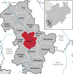
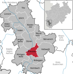
Hürtgenwald (Hürtgenwald)


- municipality in the Düren district, in North Rhine-Westphalia, Germany
 Hiking in Hürtgenwald
Hürtgenwald, located in North Rhine-Westphalia, Germany, is known for its lush forests, rolling hills, and rich history, making it a fantastic destination for hikers. The area is characterized by its dense woodlands and diverse flora and fauna, offering a peaceful environment for outdoor enthusiasts. Here’s what you need to know about hiking in Hürtgenwald:
Trails and Routes
-
Hürtgenwald-Weg: This is a designated hiking trail that takes you through the heart of the Hürtgenwald region. The trail spans approximately 80 kilometers and is marked with signs, making it easy to navigate.
-
Local Circular Hikes: There are various shorter circular routes ranging from beginner to intermediate levels, allowing hikers to explore specific areas of the forest without committing to long treks.
-
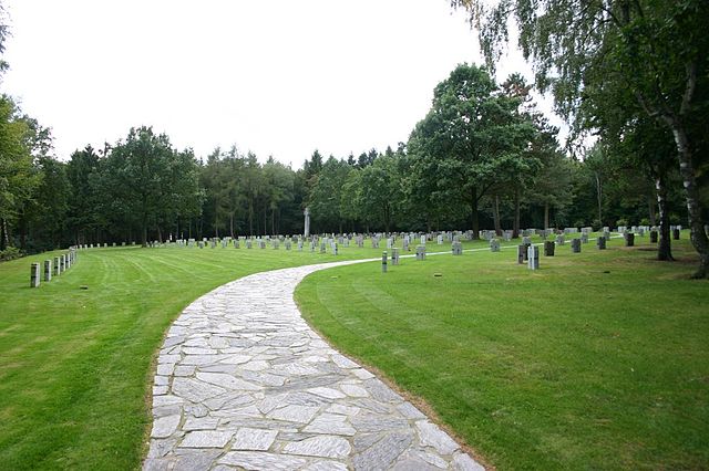
Historical Trails: Many trails incorporate significant historical sites, particularly from World War II, such as remnants of battlefield areas and memorials. This adds an educational aspect to your hike.
Terrain and Difficulty
- The terrain in Hürtgenwald is generally forested with some hilly sections, which can be challenging but is mostly accessible for hikers of various skill levels.
- Beginners may prefer the shorter loop trails, while more experienced hikers can take advantage of the longer routes that may require a moderate level of fitness.
Best Time to Hike
- The best times to hike in Hürtgenwald are during spring (April to June) and autumn (September to October) when the weather is mild and the scenery is particularly beautiful with blooming flowers or colorful fall foliage.
- Summer can be warm, so early morning or late afternoon hikes are recommended. Winter hikes are possible but may require appropriate gear due to snow and ice.
What to Bring
- Sturdy hiking boots or shoes for grip and comfort.
- Weather-appropriate clothing, including layers for variable temperatures.
- A map or GPS device, as well as water and snacks.
- A first-aid kit for emergencies.
Local Facilities
- There are several small villages and towns in the area where you can find accommodations, restaurants, and shops for supplies.
- Some areas have designated picnic spots, adding a nice option for lunchtime breaks during your hike.
Conservation and Respect
- Remember to follow Leave No Trace principles. Keep to designated trails, respect wildlife, and ensure that you take all your trash with you.
Hiking in Hürtgenwald not only offers a chance to immerse yourself in nature but also to explore a region rich in history. Whether you're interested in a leisurely stroll or a more challenging hike, Hürtgenwald provides beautiful scenery and a fulfilling outdoor experience.
- Country:

- Postal Code: 52393
- Local Dialing Code: 02429
- Licence Plate Code: DN
- Coordinates: 50° 43' 0" N, 6° 22' 0" E


- GPS tracks (wikiloc): [Link]
- AboveSeaLevel: 380 м m
- Area: 88.05 sq km
- Population: 8644
- Web site: http://www.huertgenwald.de
- Wikipedia en: wiki(en)
- Wikipedia: wiki(de)
- Wikidata storage: Wikidata: Q199974
- Wikipedia Commons Category: [Link]
- Freebase ID: [/m/0bflxf]
- GeoNames ID: Alt: [6553054]
- VIAF ID: Alt: [137229316]
- OSM relation ID: [163315]
- GND ID: Alt: [4026082-3]
- archINFORM location ID: [43425]
- Library of Congress authority ID: Alt: [n82089237]
- MusicBrainz area ID: [6465eba6-2d99-4138-b51e-ec33c6d34a6e]
- WOEID: [663021]
- Historical Gazetteer (GOV) ID: [HURALDJO30ER]
- National Library of Israel ID: [000993745]
- German municipality key: 05358016
- GNS Unique Feature ID: -1799552
Includes regions:
Schafberg
- human settlement in Germany
Hiking in Schafberg
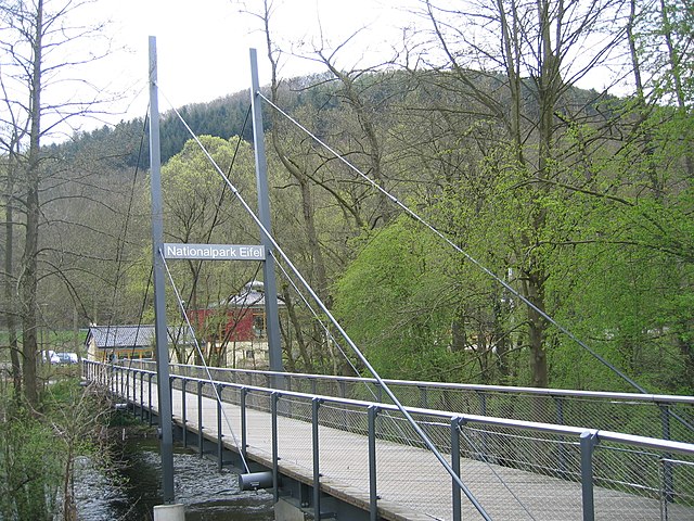
Hiking in the Schafberg area of Hürtgenwald, Germany, offers a beautiful experience characterized by its lush forests, rolling hills, and historical significance. The Hürtgenwald region is part of the Eifel National Park and is known for its diverse landscapes, making it popular among nature lovers and hikers....
- Country:
- Postal Code: 52393
- Local Dialing Code: 02429
- Coordinates: 50° 44' 0" N, 6° 26' 0" E
- GPS tracks (wikiloc): [Link]
- AboveSeaLevel: 310 м m
Simonskall
- human settlement in Germany
Hiking in Simonskall
Simonskall is a picturesque area in the northern part of Germany, located in the state of Schleswig-Holstein, near the border with Denmark. It’s known for its natural beauty, including lush forests, rolling hills, and scenic waterways, making it an ideal location for hiking enthusiasts. Here are some key points about hiking in Simonskall:...
- Country:
- Postal Code: 52393
- Local Dialing Code: 02429
- Coordinates: 50° 40' 0" N, 6° 21' 0" E
- GPS tracks (wikiloc): [Link]
- AboveSeaLevel: 300 м m
- Area: 25.92 sq km
Hürtgen
- human settlement in Germany
Hiking in Hürtgen
Hürtgen, located in the Eifel region of Germany, is known for its beautiful landscapes, lush forests, and historical significance. It offers a variety of hiking opportunities that cater to different skill levels, making it an excellent destination for outdoor enthusiasts....
- Country:
- Postal Code: 52393
- Local Dialing Code: 02429
- Coordinates: 50° 42' 37" N, 6° 22' 32" E
- GPS tracks (wikiloc): [Link]
- AboveSeaLevel: 388 м m
- Area: 13.41 sq km
Raffelsbrand
- human settlement in Germany
Hiking in Raffelsbrand
Raffelsbrand is not widely known as a specific hiking destination, so it may refer to a regional trail or an area within a larger hiking network. If you are referring to a particular local trail or mountain, I recommend checking with local hiking clubs, visitor centers, or park services for the most accurate and up-to-date information....
- Country:
- Postal Code: 52393
- Local Dialing Code: 02429
- Coordinates: 50° 42' 0" N, 6° 19' 0" E
- GPS tracks (wikiloc): [Link]
- AboveSeaLevel: 500 м m
- Area: 1.66 sq km
Großhau
- human settlement in Germany
Hiking in Großhau
Großhau, located in Germany, offers a wonderful environment for hiking enthusiasts. The area features diverse landscapes, including lush forests, rolling hills, and scenic meadows. While it may not be as well-known as some of Germany's highlighted hiking destinations, it still offers a variety of trails suitable for various levels of hikers....
- Country:
- Postal Code: 52393
- Local Dialing Code: 02429
- Coordinates: 50° 44' 3" N, 6° 23' 25" E
- GPS tracks (wikiloc): [Link]
- AboveSeaLevel: 374 м m
- Population: 549

Gey
- human settlement in Germany
Hiking in Gey
Hiking in Gey, particularly focusing on Geyser region areas such as Geysir in Iceland, offers unique landscapes and experiences. The iconic Geysir area is known for its geothermal activity, featuring various hot springs and geysers. Here are some highlights and tips for hiking in this region:...
- Country:
- Postal Code: 52393
- Local Dialing Code: 02429
- Coordinates: 50° 44' 58" N, 6° 25' 8" E
- GPS tracks (wikiloc): [Link]
- AboveSeaLevel: 233 м m
- Area: 11.61 sq km
Horm
- human settlement in Germany
Hiking in Horm
Hiking in Horm, which is located in the northern part of Iran near the Caspian Sea, offers a unique experience due to its diverse landscapes, rich flora and fauna, and cultural insights. The region boasts lush forests, mountainous terrain, and scenic views, making it an appealing destination for hiking enthusiasts....
- Country:
- Postal Code: 52393
- Local Dialing Code: 02429
- Coordinates: 50° 44' 49" N, 6° 26' 20" E
- GPS tracks (wikiloc): [Link]
- AboveSeaLevel: 215 м m
Kleinhau
- borough of Hürtgenwald, Germany
Hiking in Kleinhau
Kleinhau is a small village located in the region of North Rhine-Westphalia, Germany, and it is surrounded by scenic landscapes that are great for hiking. While it may not be as well-known as larger hiking destinations, the area offers charming trails showcasing the natural beauty of the surrounding countryside, including forests, rivers, and hills....
- Country:
- Postal Code: 52393
- Local Dialing Code: 02429
- Coordinates: 50° 43' 23" N, 6° 23' 38" E
- GPS tracks (wikiloc): [Link]
- AboveSeaLevel: 398 м m
Zerkall
- district of Hürtgenwald
Hiking in Zerkall
Zerkall, located in Germany, is known for its picturesque landscapes and outdoor recreational opportunities, making it a great destination for hiking enthusiasts. The region is characterized by its beautiful river valleys, dense forests, and scenic hills, providing a variety of trails suitable for different skill levels....
- Country:
- Postal Code: 52393
- Local Dialing Code: 02427
- Coordinates: 50° 41' 31" N, 6° 27' 4" E
- GPS tracks (wikiloc): [Link]
- AboveSeaLevel: 179 м m
- Area: 6.72 sq km
Straß
- human settlement in Germany
Hiking in Straß
Straß, located in the Hürtgenwald region of Germany, is a great destination for hiking enthusiasts. The Hürtgenwald itself is known for its dense forests, scenic landscapes, and historical significance, particularly from World War II. Here are some aspects to consider when hiking in this area:...
- Country:
- Postal Code: 52393
- Local Dialing Code: 02429
- Coordinates: 50° 44' 28" N, 6° 25' 48" E
- GPS tracks (wikiloc): [Link]
- AboveSeaLevel: 248 м m
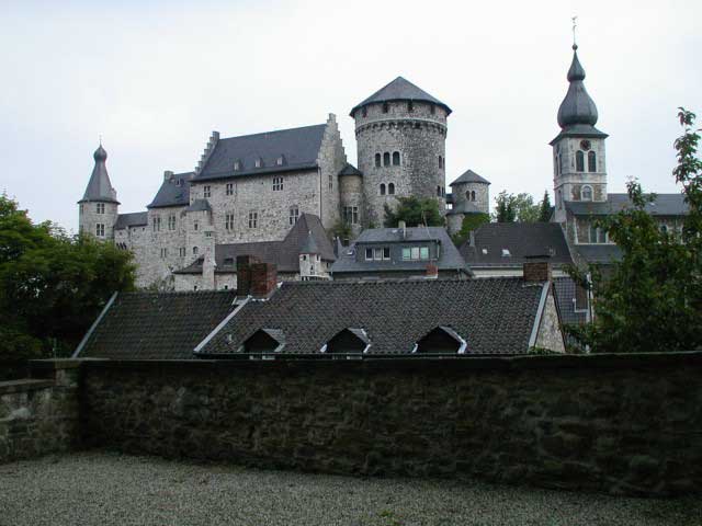
Bergstein
- ortsteil in Hürtgenwald, Germany
Hiking in Bergstein
Bergstein is a picturesque village located in the Hürtgenwald region of Germany, known for its stunning natural landscapes, rich history, and diverse hiking opportunities. Here’s an overview of what you can expect while hiking in this area:...
- Country:
- Postal Code: 52393
- Local Dialing Code: 02429
- Coordinates: 50° 41' 38" N, 6° 25' 54" E
- GPS tracks (wikiloc): [Link]
- AboveSeaLevel: 356 м m
Brandenberg (Hürtgenwald)
- human settlement in Germany
Hiking in Brandenberg (Hürtgenwald)
Hiking in the Brandenberg area of Hürtgenwald offers a unique experience set amidst beautiful woodlands and historical significance. Here are some key points about hiking in this region:...
- Country:
- Postal Code: 52393
- Local Dialing Code: 02429
- Coordinates: 50° 42' 3" N, 6° 24' 45" E
- GPS tracks (wikiloc): [Link]
- AboveSeaLevel: 370 м m
Vossenack
- district of Hürtgenwald
Hiking in Vossenack
Vossenack is a charming village located in the North Rhine-Westphalia region of Germany, specifically in the Eifel area. The region is known for its beautiful natural landscapes, making it a fantastic destination for hiking enthusiasts....
- Country:
- Postal Code: 52393
- Local Dialing Code: 02429
- Coordinates: 50° 41' 7" N, 6° 22' 26" E
- GPS tracks (wikiloc): [Link]
- AboveSeaLevel: 414 м m
- Area: 25.92 sq km
Shares border with regions:
Düren
- town in the Düren district, in North Rhine-Westphalia, Germany
Hiking in Düren
Düren, a town in North Rhine-Westphalia, Germany, offers several hiking opportunities that allow you to explore the surrounding landscape and enjoy nature. Here’s an overview of what you can expect when hiking in and around Düren:...
- Country:
- Postal Code: 52355; 52353; 52349; 52351
- Local Dialing Code: 02421
- Licence Plate Code: DN
- Coordinates: 50° 48' 0" N, 6° 29' 0" E
- GPS tracks (wikiloc): [Link]
- AboveSeaLevel: 125 м m
- Area: 85 sq km
- Population: 90502
- Web site: [Link]

Kreuzau
- municipality in the Düren district, in North Rhine-Westphalia, Germany
Hiking in Kreuzau
Kreuzau, located in Germany’s North Rhine-Westphalia region, offers a variety of outdoor activities, including hiking. While it may not be as widely known for hiking as some larger national parks, it does have beautiful landscapes and scenic routes that nature enthusiasts can enjoy. Here are some key points to consider for hiking in and around Kreuzau:...
- Country:
- Postal Code: 52372
- Local Dialing Code: 02427; 02422; 02421
- Licence Plate Code: DN
- Coordinates: 50° 44' 49" N, 6° 29' 26" E
- GPS tracks (wikiloc): [Link]
- AboveSeaLevel: 148 м m
- Area: 41.77 sq km
- Population: 17582
- Web site: [Link]


Langerwehe
- municipality in the Düren district, in North Rhine-Westphalia, Germany
Hiking in Langerwehe
Langerwehe is a small town located in North Rhine-Westphalia, Germany, nestled in the picturesque area of the Rureifel region. While it might not be as well-known as larger hiking destinations, it offers several enjoyable trails that are suitable for different skill levels....
- Country:
- Postal Code: 52379
- Local Dialing Code: 02423
- Licence Plate Code: DN
- Coordinates: 50° 49' 0" N, 6° 20' 59" E
- GPS tracks (wikiloc): [Link]
- AboveSeaLevel: 158 м m
- Area: 41.49 sq km
- Population: 13986
- Web site: [Link]


Nideggen
- town in the Düren district, in North Rhine-Westphalia, Germany
Hiking in Nideggen
Nideggen, located in the North Rhine-Westphalia region of Germany, is a beautiful area for hiking enthusiasts, offering a mix of picturesque landscapes, historical sites, and well-maintained trails. Here are some highlights and tips for hiking in and around Nideggen:...
- Country:
- Postal Code: 52385
- Local Dialing Code: 02474; 02427; 02425
- Licence Plate Code: DN
- Coordinates: 50° 42' 0" N, 6° 29' 0" E
- GPS tracks (wikiloc): [Link]
- AboveSeaLevel: 312 м m
- Area: 65.04 sq km
- Population: 9855
- Web site: [Link]


Simmerath
- municipality in the district of Aachen, in North Rhine-Westphalia, Germany
Hiking in Simmerath
Simmerath is a picturesque town located in the Eifel region of Germany, known for its stunning landscapes and rich natural beauty, making it an excellent destination for hiking enthusiasts. Here are some highlights regarding hiking in and around Simmerath:...
- Country:
- Postal Code: 52152
- Local Dialing Code: 02473
- Licence Plate Code: AC
- Coordinates: 50° 36' 0" N, 6° 17' 59" E
- GPS tracks (wikiloc): [Link]
- AboveSeaLevel: 280 м m
- Area: 110.92 sq km
- Population: 15094
- Web site: [Link]

Stolberg
- city in the district of Aachen, in North Rhine-Westphalia, Germany
Hiking in Stolberg
Stolberg is located in the Rhineland region of Germany and is surrounded by beautiful landscapes that are perfect for hiking enthusiasts. Here are some highlights and tips for hiking in and around Stolberg:...
- Country:
- Postal Code: 52224; 52223; 52222
- Local Dialing Code: 02409; 02408; 02402
- Licence Plate Code: AC
- Coordinates: 50° 46' 0" N, 6° 14' 0" E
- GPS tracks (wikiloc): [Link]
- AboveSeaLevel: 260 м m
- Area: 98.48 sq km
- Population: 56751
- Web site: [Link]