
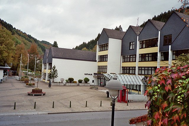
Hagen (Hagen)


- German city in North Rhine-Westphalia
 Hiking in Hagen
Hagen, located in North Rhine-Westphalia, Germany, offers a variety of hiking opportunities that showcase the area's natural beauty and diverse landscapes. Here are some highlights and tips for hiking in and around Hagen:
Trails and Natural Areas
-
Hagen's Hiking Trails: The Stadtwald Hagen (City Forest Hagen) boasts numerous trails that cater to different skill levels. The forest is lush and features a mix of coniferous and deciduous trees, making it a peaceful spot for hiking.
-
Sauerland Region: Hagen serves as a gateway to the Sauerland region, known for its stunning hills, valleys, and lakes. One popular destination is the Rothaarsteig, a long-distance hiking trail that runs through the Sauerland, offering breathtaking views and diverse flora and fauna.
-
Lennetal Valley: The Lennetal Valley provides scenic routes along the Lenne River. These trails often lead to picturesque spots and tranquil areas ideal for wildlife observation.
-
Hiking in the Ennepe-Ruhr Area: Nearby, the Ennepe-Ruhr region offers several hiking trails that connect to cultural attractions, making it a great choice for those interested in both nature and history.
Tips for Hiking in Hagen
-
Trail Maps: Make use of local maps and guides to familiarize yourself with the trails. The local tourist information center can provide valuable resources.
-
Weather Preparedness: Always check the weather before heading out, as conditions can change rapidly. Dress in layers and ensure you have waterproof gear in case of rain.
-
Footwear: Wear appropriate hiking shoes or boots that provide good support and traction, especially if you are exploring more rugged areas.
-
Hydration and Snacks: Bring plenty of water and some snacks. There are often limited amenities along the trails, especially in more remote areas.
-
Wildlife Awareness: Keep an eye out for local wildlife, including various bird species and possibly deer. Respect their habitats and maintain a safe distance.
-
Safety First: Always hike with a buddy or inform someone of your route and expected return time. Mobile reception can be spotty in remote areas.
Conclusion
Hiking in Hagen provides an excellent opportunity to explore a mix of urban and natural environments. With its abundant trails, beautiful scenery, and proximity to the Sauerland region, it’s a great destination for both novice and experienced hikers.
- Country:

- Postal Code: 58000–58135
- Local Dialing Code: 02331; 02304; 02337; 02334
- Licence Plate Code: HA
- Coordinates: 51° 21' 34" N, 7° 28' 30" E


- GPS tracks (wikiloc): [Link]
- AboveSeaLevel: 106 м m
- Area: 160.45 sq km
- Population: 188266
- Web site: https://www.hagen.de/
- Wikipedia en: wiki(en)
- Wikipedia: wiki(de)
- Wikidata storage: Wikidata: Q2871
- Wikipedia Commons Gallery: [Link]
- Wikipedia Commons Category: [Link]
- Freebase ID: [/m/018fpt]
- GeoNames ID: Alt: [2912621]
- VIAF ID: Alt: [143053076]
- OSM relation ID: [1800297]
- GND ID: Alt: [4022917-8]
- archINFORM location ID: [397]
- Library of Congress authority ID: Alt: [n79046412]
- MusicBrainz area ID: [16aea25a-b6a8-4011-a6d4-5bc0776a233b]
- Quora topic ID: [Hagen-Germany]
- Encyclopædia Britannica Online ID: [place/Hagen-Germany]
- Twitter username: Alt: [hagen_westfalen]
- National Library of Israel ID: [000975214]
- NUTS code: [DEA53]
- Facebook ID: Alt: [Hagen.Westfalen]
- Instagram username: [hagen_westfalen]
- German municipality key: 05914000
- GNS Unique Feature ID: 115698
- German district key: 05914
Shares border with regions:


Ennepe-Ruhr-Kreis
- district in North Rhine-Westphalia, Germany
Hiking in Ennepe-Ruhr-Kreis
Ennepe-Ruhr-Kreis, located in North Rhine-Westphalia, Germany, is an excellent destination for hiking enthusiasts. The region is characterized by its diverse landscapes, which include forests, hills, and scenic views of the Ruhr area. Here are some key points to consider when hiking in this region:...
- Country:
- Capital: Schwelm
- Licence Plate Code: WIT; EN
- Coordinates: 51° 21' 5" N, 7° 18' 26" E
- GPS tracks (wikiloc): [Link]
- AboveSeaLevel: 226 м m
- Area: 408.44 sq km
- Population: 322731
- Web site: [Link]


Wetter (Ruhr)
- town in the district of Ennepe-Ruhr-Kreis, in North Rhine-Westphalia, Germany
Hiking in Wetter (Ruhr)
Wetter (Ruhr) is a charming municipality located in the North Rhine-Westphalia region of Germany, offering a variety of outdoor recreation opportunities, including hiking. Nestled in the Ruhr area, it features scenic landscapes that appeal to outdoor enthusiasts. Here are some key points about hiking in Wetter (Ruhr):...
- Country:
- Postal Code: 58300
- Local Dialing Code: 02335
- Licence Plate Code: EN
- Coordinates: 51° 23' 17" N, 7° 23' 42" E
- GPS tracks (wikiloc): [Link]
- AboveSeaLevel: 110 м m
- Area: 31.47 sq km
- Population: 27628
- Web site: [Link]


Dortmund
- town in North Rhine-Westphalia, Germany
Hiking in Dortmund
Dortmund, located in the North Rhine-Westphalia region of Germany, is not only known for its industrial heritage but also offers various opportunities for hiking and enjoying nature. Here are some highlights and tips for hiking in Dortmund:...
- Country:
- Postal Code: 44135–44388
- Local Dialing Code: 02304; 0231
- Licence Plate Code: DO
- Coordinates: 51° 30' 50" N, 7° 27' 55" E
- GPS tracks (wikiloc): [Link]
- AboveSeaLevel: 86 м m
- Area: 280.71 sq km
- Population: 585813
- Web site: [Link]

Schalksmühle
- Municipality in North-Rhine Westfalia, Germany
Hiking in Schalksmühle
Schalksmühle is a scenic municipality located in North Rhine-Westphalia, Germany, known for its beautiful natural landscapes and outdoor activities, including hiking. Here are some highlights and tips for hiking in Schalksmühle:...
- Country:
- Postal Code: 58579
- Local Dialing Code: 02355; 02351; 02337
- Licence Plate Code: MK
- Coordinates: 51° 14' 0" N, 7° 32' 0" E
- GPS tracks (wikiloc): [Link]
- AboveSeaLevel: 250 м m
- Area: 38.2 sq km
- Population: 10388
- Web site: [Link]
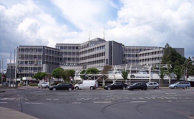

Märkischer Kreis
- district in central North Rhine-Westphalia, Germany
Hiking in Märkischer Kreis
Märkischer Kreis, located in North Rhine-Westphalia, Germany, is a beautiful region for hiking enthusiasts. It offers a blend of natural landscapes, charming small towns, and cultural heritage. Here are some highlights and things to know about hiking in this area:...
- Country:
- Capital: Lüdenscheid
- Licence Plate Code: MK
- Coordinates: 51° 13' 30" N, 7° 36' 52" E
- GPS tracks (wikiloc): [Link]
- AboveSeaLevel: 186 м m
- Area: 1058.95 sq km
- Population: 416171
- Web site: [Link]


Unna
- district in North Rhine-Westphalia, Germany
Hiking in Unna
Unna is a district located in North Rhine-Westphalia, Germany, known for its beautiful landscapes and diverse recreational opportunities, including hiking. The region attracts outdoors enthusiasts due to its varied terrains, which can range from gentle hills to river valleys and forests....
- Country:
- Capital: Unna
- Licence Plate Code: UN
- Coordinates: 51° 34' 48" N, 7° 40' 12" E
- GPS tracks (wikiloc): [Link]
- AboveSeaLevel: 70 м m
- Web site: [Link]