Le Subdray (Le Subdray)

- commune in Cher, France
- Country:

- Postal Code: 18570
- Coordinates: 47° 0' 39" N, 2° 17' 40" E


- GPS tracks (wikiloc): [Link]
- Area: 20.28 sq km
- Population: 945
- Wikipedia en: wiki(en)
- Wikipedia: wiki(fr)
- Wikidata storage: Wikidata: Q1415741
- Wikipedia Commons Category: [Link]
- Freebase ID: [/m/03mff99]
- GeoNames ID: Alt: [6455656]
- SIREN number: [211802558]
- BnF ID: [152496016]
- Library of Congress authority ID: Alt: [no2001070248]
- PACTOLS thesaurus ID: [pcrthVDES0jTOV]
- INSEE municipality code: 18255
Shares border with regions:

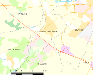
La Chapelle-Saint-Ursin
- commune in Cher, France
- Country:
- Postal Code: 18570
- Coordinates: 47° 3' 45" N, 2° 19' 30" E
- GPS tracks (wikiloc): [Link]
- Area: 7.83 sq km
- Population: 3407


Saint-Florent-sur-Cher
- commune in Cher, France
- Country:
- Postal Code: 18400
- Coordinates: 46° 59' 44" N, 2° 15' 6" E
- GPS tracks (wikiloc): [Link]
- Area: 22.41 sq km
- Population: 6671
Morthomiers
- commune in Cher, France
- Country:
- Postal Code: 18570
- Coordinates: 47° 2' 13" N, 2° 16' 36" E
- GPS tracks (wikiloc): [Link]
- Area: 14.54 sq km
- Population: 758
- Web site: [Link]

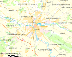
Bourges
- commune in Cher, France
- Country:
- Postal Code: 18000
- Coordinates: 47° 5' 1" N, 2° 23' 44" E
- GPS tracks (wikiloc): [Link]
- AboveSeaLevel: 153 м m
- Area: 68.74 sq km
- Population: 66071
- Web site: [Link]
Saint-Caprais
- commune in Cher, France
- Country:
- Postal Code: 18400
- Coordinates: 46° 58' 6" N, 2° 17' 36" E
- GPS tracks (wikiloc): [Link]
- Area: 14.42 sq km
- Population: 772

Trouy
- commune in Cher, France
- Country:
- Postal Code: 18570
- Coordinates: 47° 0' 37" N, 2° 21' 28" E
- GPS tracks (wikiloc): [Link]
- Area: 23.19 sq km
- Population: 3942
- Web site: [Link]

Arçay
- commune in Cher, France
- Country:
- Postal Code: 18340
- Coordinates: 46° 56' 54" N, 2° 20' 25" E
- GPS tracks (wikiloc): [Link]
- Area: 18.32 sq km
- Population: 516