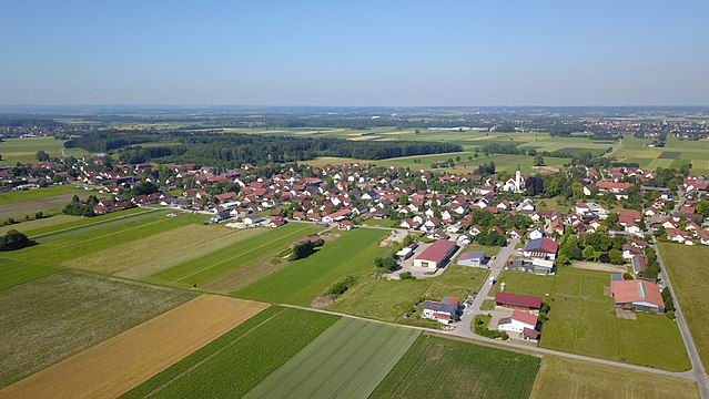
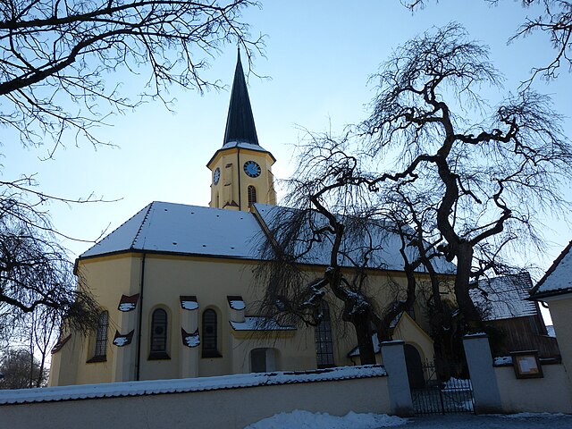
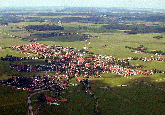
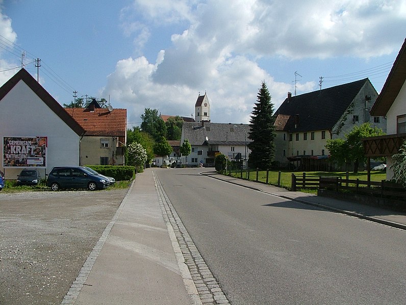
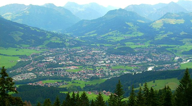
Unterallgäu (Landkreis Unterallgäu)

- district in Bavaria, Germany
 Hiking in Unterallgäu
Unterallgäu is a beautiful region in Bavaria, Germany, known for its picturesque landscapes, charming villages, and extensive hiking trails. Located in the Allgäu, it's characterized by rolling hills, lush meadows, and stunning views of the Alpine foothills. Here are some highlights if you're considering hiking in Unterallgäu:
Trail Variety
-
Scenic Trails: The region offers a wide range of hiking trails suitable for all skill levels, from easy walks to more challenging routes. Many trails provide panoramic views of the Alps and lush valleys.
-
Theme Trails: You can find themed hiking trails that focus on local history, culture, or nature. For instance, the "Rundweg Mindelheim" takes you through historical sites in the charming town of Mindelheim.
-
Long-Distance Trails: For avid hikers, routes like the Via Claudia Augusta pass through this region, presenting a great opportunity for multi-day treks connecting historical sites.
Nature and Landscape
-
Natural Parks: Unterallgäu is close to several natural parks, providing varied ecosystems and abundant wildlife. The Naturpark Augsburg – Westliche Wälder is a nearby highlight.
-
Lakes and Rivers: The area boasts beautiful lakes, such as the Mindelsee, ideal for relaxing after a hike, as well as rivers perfect for picturesque routes.
Local Culture
-
Villages and Towns: Hiking can be combined with visits to quaint villages such as Bad Wörishofen, famous for its spa culture. The area is rich in traditional Bavarian architecture and local cuisine.
-
Culinary Stops: Enjoy traditional Bavarian food and hospitality at local inns and restaurants along the trails. This could include regional specialties like cheese, pretzels, and hearty soups.
Best time to hike
- The best time for hiking in Unterallgäu is typically from late spring to early autumn (May to October), when the weather is pleasant, and the landscapes are vibrant with greenery and wildflowers.
Tips for Hiking
-
Maps and Guides: Always carry a map or download a hiking app with routes. Local tourist information centers can provide maps and current trail conditions.
-
Gear: Wear proper hiking shoes and dress in layers, as mountain weather can change quickly. Don’t forget essentials like water, snacks, and a first-aid kit.
-
Respect Nature: Follow the "Leave No Trace" principles to help preserve the natural beauty of the area.
Unterallgäu offers a delightful hiking experience blending nature, culture, and history. Whether you're a beginner or an experienced hiker, you'll find something to enjoy in this stunning Bavarian region.
- Country:

- Capital: Mindelheim
- Licence Plate Code: MN
- Coordinates: 48° 0' 0" N, 10° 30' 0" E


- GPS tracks (wikiloc): [Link]
- Area: 1230.24 sq km
- Population: 115770
- Web site: http://www.unterallgaeu.de/
- Wikipedia en: wiki(en)
- Wikipedia: wiki(de)
- Wikidata storage: Wikidata: Q10408
- Wikipedia Commons Category: [Link]
- Freebase ID: [/m/02hvr4]
- GeoNames ID: Alt: [3220889]
- VIAF ID: Alt: [245679464]
- OSM relation ID: [62398]
- GND ID: Alt: [4107431-2]
- archINFORM location ID: [3373]
- TGN ID: [7077082]
- Bavarikon ID: [ODB_A00000769]
- NUTS code: [DE27C]
- German district key: 09778
Includes regions:

Egg an der Günz
- municipality of Germany
Hiking in Egg an der Günz
Egg an der Günz is a charming village located in Bavaria, Germany, and it offers several opportunities for hiking enthusiasts. The surrounding countryside is characterized by picturesque landscapes, rolling hills, and serene nature, making it a great destination for hiking....
- Country:
- Postal Code: 87743
- Local Dialing Code: 08333
- Licence Plate Code: MN
- Coordinates: 48° 5' 0" N, 10° 17' 0" E
- GPS tracks (wikiloc): [Link]
- AboveSeaLevel: 586 м m
- Area: 20.71 sq km
- Population: 938
- Web site: [Link]
Ungerhauser Wald
- unincorporated area in Germany
Hiking in Ungerhauser Wald
Ungerhauser Wald, located in Germany, is a beautiful forested area known for its scenic hiking trails and natural beauty. Here are some key points to consider when planning a hiking trip in this region:...
- Country:
- Coordinates: 47° 59' 58" N, 10° 17' 13" E
- GPS tracks (wikiloc): [Link]

Apfeltrach
- municipality of Germany
Hiking in Apfeltrach
Apfeltrach is a small village located in Bavaria, Germany, which is known for its scenic landscapes and charming rural atmosphere. Hiking in and around Apfeltrach can be quite enjoyable, especially for those who appreciate the beauty of the Bavarian countryside....
- Country:
- Postal Code: 87742
- Local Dialing Code: 08261
- Licence Plate Code: MN
- Coordinates: 48° 1' 0" N, 10° 30' 0" E
- GPS tracks (wikiloc): [Link]
- AboveSeaLevel: 620 м m
- Area: 15.03 sq km
- Population: 842
- Web site: [Link]

Winterrieden
- municipality of Germany
Hiking in Winterrieden
Winterrieden, a lovely area likely located in Bavaria, Germany, offers great hiking opportunities, especially for those who enjoy natural landscapes and tranquil environments. While the specific trails and conditions can vary depending on the time of year and local weather, here’s some general information about hiking in that region:...
- Country:
- Postal Code: 87785
- Local Dialing Code: 08333
- Licence Plate Code: MN
- Coordinates: 48° 7' 0" N, 10° 13' 0" E
- GPS tracks (wikiloc): [Link]
- AboveSeaLevel: 575 м m
- Area: 9.79 sq km
- Population: 706
- Web site: [Link]
Amberg
- municipality of Germany
Hiking in Amberg
Amberg, located in Swabia, Bavaria, Germany, is a charming town that offers a variety of hiking opportunities. The surrounding landscape is characterized by picturesque hills, forests, and meadows, making it an attractive destination for outdoor enthusiasts. Here are some highlights about hiking in and around Amberg:...
- Country:
- Postal Code: 86854
- Local Dialing Code: 08241
- Licence Plate Code: MN
- Coordinates: 48° 4' 0" N, 10° 41' 0" E
- GPS tracks (wikiloc): [Link]
- AboveSeaLevel: 599 м m
- Area: 10.95 sq km
- Population: 994
- Web site: [Link]

Bad Wörishofen
- town in Germany
Hiking in Bad Wörishofen
Bad Wörishofen, located in Bavaria, Germany, is well known for its beautiful landscapes and wellness offerings. It’s a great place for hiking enthusiasts, offering a range of trails that showcase the picturesque scenery of the Allgäu region....
- Country:
- Postal Code: 86825
- Local Dialing Code: 08247
- Licence Plate Code: MN
- Coordinates: 48° 0' 21" N, 10° 35' 49" E
- GPS tracks (wikiloc): [Link]
- AboveSeaLevel: 625 м m
- Area: 57.80 sq km
- Population: 15922
- Web site: [Link]

Mindelheim
- municipality of Germany
Hiking in Mindelheim
Mindelheim, located in Bavaria, Germany, is a picturesque town surrounded by beautiful landscapes, making it a great base for hiking enthusiasts. Here are some key points to consider if you're planning a hiking trip in and around Mindelheim:...
- Country:
- Postal Code: 87711–87719
- Local Dialing Code: 08261
- Licence Plate Code: MN
- Coordinates: 48° 2' 0" N, 10° 28' 0" E
- GPS tracks (wikiloc): [Link]
- AboveSeaLevel: 607 м m
- Area: 56.44 sq km
- Population: 11849
- Web site: [Link]

Markt Rettenbach
- municipality of Germany
Hiking in Markt Rettenbach
Markt Rettenbach, located in the Bavarian region of Germany, is a charming area for hiking enthusiasts. Surrounded by picturesque landscapes, rolling hills, and lush greenery, this area offers numerous trails suitable for various skill levels. Here’s what you can expect when hiking in Markt Rettenbach:...
- Country:
- Postal Code: 87733
- Local Dialing Code: 08392
- Licence Plate Code: MN
- Coordinates: 48° 8' 0" N, 10° 35' 0" E
- GPS tracks (wikiloc): [Link]
- AboveSeaLevel: 679 м m
- Area: 51.45 sq km
- Population: 3282
- Web site: [Link]

Hawangen
- municipality of Germany
Hiking in Hawangen
Hawangen is a charming village located in Bavaria, Germany, and while it may not be as widely known as some other hiking destinations, it offers picturesque landscapes and trails suitable for nature enthusiasts. Here are some key points about hiking in Hawangen and its surrounding areas:...
- Country:
- Postal Code: 87749
- Local Dialing Code: 08332
- Licence Plate Code: MN
- Coordinates: 47° 58' 0" N, 10° 16' 0" E
- GPS tracks (wikiloc): [Link]
- AboveSeaLevel: 637 м m
- Area: 14.50 sq km
- Population: 1019
- Web site: [Link]

Ottobeuren
- municipality of Germany
Hiking in Ottobeuren
Ottobeuren, located in Bavaria, Germany, offers beautiful hiking opportunities surrounded by picturesque landscapes, rolling hills, and lush forests. This area is characterized by its scenic views and serene environment, making it a great destination for hikers of all levels....
- Country:
- Postal Code: 87724
- Local Dialing Code: 08332
- Licence Plate Code: MN
- Coordinates: 47° 56' 29" N, 10° 17' 58" E
- GPS tracks (wikiloc): [Link]
- AboveSeaLevel: 660 м m
- Area: 55.85 sq km
- Population: 7317
- Web site: [Link]

Lachen
- municipality in the district of Unterallgäu in Bavaria
Hiking in Lachen
Lachen, located in Bavaria, Germany, is known for its beautiful landscapes and excellent hiking opportunities. Nestled near the shores of the picturesque Lake Tegernsee, Lachen is surrounded by the stunning Bavarian Alps, making it a great destination for outdoor enthusiasts....
- Country:
- Postal Code: 87760
- Local Dialing Code: 08332; 08331
- Licence Plate Code: MN
- Coordinates: 47° 57' 0" N, 10° 14' 0" E
- GPS tracks (wikiloc): [Link]
- AboveSeaLevel: 412 м m
- Area: 13.34 sq km
- Population: 1116
- Web site: [Link]

Fellheim
- municipality of Germany
Hiking in Fellheim
Fellheim is a beautiful area located in Germany, specifically in the Bavarian region, known for its scenic landscapes and outdoor activities, including hiking. While it may not be as widely recognized as some of the more famous hiking destinations in the Alps, it offers a unique experience for outdoor enthusiasts. Here are some key points about hiking in Fellheim:...
- Country:
- Postal Code: 87748
- Local Dialing Code: 08335
- Licence Plate Code: MN
- Coordinates: 48° 5' 0" N, 10° 9' 0" E
- GPS tracks (wikiloc): [Link]
- AboveSeaLevel: 566 м m
- Area: 5.08 sq km
- Population: 772
- Web site: [Link]

Unteregg
- municipality of Germany
Hiking in Unteregg
Unteregg, located in Bavaria, Germany, is a charming area that offers beautiful landscapes for hiking enthusiasts. The region is characterized by rolling hills, lush forests, and picturesque meadows, making it a great place for both novice and experienced hikers....
- Country:
- Postal Code: 87782
- Local Dialing Code: 08269
- Licence Plate Code: MN
- Coordinates: 47° 58' 0" N, 10° 28' 0" E
- GPS tracks (wikiloc): [Link]
- AboveSeaLevel: 717 м m
- Area: 23.70 sq km
- Population: 1218
- Web site: [Link]

Salgen
- municipality of Germany
Hiking in Salgen
Salgen is a quaint village located in the Swabian region of Bavaria, Germany. It’s surrounded by picturesque landscapes, making it a great destination for hiking enthusiasts. The area offers a variety of trails suitable for different skill levels, from leisurely walks to more challenging hikes....
- Country:
- Postal Code: 87775
- Local Dialing Code: 08265
- Licence Plate Code: MN
- Coordinates: 48° 8' 0" N, 10° 29' 0" E
- GPS tracks (wikiloc): [Link]
- AboveSeaLevel: 558 м m
- Area: 23.30 sq km
- Population: 1227
- Web site: [Link]

Oberschönegg
- municipality of Germany
Hiking in Oberschönegg
Oberschönegg is a picturesque village located in Bavaria, Germany, known for its beautiful landscapes and serene hiking paths. The region is characterized by rolling hills, lush forests, and stunning panoramic views of the surrounding countryside, making it a great destination for hikers of all levels....
- Country:
- Postal Code: 87770
- Local Dialing Code: 08333
- Licence Plate Code: MN
- Coordinates: 48° 6' 0" N, 10° 18' 0" E
- GPS tracks (wikiloc): [Link]
- AboveSeaLevel: 630 м m
- Area: 18.28 sq km
- Population: 865
- Web site: [Link]

Erkheim
- municipality of Germany
Hiking in Erkheim
Erkheim is a municipality located in Bavaria, Germany, which is more known for its charming landscapes and proximity to the Allgäu region rather than being a prominent hiking destination. However, there are several aspects that could make hiking in and around Erkheim enjoyable....
- Country:
- Postal Code: 87746
- Local Dialing Code: 08336
- Licence Plate Code: MN
- Coordinates: 48° 3' 0" N, 10° 21' 0" E
- GPS tracks (wikiloc): [Link]
- AboveSeaLevel: 595 м m
- Area: 32.18 sq km
- Population: 2560
- Web site: [Link]

Benningen
- municipality of Germany
Hiking in Benningen
Benningen is a charming village located in Baden-Württemberg, Germany, known for its picturesque surroundings. While not a major hiking destination like larger national parks, it offers several trails that allow you to enjoy the beautiful countryside and nearby natural areas. Here are some highlights about hiking in and around Benningen:...
- Country:
- Postal Code: 87734
- Local Dialing Code: 08331
- Licence Plate Code: MN
- Coordinates: 47° 58' 0" N, 10° 13' 0" E
- GPS tracks (wikiloc): [Link]
- AboveSeaLevel: 601 м m
- Area: 11.17 sq km
- Population: 1761
- Web site: [Link]

Pfaffenhausen
- municipality of Germany
Hiking in Pfaffenhausen
Pfaffenhausen is a small town located in Bavaria, Germany, known for its scenic views and charming countryside. When hiking in and around Pfaffenhausen, you can expect a mix of beautiful landscapes, including fields, forests, and rolling hills, which are characteristic of this region....
- Country:
- Postal Code: 87772
- Local Dialing Code: 08265
- Licence Plate Code: MN
- Coordinates: 48° 7' 0" N, 10° 27' 0" E
- GPS tracks (wikiloc): [Link]
- AboveSeaLevel: 563 м m
- Area: 21.11 sq km
- Population: 1997
- Web site: [Link]

Tussenhausen
- municipality of Germany
Hiking in Tussenhausen
Tussenhausen is a small municipality located in Bavaria, Germany, surrounded by beautiful landscapes and countryside that offer a variety of hiking opportunities. Here are some details to consider if you're planning a hiking trip in the area:...
- Country:
- Postal Code: 86874
- Local Dialing Code: 08268
- Licence Plate Code: MN
- Coordinates: 48° 6' 0" N, 10° 34' 0" E
- GPS tracks (wikiloc): [Link]
- AboveSeaLevel: 575 м m
- Area: 41.75 sq km
- Population: 2360
- Web site: [Link]

Sontheim
- municipality of Germany
Hiking in Sontheim
Sontheim, located in Bavaria, Germany, is surrounded by picturesque landscapes that make it a great destination for hiking enthusiasts. Here are some highlights and tips for hiking in this area:...
- Country:
- Postal Code: 87776
- Local Dialing Code: 08336
- Licence Plate Code: MN
- Coordinates: 48° 0' 0" N, 10° 21' 0" E
- GPS tracks (wikiloc): [Link]
- AboveSeaLevel: 620 м m
- Area: 26.53 sq km
- Population: 2080
- Web site: [Link]

Kronburg
- municipality of Germany
Hiking in Kronburg
Kronburg is a picturesque area that offers a variety of hiking opportunities, making it an excellent destination for both casual walkers and experienced hikers. Nestled in scenic surroundings, it features trails that can range from easy strolls to more challenging hikes, depending on your abilities and interests....
- Country:
- Postal Code: 87758
- Local Dialing Code: 08394
- Licence Plate Code: MN
- Coordinates: 47° 55' 0" N, 10° 10' 0" E
- GPS tracks (wikiloc): [Link]
- AboveSeaLevel: 744 м m
- Area: 20.26 sq km
- Population: 1398
- Web site: [Link]
Memmingerberg
- municipality of Germany
Hiking in Memmingerberg
Memmingerberg, located in Bavaria, Germany, is a charming area that offers great opportunities for hiking enthusiasts. Nestled near the picturesque town of Memmingen, this region boasts beautiful landscapes, lush forests, and panoramic views of the surrounding countryside, including the Allgäu and the foothills of the Alps....
- Country:
- Postal Code: 87766
- Local Dialing Code: 08331
- Licence Plate Code: MN
- Coordinates: 47° 59' 0" N, 10° 13' 0" E
- GPS tracks (wikiloc): [Link]
- AboveSeaLevel: 603 м m
- Area: 6.09 sq km
- Population: 2023
- Web site: [Link]

Niederrieden
- municipality of Germany
Hiking in Niederrieden
Niederrieden, a small municipality in Bavaria, Germany, offers beautiful landscapes and opportunities for hiking enthusiasts. The area is characterized by rolling hills, forests, and agricultural land, providing a peaceful setting for outdoor activities....
- Country:
- Postal Code: 87767
- Local Dialing Code: 08335
- Licence Plate Code: MN
- Coordinates: 48° 3' 0" N, 10° 11' 0" E
- GPS tracks (wikiloc): [Link]
- AboveSeaLevel: 582 м m
- Area: 13.90 sq km
- Population: 1088
- Web site: [Link]

Markt Wald
- municipality of Germany
Hiking in Markt Wald
Markt Wald, located in the Bavaria region of Germany, offers a charming setting for hiking enthusiasts. The area features a mix of gently rolling hills, picturesque forests, and agricultural landscapes, providing a serene environment for outdoor activities. Here are some highlights for hiking in Markt Wald:...
- Country:
- Postal Code: 86865
- Local Dialing Code: 08262
- Licence Plate Code: MN
- Coordinates: 48° 8' 0" N, 10° 35' 0" E
- GPS tracks (wikiloc): [Link]
- AboveSeaLevel: 600 м m
- Area: 30.82 sq km
- Population: 2185
- Web site: [Link]

Wolfertschwenden
- municipality of Germany
Hiking in Wolfertschwenden
Wolfertschwenden is a charming village located in Bavaria, Germany, known for its picturesque countryside and proximity to beautiful hiking trails. The surrounding area offers a variety of routes suitable for all levels of hikers, from casual walks to more challenging trails....
- Country:
- Postal Code: 87787
- Local Dialing Code: 08334
- Licence Plate Code: MN
- Coordinates: 47° 53' 0" N, 10° 16' 0" E
- GPS tracks (wikiloc): [Link]
- AboveSeaLevel: 678 м m
- Area: 14.48 sq km
- Population: 1440
- Web site: [Link]

Böhen
- municipality of Germany
Hiking in Böhen
Böhen is a picturesque area in Germany, known for its scenic landscapes and hiking opportunities. While it may not be as widely recognized as some other hiking destinations, it offers various trails that cater to both novice hikers and experienced outdoor enthusiasts....
- Country:
- Postal Code: 87736
- Local Dialing Code: 08338
- Licence Plate Code: MN
- Coordinates: 47° 53' 0" N, 10° 18' 0" E
- GPS tracks (wikiloc): [Link]
- AboveSeaLevel: 783 м m
- Area: 20.53 sq km
- Population: 731
- Web site: [Link]

Eppishausen
- municipality in Bavaria, Germany
Hiking in Eppishausen
Eppishausen is a small village located in the picturesque Bavaria region of Germany. While it may not be widely recognized as a hiking hotspot, it offers access to some charming walking trails and scenic landscapes typical of the Bavarian countryside....
- Country:
- Postal Code: 87745
- Local Dialing Code: 08266
- Licence Plate Code: MN
- Coordinates: 48° 10' 0" N, 10° 31' 0" E
- GPS tracks (wikiloc): [Link]
- AboveSeaLevel: 550 м m
- Area: 39.50 sq km
- Population: 1816
- Web site: [Link]

Dirlewang
- municipality of Germany
Hiking in Dirlewang
Dirlewang is a small village located in Bavaria, Germany, surrounded by picturesque landscapes that offer a variety of hiking opportunities. The region is characterized by rolling hills, lush forests, and farmland, making it ideal for both casual walkers and more experienced hikers....
- Country:
- Postal Code: 87742
- Local Dialing Code: 08267
- Licence Plate Code: MN
- Coordinates: 48° 0' 0" N, 10° 30' 0" E
- GPS tracks (wikiloc): [Link]
- AboveSeaLevel: 620 м m
- Area: 23.25 sq km
- Population: 1762
- Web site: [Link]

Kirchhaslach
- municipality of Unterallgäu, Bavaria, Germany
Hiking in Kirchhaslach
Kirchhaslach is a lovely area located in the Black Forest region of Germany, known for its picturesque landscapes and well-maintained hiking trails. Here are some details that can help you plan your hiking experience there:...
- Country:
- Postal Code: 87755
- Local Dialing Code: 08333
- Licence Plate Code: MN
- Coordinates: 48° 9' 0" N, 10° 18' 0" E
- GPS tracks (wikiloc): [Link]
- AboveSeaLevel: 550 м m
- Area: 32.04 sq km
- Population: 1157
- Web site: [Link]

Holzgünz
- municipality of Germany
Hiking in Holzgünz
Holzgünz is a picturesque village located in Bavaria, Germany, known for its beautiful landscapes and outdoor opportunities, including hiking. Here are some aspects to consider when hiking in the Holzgünz area:...
- Country:
- Postal Code: 87752
- Local Dialing Code: 08393
- Licence Plate Code: MN
- Coordinates: 48° 1' 0" N, 10° 16' 0" E
- GPS tracks (wikiloc): [Link]
- AboveSeaLevel: 602 м m
- Area: 12.10 sq km
- Population: 914
- Web site: [Link]

Heimertingen
- municipality of Germany
Hiking in Heimertingen
Heimertingen is a small village in Bavaria, Germany, surrounded by beautiful landscapes that are ideal for hiking enthusiasts. While the village itself may not be a major hiking destination, it serves as a great starting point for exploring the diverse trails in the surrounding region....
- Country:
- Postal Code: 87751
- Local Dialing Code: 08335
- Licence Plate Code: MN
- Coordinates: 48° 2' 0" N, 10° 9' 0" E
- GPS tracks (wikiloc): [Link]
- AboveSeaLevel: 579 м m
- Area: 13.88 sq km
- Population: 1406
- Web site: [Link]

Woringen
- municipality of Germany
Hiking in Woringen
Woringen, a district of the city of Memmingen in Bavaria, Germany, offers scenic views and opportunities for hiking enthusiasts. While it may not be as famous as some major hiking destinations, it is surrounded by beautiful landscapes, including lush farmlands and woodlands....
- Country:
- Postal Code: 87789
- Local Dialing Code: 08331
- Licence Plate Code: MN
- Coordinates: 47° 55' 0" N, 10° 12' 0" E
- GPS tracks (wikiloc): [Link]
- AboveSeaLevel: 632 м m
- Area: 17.55 sq km
- Population: 1405
- Web site: [Link]

Trunkelsberg
- municipality of Germany
Hiking in Trunkelsberg
Trunkelsberg is a popular hiking destination located in Germany, particularly known for its beautiful landscapes, scenic views, and well-marked trails. Here’s an overview of what you can expect when hiking in the Trunkelsberg area:...
- Country:
- Postal Code: 87779
- Local Dialing Code: 08331
- Licence Plate Code: MN
- Coordinates: 48° 0' 0" N, 10° 13' 0" E
- GPS tracks (wikiloc): [Link]
- AboveSeaLevel: 625 м m
- Area: 1.94 sq km
- Population: 1400
- Web site: [Link]

Kammlach
- municipality of Germany
Hiking in Kammlach
Kammlach, a small village located in Bavaria, Germany, offers a serene environment and beautiful landscapes for hiking enthusiasts. The area around Kammlach features a mix of flat terrains, mild hills, and scenic views of the Bavarian countryside, making it suitable for hikers of all skill levels....
- Country:
- Postal Code: 87754
- Local Dialing Code: 08261
- Licence Plate Code: MN
- Coordinates: 48° 3' 0" N, 10° 25' 0" E
- GPS tracks (wikiloc): [Link]
- AboveSeaLevel: 600 м m
- Area: 26.73 sq km
- Population: 1483
- Web site: [Link]

Bad Grönenbach
- municipality of Germany in southern Germany
Hiking in Bad Grönenbach
Bad Grönenbach, located in the Allgäu region of Bavaria, Germany, is a charming destination for hiking enthusiasts. The area is characterized by its picturesque landscapes, including rolling hills, lush forests, and scenic views of the Allgäu Alps. Here are some highlights and tips for hiking in and around Bad Grönenbach:...
- Country:
- Postal Code: 87730
- Local Dialing Code: 08334
- Licence Plate Code: MN
- Coordinates: 47° 52' 0" N, 10° 13' 0" E
- GPS tracks (wikiloc): [Link]
- AboveSeaLevel: 718 м m
- Area: 42.03 sq km
- Population: 5528
- Web site: [Link]

Türkheim
- municipality in Bavaria, Germany
Hiking in Türkheim
Türkheim is a quaint town in southern Germany, located in the Bavarian region. While it may not be as well-known as some major hiking destinations, it offers several charming trails and natural areas for outdoor enthusiasts....
- Country:
- Postal Code: 86842
- Local Dialing Code: 08245
- Licence Plate Code: MN
- Coordinates: 48° 4' 0" N, 10° 37' 0" E
- GPS tracks (wikiloc): [Link]
- AboveSeaLevel: 598 м m
- Area: 23.52 sq km
- Population: 5236
- Web site: [Link]

Wiedergeltingen
- municipality of Germany
Hiking in Wiedergeltingen
Wiedergeltingen is a charming village located in Bavaria, Germany, and while it might not be as widely known as some larger hiking destinations, it offers a delightful experience for nature lovers and hikers. The surrounding areas boast scenic landscapes, lush forests, and picturesque countryside, making it a great spot for outdoor activities....
- Country:
- Postal Code: 86879
- Local Dialing Code: 08241
- Licence Plate Code: MN
- Coordinates: 48° 1' 0" N, 10° 40' 0" E
- GPS tracks (wikiloc): [Link]
- AboveSeaLevel: 609 м m
- Area: 11.61 sq km
- Population: 1021
- Web site: [Link]

Pleß
- municipality of Germany
Hiking in Pleß
Pleß is a region located in the foothills of the Alps, often characterized by stunning landscapes, varying terrains, and picturesque vistas. While specific trails and paths can vary depending on the exact area you're referring to, hiking in this region generally offers:...
- Country:
- Postal Code: 87773
- Local Dialing Code: 08335
- Licence Plate Code: MN
- Coordinates: 48° 6' 0" N, 10° 9' 0" E
- GPS tracks (wikiloc): [Link]
- AboveSeaLevel: 558 м m
- Area: 15.38 sq km
- Population: 705
- Web site: [Link]

Oberrieden
- municipality in Germany
Hiking in Oberrieden
Oberrieden, located in Bavaria, Germany, offers a picturesque setting for hiking enthusiasts. Nestled near the foothills of the Alps and close to Lake Starnberg, Oberrieden provides a variety of trails that cater to different skill levels and preferences....
- Country:
- Postal Code: 87769
- Local Dialing Code: 08265
- Licence Plate Code: MN
- Coordinates: 48° 6' 0" N, 10° 26' 0" E
- GPS tracks (wikiloc): [Link]
- AboveSeaLevel: 578 м m
- Area: 20.82 sq km
- Population: 1160
- Web site: [Link]
Legau
- municipality of Germany
Hiking in Legau
Legau is a charming village located in the Bavarian region of Germany, with beautiful landscapes that provide excellent opportunities for hiking enthusiasts. Nestled near the Allgäu region, it offers a mix of picturesque countryside, meadows, and gentle hills, making it suitable for hikers of all levels....
- Country:
- Postal Code: 87764
- Local Dialing Code: 08330
- Licence Plate Code: MN
- Coordinates: 47° 51' 0" N, 10° 8' 0" E
- GPS tracks (wikiloc): [Link]
- AboveSeaLevel: 667 м m
- Area: 36.35 sq km
- Population: 2894
- Web site: [Link]

Rammingen
- municipality of Germany
Hiking in Rammingen
Rammingen, located in the picturesque region of Bavaria, Germany, offers a scenic backdrop for hiking enthusiasts. The area is characterized by its rolling hills, lush forests, and charming countryside, making it a great spot for both casual walkers and more experienced trekkers....
- Country:
- Postal Code: 86871
- Local Dialing Code: 08245
- Licence Plate Code: MN
- Coordinates: 48° 4' 0" N, 10° 35' 0" E
- GPS tracks (wikiloc): [Link]
- AboveSeaLevel: 650 м m
- Area: 19.27 sq km
- Population: 1164
- Web site: [Link]

Ettringen
- municipality in Bavaria, Germany
Hiking in Ettringen
Ettringen, Bavaria, offers beautiful hiking opportunities surrounded by stunning landscapes. Nestled in the foothills of the Alps, this region boasts a mix of rolling hills, forests, and scenic vistas. Here are some highlights you can expect while hiking in and around Ettringen:...
- Country:
- Postal Code: 86833
- Local Dialing Code: 08249
- Licence Plate Code: MN
- Coordinates: 48° 6' 0" N, 10° 39' 0" E
- GPS tracks (wikiloc): [Link]
- AboveSeaLevel: 583 м m
- Area: 41.52 sq km
- Population: 2993
- Web site: [Link]

Westerheim
- municipality in the Unterallgäu district of Bavaria, Germany
Hiking in Westerheim
Westerheim is a quaint village located in Bavaria, Germany, situated amidst the picturesque landscapes of the Swabian Jura. The area is known for its scenic beauty, with rolling hills, dense forests, and limestone formations, making it an excellent destination for hiking enthusiasts....
- Country:
- Postal Code: 87784
- Local Dialing Code: 08336
- Licence Plate Code: MN
- Coordinates: 48° 1' 0" N, 10° 18' 0" E
- GPS tracks (wikiloc): [Link]
- AboveSeaLevel: 602 м m
- Area: 21.17 sq km
- Population: 1679
- Web site: [Link]

Lautrach
- municipality of Germany
Hiking in Lautrach
Lautrach is a charming village located in the Allgäu region of Bavaria, Germany. While it may not be one of the most widely known hiking destinations, it offers a variety of beautiful trails suitable for different skill levels. Here are some key points to consider when hiking in and around Lautrach:...
- Country:
- Postal Code: 87763
- Local Dialing Code: 08394
- Licence Plate Code: MN
- Coordinates: 47° 54' 0" N, 10° 8' 0" E
- GPS tracks (wikiloc): [Link]
- AboveSeaLevel: 631 м m
- Area: 8.07 sq km
- Population: 1085
- Web site: [Link]

Babenhausen
- municipality in the district of Unterallgäu in Bavaria, Germany
Hiking in Babenhausen
Babenhausen, located in Bavaria, Germany, offers some excellent hiking opportunities amidst picturesque landscapes. The region is characterized by its rolling hills, lush forests, and scenic meadows, making it ideal for both beginners and experienced hikers....
- Country:
- Postal Code: 87727
- Local Dialing Code: 08333
- Licence Plate Code: MN
- Coordinates: 48° 9' 0" N, 10° 15' 0" E
- GPS tracks (wikiloc): [Link]
- AboveSeaLevel: 561 м m
- Area: 27.24 sq km
- Population: 4630
- Web site: [Link]

Stetten
- municipality of Germany
Hiking in Stetten
Stetten, Bavaria is a charming town that offers access to scenic hiking trails and the beautiful Bavarian countryside. Here are some highlights and tips for hiking in this region:...
- Country:
- Postal Code: 87778
- Local Dialing Code: 08261
- Licence Plate Code: MN
- Coordinates: 48° 2' 0" N, 10° 26' 0" E
- GPS tracks (wikiloc): [Link]
- AboveSeaLevel: 612 м m
- Area: 15.71 sq km
- Population: 1092
- Web site: [Link]

Breitenbrunn
- municipality of Germany
Hiking in Breitenbrunn
Breitenbrunn, located in the Swabian region of Germany, offers a charming backdrop for hikers and outdoor enthusiasts. This picturesque village is nestled in the Bavarian highlands, characterized by rolling hills, lush forests, and diverse landscapes....
- Country:
- Postal Code: 87739
- Local Dialing Code: 08263
- Licence Plate Code: MN
- Coordinates: 48° 8' 0" N, 10° 23' 0" E
- GPS tracks (wikiloc): [Link]
- AboveSeaLevel: 556 м m
- Area: 41.92 sq km
- Population: 2081
- Web site: [Link]

Ungerhausen
- municipality of Germany
Hiking in Ungerhausen
Ungerhausen, located in Germany's scenic Bavarian region, offers hiking opportunities that showcase its beautiful landscapes, including rolling hills, lush forests, and charming villages. Here are some highlights for hiking in and around Ungerhausen:...
- Country:
- Postal Code: 87781
- Local Dialing Code: 08393
- Licence Plate Code: MN
- Coordinates: 48° 1' 0" N, 10° 16' 0" E
- GPS tracks (wikiloc): [Link]
- AboveSeaLevel: 615 м m
- Area: 7.02 sq km
- Population: 954
- Web site: [Link]
Kettershausen
- municipality of Germany
Hiking in Kettershausen
Kettershausen is a small town located in Bavaria, Germany, surrounded by picturesque landscapes that are great for hiking enthusiasts. While the town itself might not be widely known in hiking literature, the surrounding areas offer various trails and natural attractions suitable for both beginner and experienced hikers....
- Country:
- Postal Code: 86498
- Local Dialing Code: 08333
- Licence Plate Code: MN
- Coordinates: 48° 11' 0" N, 10° 16' 0" E
- GPS tracks (wikiloc): [Link]
- AboveSeaLevel: 540 м m
- Area: 26.69 sq km
- Population: 1621
- Web site: [Link]

Kirchheim in Schwaben
- municipality of Germany
Hiking in Kirchheim in Schwaben
Kirchheim in Schwaben, located in the district of Unterallgäu in Bavaria, Germany, offers a variety of hiking opportunities for outdoor enthusiasts. The region is characterized by its beautiful landscapes, including rolling hills, forests, and agricultural fields, making it ideal for hiking and exploring nature....
- Country:
- Postal Code: 87757
- Local Dialing Code: 08266
- Licence Plate Code: MN
- Coordinates: 48° 10' 21" N, 10° 28' 31" E
- GPS tracks (wikiloc): [Link]
- AboveSeaLevel: 581 м m
- Area: 31.95 sq km
- Population: 2403
- Web site: [Link]

Lauben
- human settlement in Germany
Hiking in Lauben
Lauben, located in Unterallgäu, Germany, is a picturesque spot for hiking enthusiasts. Nestled in the scenic Bavarian countryside, the region offers a variety of trails that cater to different skill levels and preferences....
- Country:
- Postal Code: 87761
- Local Dialing Code: 08336
- Licence Plate Code: MN
- Coordinates: 48° 3' 0" N, 10° 17' 0" E
- GPS tracks (wikiloc): [Link]
- AboveSeaLevel: 590 м m
- Area: 18.38 sq km
- Population: 1168
- Web site: [Link]

Buxheim
- human settlement in Germany
Hiking in Buxheim
Buxheim, located in the Swabia region of Bavaria, Germany, offers a charming setting for hiking enthusiasts. The area is characterized by picturesque landscapes, rolling hills, forests, and agricultural fields, which create an inviting atmosphere for outdoor activities....
- Country:
- Postal Code: 87740
- Local Dialing Code: 08331
- Licence Plate Code: MN
- Coordinates: 48° 0' 0" N, 10° 8' 0" E
- GPS tracks (wikiloc): [Link]
- AboveSeaLevel: 587 м m
- Area: 10.25 sq km
- Population: 2649
- Web site: [Link]

Boos
- municipality of Germany
Hiking in Boos
Boos, a small village in Bavaria, Germany, is surrounded by beautiful landscapes that are perfect for hiking enthusiasts. Located near the Allgäu region, it offers a variety of trails that cater to different skill levels, from casual walkers to more experienced hikers....
- Country:
- Postal Code: 87737
- Local Dialing Code: 08335
- Licence Plate Code: MN
- Coordinates: 48° 4' 0" N, 10° 12' 0" E
- GPS tracks (wikiloc): [Link]
- AboveSeaLevel: 629 м m
- Area: 17.67 sq km
- Population: 1692
- Web site: [Link]
Shares border with regions:
Oberallgäu
- district in Bavaria, Germany
Hiking in Oberallgäu
Oberallgäu, located in Bavaria, Germany, is a stunning region known for its breathtaking landscapes, rolling hills, and majestic Alps. It offers a wide range of hiking opportunities suitable for all levels of experience, from leisurely walks to challenging mountain ascents. Here are some highlights and tips for hiking in Oberallgäu:...
- Country:
- Capital: Sonthofen
- Licence Plate Code: OA
- Coordinates: 47° 34' 48" N, 10° 15' 0" E
- GPS tracks (wikiloc): [Link]
- AboveSeaLevel: 711 м m
- Area: 1528.00 sq km
- Population: 128665
- Web site: [Link]

Ostallgäu
- district in Bavaria, Germany
Hiking in Ostallgäu
Ostallgäu is a picturesque region in Bavaria, Germany, known for its stunning landscapes dominated by the Alps, rolling hills, and charming villages. It's an excellent destination for hiking, offering a variety of trails suitable for different skill levels, from beginner to advanced. Here are some key highlights of hiking in Ostallgäu:...
- Country:
- Capital: Marktoberdorf
- Licence Plate Code: OAL; MOD; FÜS
- Coordinates: 47° 45' 0" N, 10° 34' 48" E
- GPS tracks (wikiloc): [Link]
- AboveSeaLevel: 724 м m
- Area: 1395.00 sq km
- Population: 114547
- Web site: [Link]


Neu-Ulm
- district in Bavaria, Germany
Hiking in Neu-Ulm
Neu-Ulm, located in Bavaria, Germany, offers several options for hiking enthusiasts. The region is known for its picturesque landscapes, combining rivers, hills, and forests. Here are some key points about hiking in Neu-Ulm:...
- Country:
- Capital: Neu-Ulm
- Licence Plate Code: NU; ILL
- Coordinates: 48° 20' 0" N, 10° 10' 0" E
- GPS tracks (wikiloc): [Link]
- AboveSeaLevel: 474 м m
- Area: 515.00 sq km
- Population: 140666
- Web site: [Link]

Günzburg
- district in Bavaria, Germany
Hiking in Günzburg
Günzburg district, located in Bavaria, Germany, offers various hiking opportunities that showcase the beautiful landscapes of southern Germany. Here are some highlights about hiking in the area:...
- Country:
- Capital: Günzburg
- Licence Plate Code: KRU; GZ
- Coordinates: 48° 19' 48" N, 10° 19' 48" E
- GPS tracks (wikiloc): [Link]
- AboveSeaLevel: 537 м m
- Area: 763.00 sq km
- Population: 107120
- Web site: [Link]
Augsburg
- district in Bavaria, Germany
Hiking in Augsburg
Augsburg is a city in Bavaria, Germany, known for its rich history and beautiful surroundings, making it a great base for hiking enthusiasts. While the city itself offers various parks and local trails, the surrounding district provides a variety of hiking options for different skill levels. Here are some highlights:...
- Country:
- Capital: Augsburg
- Licence Plate Code: A
- Coordinates: 48° 25' 12" N, 10° 49' 48" E
- GPS tracks (wikiloc): [Link]
- AboveSeaLevel: 521 м m
- Area: 1071.00 sq km
- Population: 191469
- Web site: [Link]

Memmingen
- town in Bavaria, Germany
Hiking in Memmingen
Memmingen, located in Bavaria, Germany, is surrounded by picturesque landscapes and offers various hiking opportunities. Here’s an overview of what you can expect when hiking in and around Memmingen:...
- Country:
- Postal Code: 87700
- Local Dialing Code: 08331
- Licence Plate Code: MM
- Coordinates: 47° 59' 16" N, 10° 10' 52" E
- GPS tracks (wikiloc): [Link]
- AboveSeaLevel: 601 м m
- Area: 70 sq km
- Population: 42841
- Web site: [Link]


Biberach district
- district in Baden-Württemberg, Germany
Hiking in Biberach district
Biberach district, located in Baden-Württemberg, Germany, is an excellent destination for hikers, offering a blend of picturesque landscapes, cultural heritage, and diverse trails suitable for all skill levels....
- Country:
- Capital: Biberach an der Riss
- Licence Plate Code: BC
- Coordinates: 48° 4' 48" N, 9° 49' 48" E
- GPS tracks (wikiloc): [Link]
- AboveSeaLevel: 581 м m
- Area: 1409.82 sq km
- Population: 194019
- Web site: [Link]


Landkreis Ravensburg
- district of Baden-Württemberg, Germany
Hiking in Landkreis Ravensburg
Ravensburg district, located in the state of Baden-Württemberg in Germany, offers a diverse range of hiking opportunities for both casual walkers and experienced hikers. The region is characterized by its beautiful landscapes, rolling hills, and picturesque villages. Here are some highlights and tips for hiking in Ravensburg:...
- Country:
- Capital: Ravensburg
- Licence Plate Code: RV
- Coordinates: 47° 49' 12" N, 9° 48' 0" E
- GPS tracks (wikiloc): [Link]
- AboveSeaLevel: 698 м m
- Area: 1631.81 sq km
- Population: 272425
- Web site: [Link]