
Treptow-Köpenick (Treptow-Köpenick)
.svg)
- borough of Berlin, Germany
 Hiking in Treptow-Köpenick
Treptow-Köpenick, located in the southeastern part of Berlin, is a picturesque district known for its natural beauty and recreational opportunities, making it an excellent area for hiking and enjoying the outdoors.
Key Features for Hikers in Treptow-Köpenick:
-
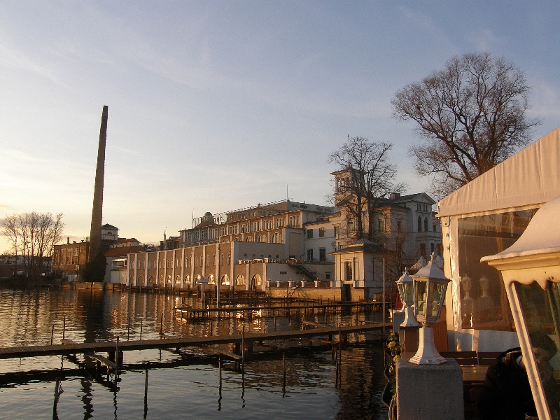
Rich Natural Landscapes: The district boasts a mix of forests, lakes, and rivers. Key natural attractions include the Treptower Park, which has expansive green spaces, and the Müggelsee, the largest lake in Berlin.
-
Müggelberge: This area features the highest elevations in Berlin, offering scenic views and a range of hiking trails. The Müggelberge are ideal for those wanting a more elevated hike and to explore the surrounding woodlands.
-
Riverside Trails: The banks of the Spree River provide beautiful walking paths. Hikers can enjoy the tranquility of river views while spotting local wildlife along the way.
-
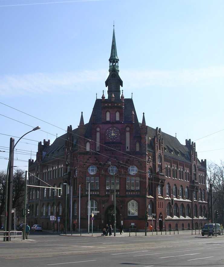
Historic Sites: While hiking, you can explore remnants of Berlin's history, such as the old castles and estates found within the district. The Köpenick Palace, situated on an island, is a notable landmark.
-
Trail Variety: There are trails suitable for all levels, from easy walks in the parks to more challenging paths in the woods and hills. Some routes are also suitable for cycling.
-
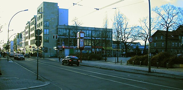
Public Transport Access: Treptow-Köpenick is accessible via public transport, making it easy to reach hiking spots. The S-Bahn and several bus routes connect to key locations within the district.
Hiking Tips:
- Plan Your Route: Have a map or GPS, as some trails may not be well-marked.
- Dress Appropriately: Wear sturdy hiking shoes and dress in layers, as weather can change quickly.
- Stay Hydrated: Bring enough water, especially during warmer months, as some areas may lack facilities.
- Observe Nature: Keep an eye out for birds and other wildlife; the area is home to diverse flora and fauna.
- Respect Nature: Follow Leave No Trace principles by staying on trails and disposing of garbage properly.
Best Times to Hike:
Spring and early autumn are particularly lovely for hiking in Treptow-Köpenick, with blooming flowers and colorful foliage respectively. Summer can be warm and busy, while winter hikes can offer a serene experience, albeit with precaution for slippery paths.
Overall, Treptow-Köpenick is a wonderful destination for those looking to hike in an urban environment while enjoying ample green space and natural beauty.
- Country:

- Coordinates: 52° 27' 0" N, 13° 34' 0" E


- GPS tracks (wikiloc): [Link]
- Area: 168 sq km
- Web site: http://www.berlin.de/ba-treptow-koepenick/index.html
- Wikipedia en: wiki(en)
- Wikipedia: wiki(de)
- Wikidata storage: Wikidata: Q158089
- Wikipedia Commons Gallery: [Link]
- Wikipedia Commons Category: [Link]
- Freebase ID: [/m/022ndz]
- GeoNames ID: Alt: [3336298]
- VIAF ID: Alt: [152816090]
- OSM relation ID: [55754]
- GND ID: Alt: [4737316-7]
- archINFORM location ID: [43212]
- Library of Congress authority ID: Alt: [no2006129503]
- TGN ID: [7032548]
Includes regions:


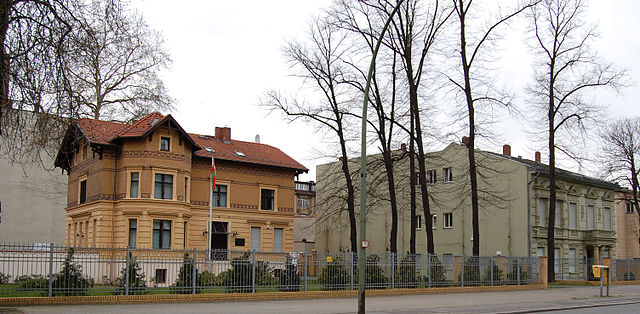
Köpenick
- locality of Berlin
Hiking in Köpenick
Köpenick is a district in the southeast of Berlin, Germany, and is known for its beautiful natural landscapes, historic architecture, and proximity to water. While Köpenick itself is more urban than rural, there are several opportunities for hiking and outdoor activities in and around the area. Here are some highlights for hiking in Köpenick:...
- Country:
- Postal Code: 12587; 12559; 12557; 12555; 12459
- Coordinates: 52° 26' 45" N, 13° 34' 38" E
- GPS tracks (wikiloc): [Link]
- AboveSeaLevel: 32 м m
- Area: 34.9 sq km
- Population: 62569

Plänterwald
- locality of Berlin
Hiking in Plänterwald
Plänterwald is a beautiful green area located in Berlin, Germany, particularly known for its scenic landscapes and unique blend of nature and urban environment. While it may not be the first location that comes to mind for hiking, it offers a number of trails and paths that can be enjoyable for walkers and nature enthusiasts....
- Country:
- Coordinates: 52° 28' 47" N, 13° 28' 31" E
- GPS tracks (wikiloc): [Link]
- AboveSeaLevel: 31 м m
- Area: 3.01 sq km


Bohnsdorf
- locality of Berlin
Hiking in Bohnsdorf
Bohnsdorf is a district located in the outskirts of Berlin, Germany. While it may not be widely recognized as a major hiking destination, it offers several opportunities for nature walks and outdoor activities....
- Country:
- Coordinates: 52° 24' 0" N, 13° 34' 0" E
- GPS tracks (wikiloc): [Link]
- AboveSeaLevel: 37 м m
- Area: 6.52 sq km
- Population: 10805

Friedrichshagen
- locality of Berlin
Hiking in Friedrichshagen
Friedrichshagen is a charming district located in the eastern part of Berlin, Germany. It’s situated along the shores of the Müggelsee, which is the largest lake in Berlin, and surrounded by beautiful natural landscapes, making it a great spot for hiking and outdoor activities....
- Country:
- Coordinates: 52° 27' 0" N, 13° 37' 0" E
- GPS tracks (wikiloc): [Link]
- AboveSeaLevel: 38 м m
- Area: 14 sq km
- Population: 18793


Schmöckwitz
- locality of Berlin
Hiking in Schmöckwitz
Schmöckwitz is a scenic area located in the southeastern part of Berlin, Germany, known for its beautiful landscapes, lakes, and natural surroundings. While it's not a traditional hiking destination, it offers several walking and hiking opportunities, especially for those looking to enjoy nature without venturing far from the city....
- Country:
- Postal Code: 12527
- Coordinates: 52° 22' 40" N, 13° 38' 57" E
- GPS tracks (wikiloc): [Link]
- AboveSeaLevel: 37 м m
- Area: 17.1 sq km
- Population: 4218


Rahnsdorf
- locality of Berlin
Hiking in Rahnsdorf
Rahnsdorf, a picturesque neighborhood located in the eastern part of Berlin, Germany, offers some charming hiking opportunities, particularly for those looking to escape the hustle and bustle of city life and enjoy some natural landscapes. While not as mountainous as some other hiking destinations, Rahnsdorf is surrounded by beautiful areas that provide lovely trails....
- Country:
- Coordinates: 52° 26' 0" N, 13° 42' 0" E
- GPS tracks (wikiloc): [Link]
- AboveSeaLevel: 36 м m
- Area: 21.5 sq km

Adlershof
- locality of Berlin, Germany
Hiking in Adlershof
Adlershof is a neighborhood in Berlin, Germany, primarily known for its historical significance and technological developments. While it may not be renowned for hiking in the traditional sense, there are several opportunities for outdoor activities and exploring nature in nearby areas....
- Country:
- Coordinates: 52° 26' 16" N, 13° 32' 51" E
- GPS tracks (wikiloc): [Link]
- AboveSeaLevel: 37 м m
- Area: 6.11 sq km
- Population: 15294


Altglienicke
- locality of Berlin
Hiking in Altglienicke
Altglienicke is a district located in the southeastern part of Berlin, Germany. While it's primarily urban and residential, there are still some opportunities for hiking enthusiasts to enjoy nature nearby. Here are some aspects to consider if you're planning to hike in or around Altglienicke:...
- Country:
- Coordinates: 52° 25' 0" N, 13° 32' 0" E
- GPS tracks (wikiloc): [Link]
- AboveSeaLevel: 34 м m
- Area: 7.89 sq km
- Population: 26426


Grünau
- locality of Berlin
Hiking in Grünau
Grünau is a lovely district located in the southeastern part of Berlin, surrounded by beautiful nature, including the scenic shores of the Dahme River and various lakes. While it may not be as expansive in hiking trails as some national parks, it offers several appealing routes for outdoor enthusiasts. Here are some highlights:...
- Country:
- Coordinates: 52° 25' 0" N, 13° 34' 0" E
- GPS tracks (wikiloc): [Link]
- AboveSeaLevel: 35 м m
- Area: 9.13 sq km


Niederschöneweide
- locality of Berlin
Hiking in Niederschöneweide
Niederschöneweide is a district in the southern part of Berlin, Germany, located along the banks of the River Spree. While it may not be as widely recognized as a traditional hiking destination compared to other more nature-centric areas, it offers some unique opportunities for outdoor activities and exploration....
- Country:
- Coordinates: 52° 27' 22" N, 13° 30' 47" E
- GPS tracks (wikiloc): [Link]
- AboveSeaLevel: 36 м m
- Area: 3.49 sq km
- Population: 10446


Baumschulenweg
- locality of Berlin
Hiking in Baumschulenweg
Baumschulenweg is a neighborhood located in the Treptow-Köpenick district of Berlin, Germany. While it may not be well-known as a traditional hiking destination, there are several outdoor opportunities in and around the area for those looking to enjoy nature and scenic walks....
- Country:
- Coordinates: 52° 27' 54" N, 13° 29' 10" E
- GPS tracks (wikiloc): [Link]
- AboveSeaLevel: 37 м m
- Area: 4.82 sq km
- Population: 17186


Müggelheim
- locality of Berlin
Hiking in Müggelheim
Müggelheim, located in the district of Treptow-Köpenick in Berlin, Germany, is a great destination for hiking enthusiasts seeking a blend of nature, tranquility, and scenic views. This area is known for its lush forests, serene lakes, and extensive walking trails. Here are some highlights and tips for hiking in Müggelheim:...
- Country:
- Coordinates: 52° 24' 0" N, 13° 39' 0" E
- GPS tracks (wikiloc): [Link]
- AboveSeaLevel: 36 м m
- Area: 22.2 sq km
- Population: 6463


Oberschöneweide
- locality of Berlin
Hiking in Oberschöneweide
Oberschöneweide is a district in the borough of Treptow-Köpenick in Berlin, Germany. While it's primarily known for its industrial history and urban environment, there are still opportunities for hiking and enjoying nature in and around the area....
- Country:
- Coordinates: 52° 27' 43" N, 13° 30' 54" E
- GPS tracks (wikiloc): [Link]
- AboveSeaLevel: 36 м m
- Area: 6.18 sq km
- Population: 18919


Johannisthal
- locality of Berlin
Hiking in Johannisthal
Johannisthal is a district in Berlin that is primarily known for its residential areas and proximity to green spaces rather than hiking trails. However, you can still enjoy outdoor activities and lighter hiking options in and around the area....
- Country:
- Coordinates: 52° 26' 36" N, 13° 30' 8" E
- GPS tracks (wikiloc): [Link]
- AboveSeaLevel: 37 м m
- Area: 6.54 sq km


Alt-Treptow
- locality of Berlin
Hiking in Alt-Treptow
Alt-Treptow, a district in Berlin, offers a variety of hiking and walking opportunities, particularly along the banks of the Spree River and through its green parks. While it may not be as rugged as traditional hiking destinations, it provides pleasant routes for leisurely walks, nature walks, and urban hiking experiences. Here are some highlights for hiking in Alt-Treptow:...
- Country:
- Coordinates: 52° 29' 24" N, 13° 26' 58" E
- GPS tracks (wikiloc): [Link]
- AboveSeaLevel: 36 м m
- Area: 2.31 sq km
- Population: 10859
Shares border with regions:

Marzahn-Hellersdorf
- borough of Berlin, Germany
Hiking in Marzahn-Hellersdorf
Marzahn-Hellersdorf, located in the eastern part of Berlin, is primarily known as a residential district, but it does have some green spaces and parks that can be suitable for short hikes and nature walks. Although it may not offer extensive hiking trails like more rural areas, there are still some places worth exploring:...
- Country:
- Coordinates: 52° 32' 0" N, 13° 35' 0" E
- GPS tracks (wikiloc): [Link]
- Area: 61.74 sq km
- Web site: [Link]


Friedrichshain-Kreuzberg
- borough of Berlin, Germany
Hiking in Friedrichshain-Kreuzberg
Friedrichshain-Kreuzberg is a vibrant district in Berlin, known for its rich culture, street art, and diverse communities rather than traditional hiking trails. However, it does offer some great opportunities for walking and exploring. Here are some options for those looking to enjoy urban hiking in this area:...
- Country:
- Coordinates: 52° 30' 0" N, 13° 27' 0" E
- GPS tracks (wikiloc): [Link]
- Area: 20.2 sq km
- Population: 281076
- Web site: [Link]

Lichtenberg
- borough of Berlin, Germany
Hiking in Lichtenberg
Lichtenberg is a beautiful region that offers various hiking opportunities, especially notable in both natural beauty and cultural significance. While there are different locations and contexts for Lichtenberg (such as a district in Berlin or other areas named Lichtenberg), I'll focus on general hiking aspects that you might find in such areas....
- Country:
- Coordinates: 52° 32' 0" N, 13° 30' 0" E
- GPS tracks (wikiloc): [Link]
- Area: 52.11 sq km
- Population: 275142
- Web site: [Link]

Neukölln
- borough of Berlin, Germany
Hiking in Neukölln
Neukölln is one of the most vibrant districts in Berlin, Germany, known for its diverse culture, artistic scenes, and community spaces. While it's not traditionally associated with hiking in the classic sense, there are still some great outdoor activities and parks in the area that can provide a satisfying experience for those looking to enjoy nature and explore on foot....
- Country:
- Coordinates: 52° 29' 0" N, 13° 27' 0" E
- GPS tracks (wikiloc): [Link]
- Area: 44.9 sq km
- Population: 306000
- Web site: [Link]