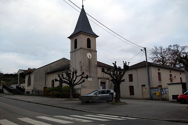
Velaine-en-Haye (Velaine-en-Haye)

- commune in Meurthe-et-Moselle, France
- Country:

- Postal Code: 54840
- Coordinates: 48° 42' 10" N, 6° 1' 16" E


- GPS tracks (wikiloc): [Link]
- Area: 17.87 sq km
- Population: 1821
- Wikipedia en: wiki(en)
- Wikipedia: wiki(fr)
- Wikidata storage: Wikidata: Q1096674
- Wikipedia Commons Category: [Link]
- Freebase ID: [/m/03qdns4]
- Freebase ID: [/m/03qdns4]
- GeoNames ID: Alt: [2970225]
- GeoNames ID: Alt: [2970225]
- SIREN number: [215405572]
- SIREN number: [215405572]
- BnF ID: [152646242]
- BnF ID: [152646242]
- VIAF ID: Alt: [136854576]
- VIAF ID: Alt: [136854576]
- INSEE municipality code: 54557
- INSEE municipality code: 54557
Shares border with regions:


Gondreville
- commune in Meurthe-et-Moselle, France
- Country:
- Postal Code: 54840
- Coordinates: 48° 41' 35" N, 5° 57' 38" E
- GPS tracks (wikiloc): [Link]
- Area: 25.03 sq km
- Population: 2828
Sexey-les-Bois
- commune in Meurthe-et-Moselle, France
- Country:
- Postal Code: 54840
- Coordinates: 48° 42' 56" N, 6° 1' 10" E
- GPS tracks (wikiloc): [Link]
- Area: 6.81 sq km
- Population: 362
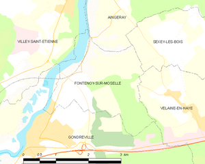
Fontenoy-sur-Moselle
- commune in Meurthe-et-Moselle, France
- Country:
- Postal Code: 54840
- Coordinates: 48° 42' 40" N, 5° 58' 52" E
- GPS tracks (wikiloc): [Link]
- Area: 5.54 sq km
- Population: 371


Champigneulles
- commune in Meurthe-et-Moselle, France
- Country:
- Postal Code: 54250
- Coordinates: 48° 44' 1" N, 6° 9' 52" E
- GPS tracks (wikiloc): [Link]
- Area: 23.99 sq km
- Population: 6808
- Web site: [Link]

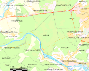
Maron
- commune in Meurthe-et-Moselle, France
- Country:
- Postal Code: 54230
- Coordinates: 48° 38' 5" N, 6° 2' 50" E
- GPS tracks (wikiloc): [Link]
- Area: 19.1 sq km
- Population: 847

Liverdun
- commune in Meurthe-et-Moselle, France
- Country:
- Postal Code: 54460
- Coordinates: 48° 45' 1" N, 6° 3' 43" E
- GPS tracks (wikiloc): [Link]
- Area: 25.23 sq km
- Population: 6033
- Web site: [Link]