
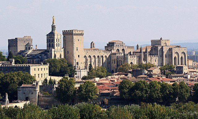
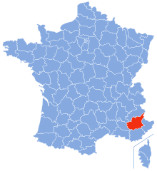
Provence-Alpes-Côte d'Azur (Provence-Alpes-Côte d'Azur)


- region of France
 Hiking in Provence-Alpes-Côte d'Azur
Provence-Alpes-Côte d'Azur (PACA) is a stunning region in southeastern France, known for its diverse landscapes, rich history, and vibrant culture. It offers a wide range of hiking opportunities, from coastal trails along the Mediterranean to rugged paths in the Alps. Here are some key points to consider when hiking in this beautiful region:
1.
- Coastal Trails: The Calanques National Park, located between Marseille and Cassis, features dramatic cliffs and turquoise waters. Trails here range from easy walks to challenging treks that offer breathtaking views of the Mediterranean.
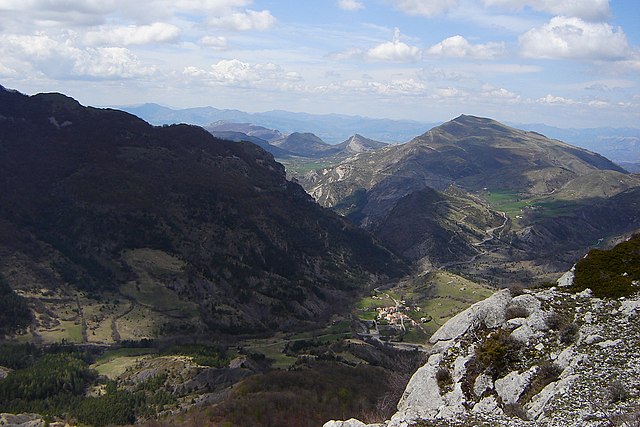
- Alpine Hikes: The Alpes-de-Haute-Provence and Hautes-Alpes provide mountainous terrain, with trails suitable for all levels. The Écrins National Park is particularly noted for its stunning high-altitude hikes and glacial landscapes.
- Vineyards and Fields: The lower regions of Provence offer scenic walks through vineyards, lavender fields (especially in July), and charming villages like Gordes and Roussillon.
2.
- Calanques National Park: Explore the breathtaking rocky inlets and cliffs, with trails like the path to the Calanque de Sugiton or the more challenging route to Calanque d’En Vau.
- Luberon Regional Park: Known for its picturesque villages and varied flora, hikes here include the hilltop village of Bonnieux and the ochre cliffs of Roussillon.
- Mercantour National Park: Located close to the Italian border, it features stunning alpine scenery and wildlife. Popular hikes include the Vallée des Merveilles, known for its rock engravings.
3.
- Marked Trails: Most trails are well-marked with signs and colored blazes. The GR (Grande Randonnée) network offers long-distance hikes across the region.
- Difficulty Levels: Trails vary from easy strolls to challenging scrambles, so check the difficulty rating before heading out.
4.
- Weather: The climate is typically Mediterranean, with hot summers and mild winters. Spring and fall are ideal times for hiking due to more temperate weather.
- Gear: Good hiking boots are essential, as many trails can be rocky and uneven. Carry plenty of water, snacks, and sun protection, especially in summer.
- Local Regulations: Respect nature and local wildlife, and make sure to follow any park regulations regarding fires, camping, and trail usage.
5.
- Enjoy local cuisine in nearby villages or towns after a day of hiking. Provence is famous for its food, including fresh vegetables, herbs, and wines.
- Explore historical sites like ancient Roman ruins, chapels, and castles along the hiking trails, enriching your outdoor experience with cultural insights.
6.
- Always inform someone of your hiking plans and estimated return time.
- Carry a map, compass, or GPS device, especially in less-marked areas.
- Be prepared for changes in weather, particularly in the mountains where conditions can vary rapidly.
Hiking in Provence-Alpes-Côte d'Azur provides not only breathtaking scenery and a range of hiking experiences but also a unique opportunity to connect with the region's rich cultural heritage. Enjoy your adventure!
- Country:

- Capital: Marseille
- Coordinates: 44° 0' 0" N, 6° 0' 0" E


- GPS tracks (wikiloc): [Link]
- Area: 31400 sq km
- Population: 5007977
- Web site: http://www.regionpaca.fr/
- Wikipedia en: wiki(en)
- Wikipedia: wiki(fr)
- Wikidata storage: Wikidata: Q15104
- Wikipedia Commons Gallery: [Link]
- Wikipedia Commons Category: [Link]
- Wikipedia Commons Maps Category: [Link]
- Freebase ID: [/m/01c7nt]
- GeoNames ID: Alt: [2985244]
- SIREN number: [231300021]
- BnF ID: [11872781c]
- VIAF ID: Alt: [168743165]
- OSM relation ID: [8654]
- GND ID: Alt: [4224358-0]
- archINFORM location ID: [3291]
- Library of Congress authority ID: Alt: [n82051760]
- PACTOLS thesaurus ID: [pcrtvVEJGc5bsY]
- MusicBrainz area ID: [d0db0e5b-de99-40c5-8c39-b7ed17b36d0d]
- Quora topic ID: [Provence-Alpes-Côte-dAzur-France]
- SUDOC authorities ID: [026488981]
- Encyclopædia Britannica Online ID: [place/Provence-Alpes-Cote-dAzur]
- Encyclopædia Universalis ID: [provence-alpes-cote-d-azur-region-administrative]
- Twitter username: Alt: [regionpaca]
- ISNI: Alt: [0000 0001 2205 3937]
- DMOZ ID: Alt: [Regional/Europe/France/Regions/Provence-Alpes-Cote_d'Azur/]
- data.gouv.fr org ID: [region-provence-alpes-cote-d-azur-mv2]
- NUTS code: [FR82]
- INSEE region code: [93]
- US National Archives Identifier: 10044254
- ISO 3166-2 code: FR-PAC
- FIPS 10-4 (countries and regions): FRB8
- GACS ID: 16642
Includes regions:


Var
- department in France
Hiking in Var
Hiking in the Var department, located in the Provence-Alpes-Côte d'Azur region of southeastern France, offers a diverse range of landscapes and trails suitable for hikers of varying skill levels. Here are some key highlights and tips for hiking in Var:...
- Country:
- Capital: Toulon
- Coordinates: 43° 24' 3" N, 6° 12' 36" E
- GPS tracks (wikiloc): [Link]
- Area: 5973 sq km
- Population: 1048652
- Web site: [Link]
Vaucluse
- French department
Hiking in Vaucluse
Vaucluse, located in the Provence-Alpes-Côte d'Azur region of southeastern France, offers a diverse range of hiking opportunities, combining stunning landscapes, historical sites, and charming villages. Here are some highlights for hiking in Vaucluse:...
- Country:
- Capital: Avignon
- Licence Plate Code: 84
- Coordinates: 44° 0' 0" N, 5° 10' 0" E
- GPS tracks (wikiloc): [Link]
- Area: 3567 sq km
- Population: 557548
- Web site: [Link]

Hautes-Alpes
- department in southeastern France named after the Alps mountain range
Hiking in Hautes-Alpes
The Hautes-Alpes region in southeastern France is a spectacular destination for hiking enthusiasts, known for its stunning landscapes, diverse terrain, and rich biodiversity. The region is part of the French Alps and offers a variety of hiking trails suitable for different skill levels....
- Country:
- Capital: Gap
- Coordinates: 44° 40' 0" N, 6° 20' 0" E
- GPS tracks (wikiloc): [Link]
- AboveSeaLevel: 1665 м m
- Area: 5549 sq km
- Population: 140916
- Web site: [Link]
Alpes-de-Haute-Provence
- French department
Hiking in Alpes-de-Haute-Provence
Hiking in the Alpes-de-Haute-Provence region of southeastern France offers a unique blend of stunning landscapes, diverse ecosystems, and charming villages. Here are some key points to consider if you’re planning a hiking trip in this area:...
- Country:
- Capital: Digne-les-Bains
- Coordinates: 44° 5' 43" N, 6° 14' 24" E
- GPS tracks (wikiloc): [Link]
- Area: 6925 sq km
- Population: 161799
- Web site: [Link]
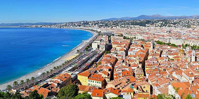

Alpes-Maritimes
- French department
Hiking in Alpes-Maritimes
Hiking in Alpes-Maritimes, located in the Provence-Alpes-Côte d'Azur region of France, offers a diverse range of trails and stunning landscapes. From coastal paths along the Mediterranean Sea to rocky mountain trails in the Mercantour National Park, the area caters to hikers of all levels....
- Country:
- Capital: Nice
- Coordinates: 43° 50' 0" N, 7° 10' 0" E
- GPS tracks (wikiloc): [Link]
- Area: 4299 sq km
- Population: 1082440
- Web site: [Link]


Bouches-du-Rhône
- French department in Provence-Alpes-Côte d'Azur
Hiking in Bouches-du-Rhône
Bouches-du-Rhône, located in the Provence-Alpes-Côte d'Azur region of southern France, offers diverse hiking opportunities amid stunning landscapes, rich history, and vibrant culture. Here are some key highlights for hiking in this beautiful area:...
- Country:
- Capital: Marseille
- Coordinates: 43° 30' 0" N, 5° 5' 0" E
- GPS tracks (wikiloc): [Link]
- Area: 5087 sq km
- Population: 2016622
- Web site: [Link]
Shares border with regions:

Piedmont
- region in North-West Italy
Hiking in Piedmont
Hiking in the Piedmont region offers a wonderful blend of natural beauty, diverse landscapes, and rich cultural heritage. This area, which generally encompasses the foothills of the Appalachian Mountains and stretches across parts of Virginia, North Carolina, South Carolina, and more, features rolling hills, lush forests, and scenic views. Here are some highlights and tips for hiking in Piedmont:...
- Country:

- Capital: Turin
- Coordinates: 45° 15' 0" N, 7° 55' 0" E
- GPS tracks (wikiloc): [Link]
- AboveSeaLevel: 421 м m
- Area: 25402 sq km
- Population: 4367559
- Web site: [Link]

Liguria
- Italian region
Hiking in Liguria
Hiking in Liguria, a stunning region located in northwestern Italy, is a fantastic experience due to its diverse landscapes, coastal views, and charming villages. Here are some key highlights:...
- Country:
- Capital: Genoa
- Coordinates: 44° 27' 0" N, 8° 46' 0" E
- GPS tracks (wikiloc): [Link]
- AboveSeaLevel: 250 м m
- Area: 5422.0 sq km
- Population: 1558812
- Web site: [Link]


Auvergne-Rhône-Alpes
- administrative region of France
Hiking in Auvergne-Rhône-Alpes
Auvergne-Rhône-Alpes is a stunning region in southeastern France known for its diverse landscapes, which include mountains, lakes, and volcanic formations. It offers a wealth of hiking opportunities for all levels of experience. Here are some highlights and notable areas for hiking in this beautiful region:...
- Country:
- Capital: Lyon
- Local Dialing Code: 04
- Coordinates: 45° 44' 25" N, 4° 49' 10" E
- GPS tracks (wikiloc): [Link]
- Area: 69711 sq km
- Population: 7877698
- Web site: [Link]


Occitania
- region of France
- Country:
- Capital: Toulouse
- Coordinates: 43° 38' 56" N, 2° 20' 37" E
- GPS tracks (wikiloc): [Link]
- Area: 72724 sq km
- Population: 5774185
- Web site: [Link]