
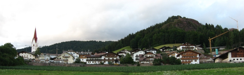
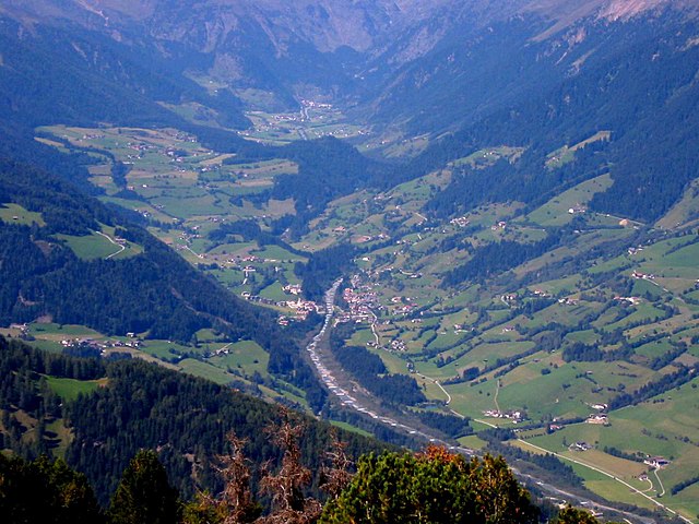
Sarntal (Sarentino)
.svg)
- Italian comune
 Hiking in Sarntal
Sarntal, also known as the Sarntal Valley, is a beautiful hiking destination located in South Tyrol, Italy, just north of Bolzano. This area is known for its stunning landscapes, diverse flora and fauna, and rich cultural heritage. Here are some key points to consider when planning a hiking trip in Sarntal:
Scenic Trails
- Varied Terrain: Sarntal offers a variety of trails that cater to different skill levels, from easy walks suitable for families to challenging mountain hikes.
- Panoramic Views: Many trails provide breathtaking views of the surrounding mountains, valleys, and dense woodlands. Popular summits include the Rittner Horn and the peaks of the Sarntal Alps.
Popular Hiking Routes
- The Sarntal Valley Trail: This is a long-distance trail that runs through the valley and showcases the beautiful landscapes of the region, including pastures, forests, and alpine meadows.
- Hikes to Mountain Lakes: The area around Sarntal has several picturesque mountain lakes, such as the Göller Lakes, which are great spots for a rest or picnic.
Flora and Fauna
- Rich Biodiversity: The Sarntal region is home to a variety of wildlife, including deer, chamois, and various bird species. Keep an eye out for wildflowers in the meadows during spring and summer.
Cultural Aspects
- Local Traditions: Hiking in Sarntal is not just about nature; it also offers a glimpse into traditional South Tyrolean culture, with charming villages and opportunities to taste local cuisine in mountain huts.
Best Time to Hike
- Summer and Autumn: The best hiking months are generally from late spring through early autumn (May to October), when the weather is mild and the trails are clear.
Tips for Hiking in Sarntal
- Preparation: Always carry a detailed map or GPS device, as some trails may not be well-marked.
- Gear: Wear appropriate hiking gear, including sturdy footwear and layering to adapt to changing weather conditions.
- Stay Hydrated: Ensure you have enough water, especially during longer hikes.
- Respect Nature: Follow the Leave No Trace principles to keep the trails beautiful for everyone.
Whether you are seeking a peaceful trek through nature or a challenging climb, Sarntal has something to offer for every hiker. Enjoy the stunning scenery and the tranquility of the South Tyrolean Alps!
- Country:

- Postal Code: 39058
- Local Dialing Code: 0471
- Licence Plate Code: BZ
- Coordinates: 46° 38' 37" N, 11° 21' 22" E


- GPS tracks (wikiloc): [Link]
- AboveSeaLevel: 2781 м m
- Area: 302.27 sq km
- Population: 7058
- Web site: http://www.comune.sarentino.bz.it
- Wikipedia en: wiki(en)
- Wikipedia: wiki(it)
- Wikidata storage: Wikidata: Q256173
- Wikipedia Commons Gallery: [Link]
- Wikipedia Commons Category: [Link]
- Freebase ID: [/m/0g9jvr]
- GeoNames ID: Alt: [6535928]
- BnF ID: [13506423n]
- VIAF ID: Alt: [135038396]
- OSM relation ID: [47282]
- GND ID: Alt: [4652836-2]
- Library of Congress authority ID: Alt: [n96096111]
- UN/LOCODE: [ITBBZ]
- ISTAT ID: 021086
- Italian cadastre code: I431
Shares border with regions:


Hafling
- Italian comune
Hiking in Hafling
Hafling, located in the South Tyrol region of northern Italy, is a stunning destination for hikers, known for its breathtaking landscapes, diverse trails, and striking views of the Alps. Nestled in the mountains near Merano, Hafling offers a unique combination of natural beauty and charming village life, making it an excellent spot for outdoor enthusiasts....
- Country:
- Postal Code: 39010
- Local Dialing Code: 0473
- Licence Plate Code: BZ
- Coordinates: 46° 38' 44" N, 11° 13' 27" E
- GPS tracks (wikiloc): [Link]
- AboveSeaLevel: 1290 м m
- Area: 27 sq km
- Population: 763
- Web site: [Link]

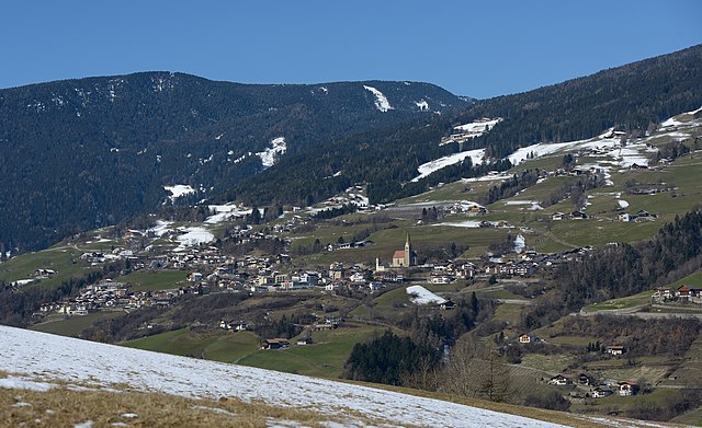
Vöran
- Italian comune
Hiking in Vöran
Vöran, also known as Verano, is a picturesque village located in the South Tyrol region of northern Italy, nestled in the foothills of the Alps. It is a popular destination for hiking enthusiasts due to its stunning natural landscapes, diverse trails, and mild climate....
- Country:
- Postal Code: 39010
- Local Dialing Code: 0473
- Licence Plate Code: BZ
- Coordinates: 46° 36' 17" N, 11° 13' 35" E
- GPS tracks (wikiloc): [Link]
- AboveSeaLevel: 1204 м m
- Area: 22.01 sq km
- Population: 952
- Web site: [Link]


Freienfeld
- Italian comune
Hiking in Freienfeld
Freienfeld, located in South Tyrol, Italy, is a beautiful area known for its stunning alpine scenery and excellent hiking opportunities. The region offers a mix of gentle walks and challenging trails, catering to hikers of all levels. Here are some highlights you can expect when hiking in Freienfeld:...
- Country:
- Postal Code: 39040
- Local Dialing Code: 0472
- Licence Plate Code: BZ
- Coordinates: 46° 52' 27" N, 11° 29' 10" E
- GPS tracks (wikiloc): [Link]
- AboveSeaLevel: 937 м m
- Area: 95.39 sq km
- Population: 2645
- Web site: [Link]


Klausen
- Italian comune in South Tyrol
Hiking in Klausen
Klausen (Chiusa) is a charming town located in South Tyrol, Italy, known for its stunning landscapes, rich history, and excellent hiking opportunities. Nestled in the Val Gardena valley, Klausen offers access to various hiking trails suitable for different skill levels. Here are some highlights about hiking in the area:...
- Country:
- Postal Code: 39043
- Local Dialing Code: 0472
- Licence Plate Code: BZ
- Coordinates: 46° 38' 24" N, 11° 33' 57" E
- GPS tracks (wikiloc): [Link]
- AboveSeaLevel: 523 м m
- Area: 51.29 sq km
- Population: 5211
- Web site: [Link]


Franzensfeste
- comune in South Tyrol
Hiking in Franzensfeste
Franzensfeste, located in South Tyrol, Italy, is a fascinating area for hiking enthusiasts. It’s known for its stunning landscapes, rich history, and variety of hiking trails that cater to different skill levels....
- Country:
- Postal Code: 39045
- Local Dialing Code: 0472
- Licence Plate Code: BZ
- Coordinates: 46° 47' 23" N, 11° 36' 36" E
- GPS tracks (wikiloc): [Link]
- AboveSeaLevel: 749 м m
- Area: 61.77 sq km
- Population: 999
- Web site: [Link]


Mölten
- Italian comune
Hiking in Mölten
Mölten, or Molten, is a lovely village in South Tyrol, Italy, situated on the sunny side of the Adige Valley. It offers a variety of hiking trails that cater to different experience levels, making it an excellent destination for hikers....
- Country:
- Postal Code: 39010
- Local Dialing Code: 0471
- Licence Plate Code: BZ
- Coordinates: 46° 35' 15" N, 11° 15' 18" E
- GPS tracks (wikiloc): [Link]
- AboveSeaLevel: 1140 м m
- Area: 36.95 sq km
- Population: 1676
- Web site: [Link]

Ratschings
- town and commune in Italy
Hiking in Ratschings
Ratschings, located in the South Tyrol region of northern Italy, is a fantastic destination for hiking enthusiasts. The area is known for its stunning alpine scenery, diverse trails, and a variety of outdoor activities. Here are some highlights of hiking in Ratschings:...
- Country:
- Postal Code: 39040
- Local Dialing Code: 0472
- Licence Plate Code: BZ
- Coordinates: 46° 52' 0" N, 11° 18' 0" E
- GPS tracks (wikiloc): [Link]
- AboveSeaLevel: 976 м m
- Area: 203.29 sq km
- Population: 4471
- Web site: [Link]


Ritten
- Italian comune
Hiking in Ritten
Ritten, also known as Renon, is a picturesque area located in South Tyrol, Italy, just outside of Bolzano. It offers a fantastic hiking experience with its stunning landscapes, diverse trails, and panoramic views of the Dolomites. Here are some highlights and tips for hiking in Ritten:...
- Country:
- Postal Code: 39054
- Local Dialing Code: 0471
- Licence Plate Code: BZ
- Coordinates: 46° 32' 29" N, 11° 27' 26" E
- GPS tracks (wikiloc): [Link]
- AboveSeaLevel: 1154 м m
- Area: 111.36 sq km
- Population: 7892
- Web site: [Link]


Jenesien
- Italian comune
Hiking in Jenesien
Jenesien, or San Genesio in Italian, is a lovely village located on the southern slopes of the Alps, just above the city of Bolzano in South Tyrol, Italy. It's known for its stunning views, rich history, and a plethora of hiking trails that cater to all skill levels. Here are some key highlights and tips if you're considering hiking in Jenesien:...
- Country:
- Postal Code: 39050
- Local Dialing Code: 0471
- Licence Plate Code: BZ
- Coordinates: 46° 32' 5" N, 11° 19' 47" E
- GPS tracks (wikiloc): [Link]
- AboveSeaLevel: 1000 м m
- Area: 68.84 sq km
- Population: 3045
- Web site: [Link]
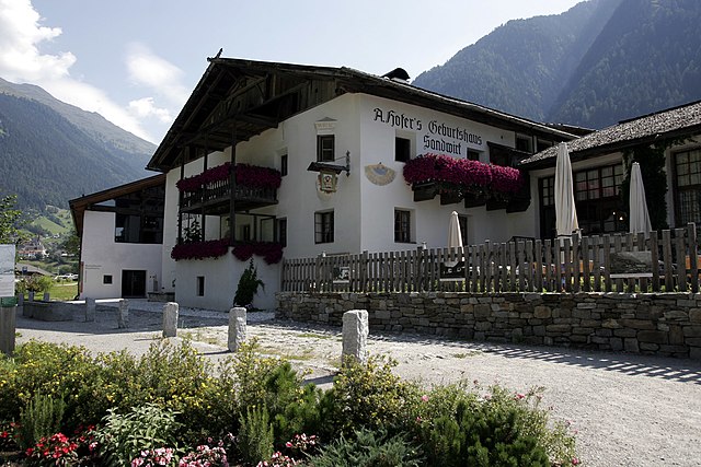

St. Leonhard in Passeier
- Italian comune
Hiking in St. Leonhard in Passeier
St. Leonhard in Passeier is a picturesque village located in the South Tyrol region of northern Italy, nestled within the Ötztal Alps. It's renowned for its stunning alpine scenery, rich cultural heritage, and a variety of outdoor activities, making it an excellent destination for hikers of all skill levels. Here are some highlights of hiking in this area:...
- Country:
- Postal Code: 39015
- Local Dialing Code: 0473
- Licence Plate Code: BZ
- Coordinates: 46° 48' 46" N, 11° 14' 45" E
- GPS tracks (wikiloc): [Link]
- AboveSeaLevel: 689 м m
- Area: 89.03 sq km
- Population: 3551
- Web site: [Link]


Schenna
- Italian comune
Hiking in Schenna
Schenna, located near Merano in South Tyrol, Italy, is a great destination for hiking enthusiasts. The region is known for its breathtaking alpine scenery, charming villages, and well-maintained hiking trails suitable for all levels, from beginners to experienced hikers....
- Country:
- Postal Code: 39017
- Local Dialing Code: 0473
- Licence Plate Code: BZ
- Coordinates: 46° 41' 24" N, 11° 11' 11" E
- GPS tracks (wikiloc): [Link]
- AboveSeaLevel: 600 м m
- Area: 48.13 sq km
- Population: 2918
- Web site: [Link]


Vahrn
- Italian comune
Hiking in Vahrn
Vahrn, located in South Tyrol, Italy, is a charming village surrounded by stunning natural landscapes, making it a great destination for hiking enthusiasts. The area is characterized by its picturesque mountain scenery, rolling hills, and vineyards, offering various trails suitable for hikers of all levels....
- Country:
- Postal Code: 39040
- Local Dialing Code: 0472
- Licence Plate Code: BZ
- Coordinates: 46° 44' 20" N, 11° 38' 15" E
- GPS tracks (wikiloc): [Link]
- AboveSeaLevel: 671 м m
- Area: 70.34 sq km
- Population: 4546
- Web site: [Link]

Villanders
- Italian comune
Hiking in Villanders
Villanders, located in South Tyrol, Italy, is a picturesque village that offers a variety of hiking opportunities amidst stunning alpine scenery. Here are some highlights for hiking in this area:...
- Country:
- Postal Code: 39043
- Local Dialing Code: 0472
- Licence Plate Code: BZ
- Coordinates: 46° 37' 51" N, 11° 32' 13" E
- GPS tracks (wikiloc): [Link]
- AboveSeaLevel: 880 м m
- Area: 43.95 sq km
- Population: 1853
- Web site: [Link]